
MyTopo
Classic USGS Dublin North Carolina 7.5'x7.5' Topo Map
Couldn't load pickup availability
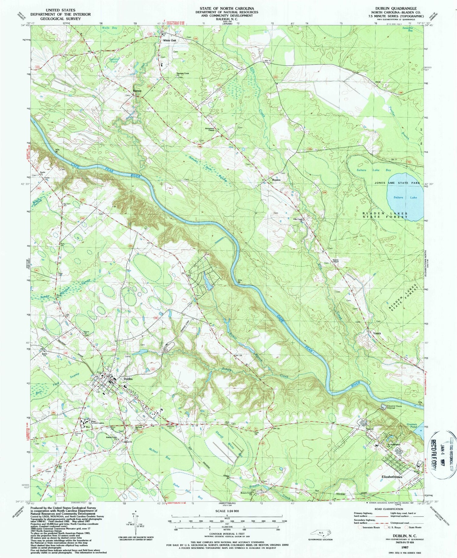
Historical USGS topographic quad map of Dublin in the state of North Carolina. Map scale may vary for some years, but is generally around 1:24,000. Print size is approximately 24" x 27"
This quadrangle is in the following counties: Bladen.
The map contains contour lines, roads, rivers, towns, and lakes. Printed on high-quality waterproof paper with UV fade-resistant inks, and shipped rolled.
Contains the following named places: Bakers Creek, Bakers Creek Church, Beaver Dam Swamp, Bethel Church, Bladen Community College, Bladen Correctional Center, Bomill Branch, Browns Creek Church, Burney, Deans Chapel, Dublin, Dublin Field, Dublin Post Office, Dublin Volunteer Fire Department, Elizabethtown Baptist Church, Ellis Creek, Ellis Creek Church, Harrison Creek, Harrison Creek Church, Jones Lake State Park, McCord Church, McNeil Bay, Purdie Church, Richardson Chapel, Ruskin, Saint Christophers Church, Salters Lake, Salters Lake Bay, Sheriff White Bay, Shiloh Church, Swamp Field, Town of Dublin, Township of Bethel, White Oak, White Oak Census Designated Place, Yorick, ZIP Code: 28332


