MyTopo
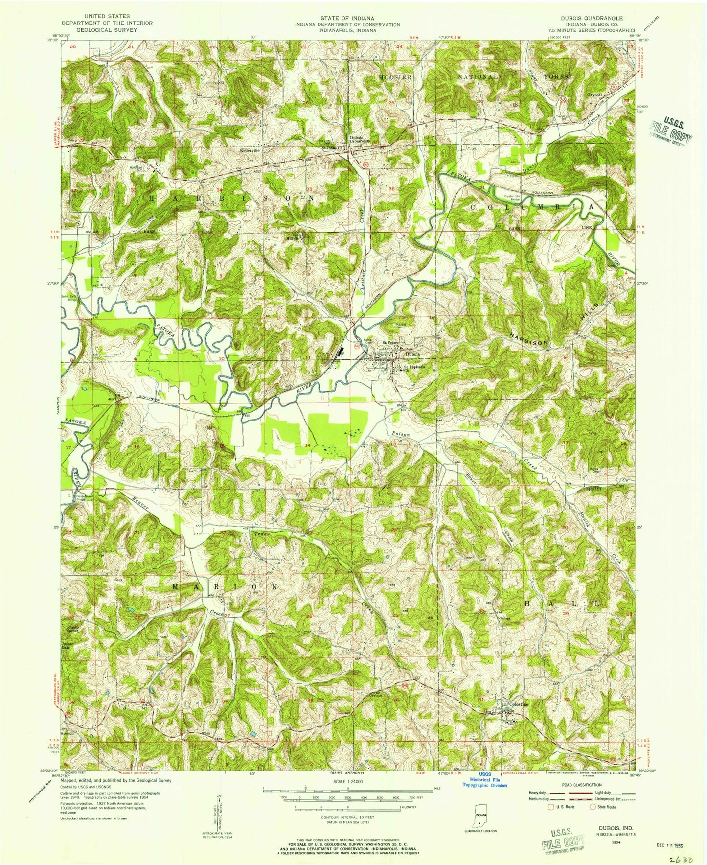
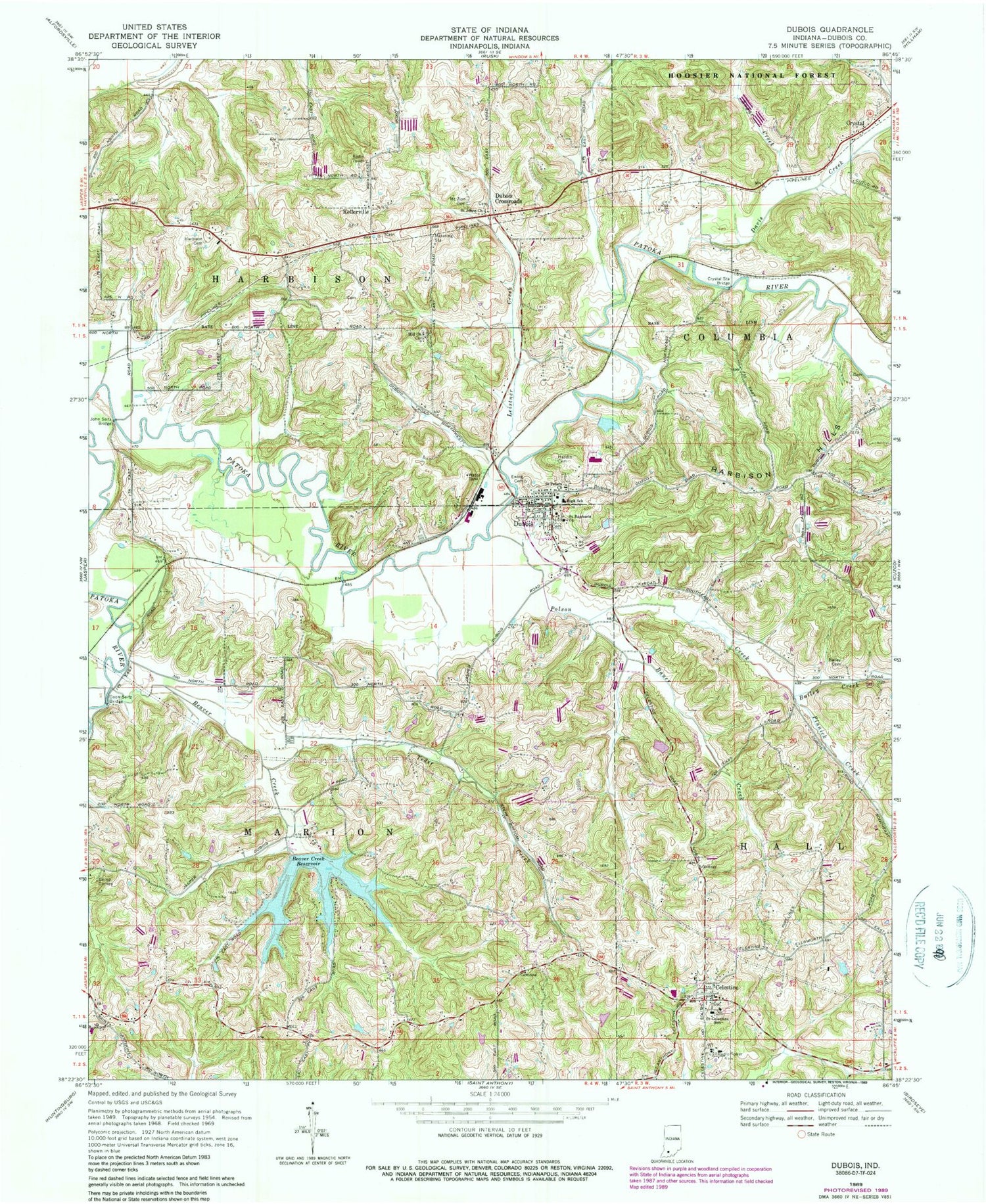
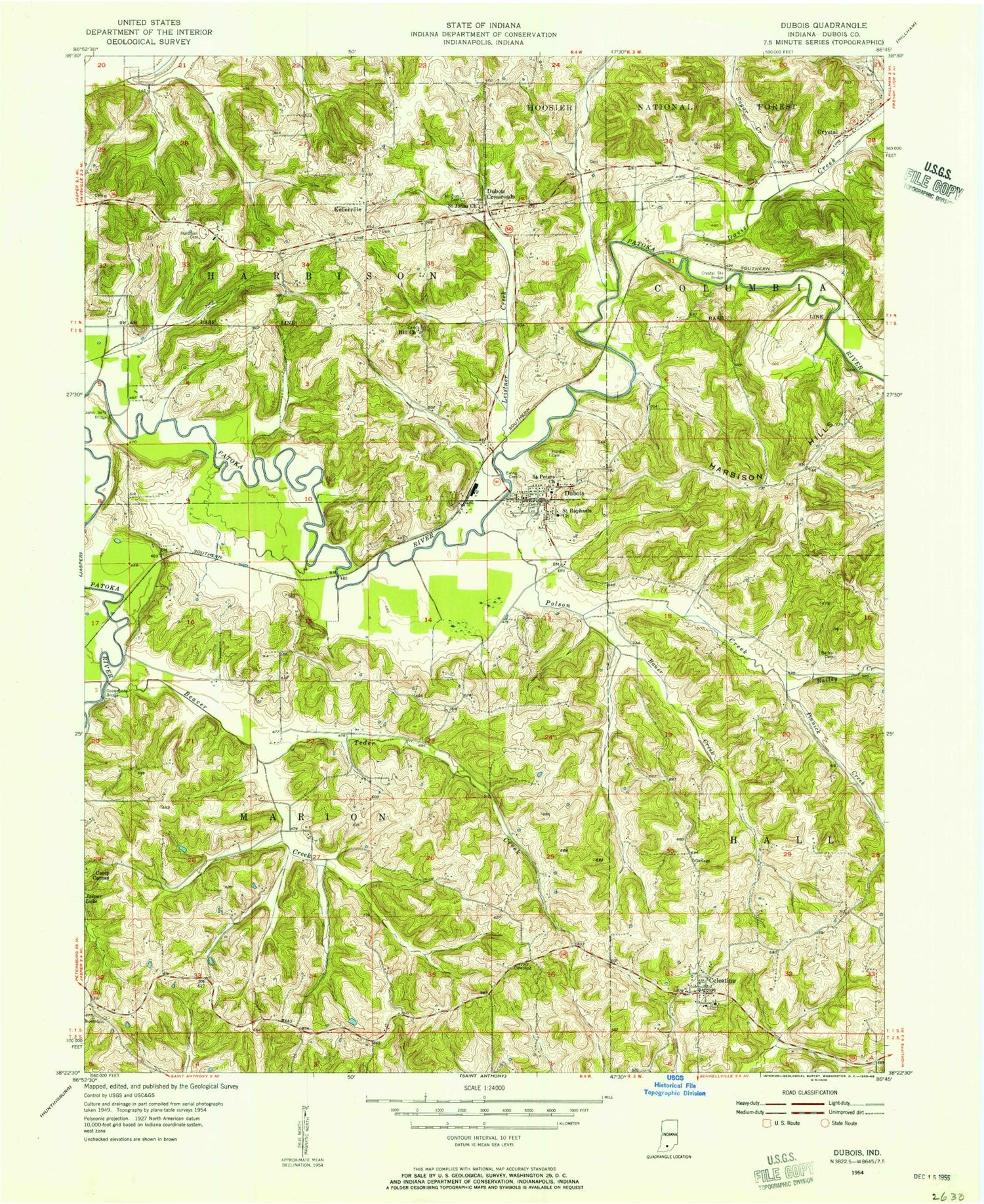
Classic USGS Dubois Indiana 7.5'x7.5' Topo Map
Couldn't load pickup availability
Historical USGS topographic quad map of Dubois in the state of Indiana. Map scale may vary for some years, but is generally around 1:24,000. Print size is approximately 24" x 27"
This quadrangle is in the following counties: Dubois.
The map contains contour lines, roads, rivers, towns, and lakes. Printed on high-quality waterproof paper with UV fade-resistant inks, and shipped rolled.
Contains the following named places: Bailey Cemetery, Bailey Creek, Bauer Creek, Beaver Creek, Beaver Creek Lake, Beaver Creek Lake Dam, Camp Carnes, Celestine, Celestine Community Club Lake, Celestine Community Club Lake Dam, Celestine Elementary School, Celestine Post Office, Celestine Volunteer Fire Department, Coon Seitz Bridge, Crystal, Crystal Station Bridge, Davis Creek, Dubois, Dubois Census Designated Place, Dubois Community Club Lake, Dubois Community Club Lake Dam, Dubois Crossroads, Dubois Post Office, Dubois Volunteer Fire Department, Ewing Cemetery, Harbison Cemetery, Harbison Hills, Hardin Cemetery, John Seitz Bridge, Kellerville, Ludlow Post Office, Mount Zion Cemetery, Northeast Dubois High School, Pinnick Creek, Polson Creek, Saint Johns Church, Saint Peters Church, Saint Peters United Church of Christ Cemetery, Saint Raphaels Cemetery, Saint Raphaels Church, Sugar Creek, Teder Creek, Township of Harbison, Township of Marion, ZIP Code: 47527