MyTopo
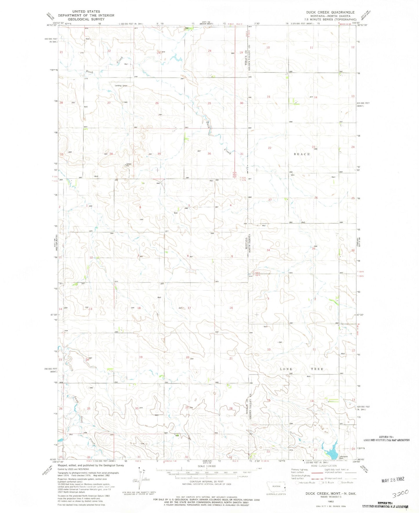
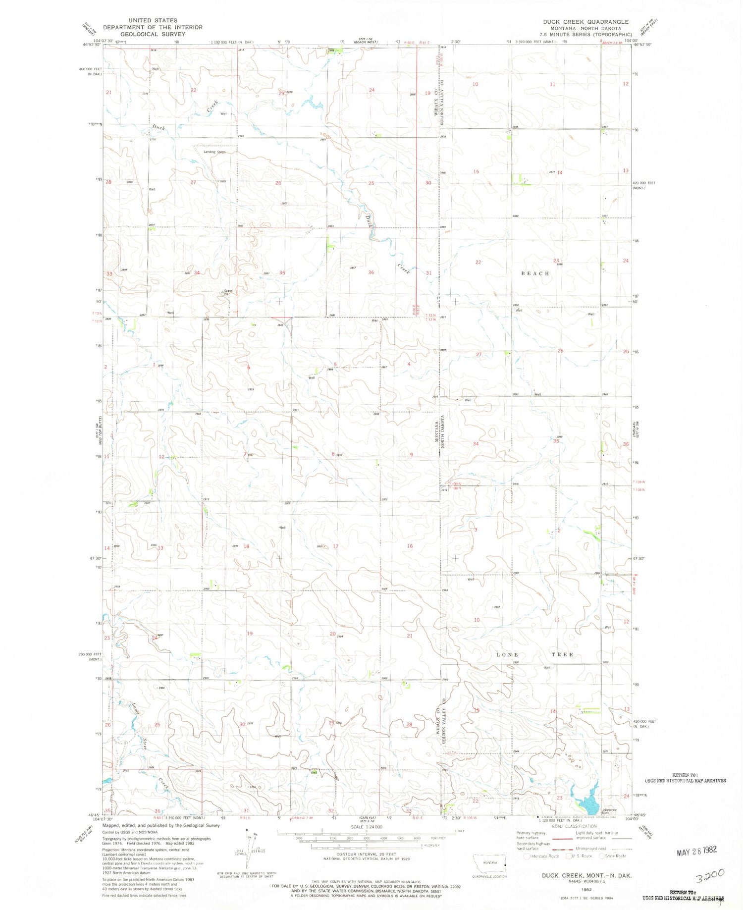
Classic USGS Duck Creek Montana 7.5'x7.5' Topo Map
Regular price
$16.95
Regular price
Sale price
$16.95
Unit price
per
Couldn't load pickup availability
Historical USGS topographic quad map of Duck Creek in the states of Montana, North Dakota. Map scale may vary for some years, but is generally around 1:24,000. Print size is approximately 24" x 27"
This quadrangle is in the following counties: Golden Valley, Wibaux.
The map contains contour lines, roads, rivers, towns, and lakes. Printed on high-quality waterproof paper with UV fade-resistant inks, and shipped rolled.
Contains the following named places: 12N61E08DDD_01 Well, 13N60E24BB__01 Well, 13N61E30AAB_01 Well, 13N61E30ABB_02 Well, Buldhaupt School, Golden Glow Coal Mine, Hollstein Ranch Airport, Johnstone Dam, Larson School, Popeil School, Zielinski School