MyTopo
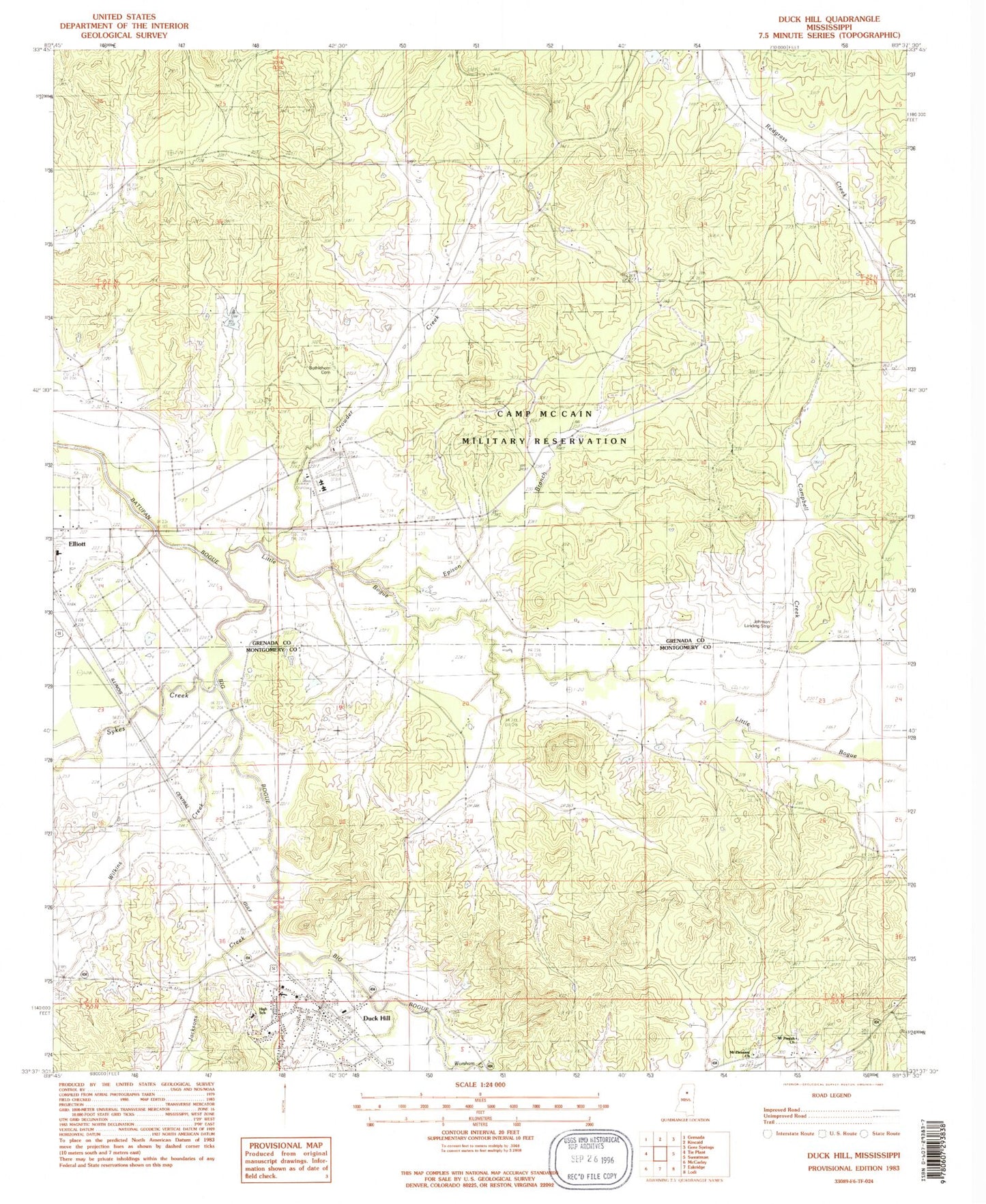
Classic USGS Duck Hill Mississippi 7.5'x7.5' Topo Map
Couldn't load pickup availability
Historical USGS topographic quad map of Duck Hill in the state of Mississippi. Map scale may vary for some years, but is generally around 1:24,000. Print size is approximately 24" x 27"
This quadrangle is in the following counties: Grenada, Montgomery.
The map contains contour lines, roads, rivers, towns, and lakes. Printed on high-quality waterproof paper with UV fade-resistant inks, and shipped rolled.
Contains the following named places: Bethleham Cemetery, Big Bogue, Bogue Watershed Y-30-108 Dam, Bowen, Camp McCain, Camp McCain Military Reservation, Campbell Creek, Crowder Creek, Duck Hill, Duck Hill Baptist Church, Duck Hill Elementary School, Duck Hill High School, Duck Hill Police Department, Duck Hill Post Office, Duck Hill Volunteer Fire Department, Elliott, Epison Branch, Jackson Creek, Little Bogue, Mount Pisgah Church, Mount Pisgah Primitive Baptist Church Cemetery, Mount Pleasant Church, Mount Pleasant Church Cemetery, Purnell Cemetery, Supervisor District 1, Supervisor District 2, Sykes Creek, Town of Duck Hill, Wilkins Creek, Worsham Creek, ZIP Code: 38925