MyTopo
Classic USGS Duffee Mississippi 7.5'x7.5' Topo Map
Couldn't load pickup availability
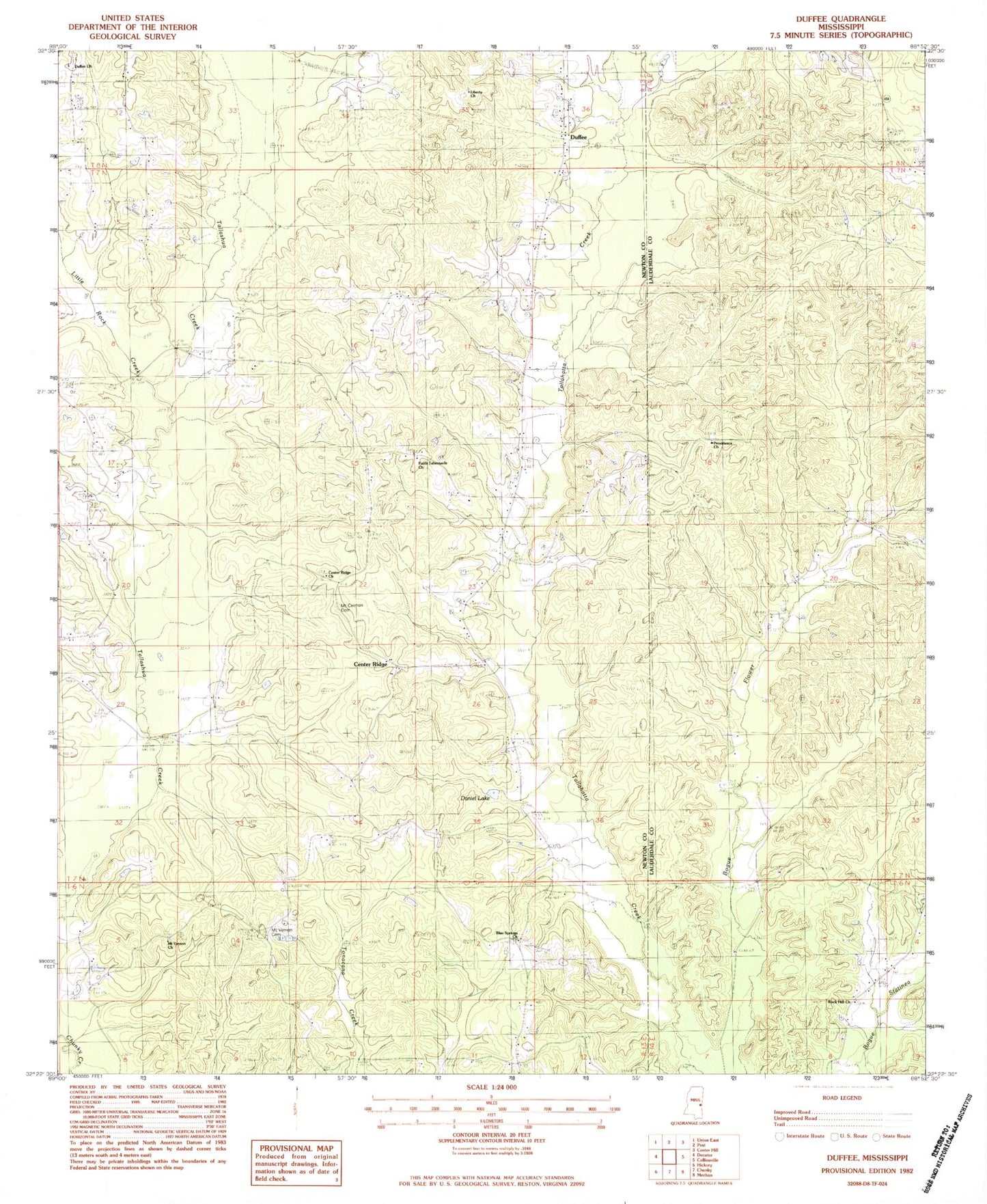
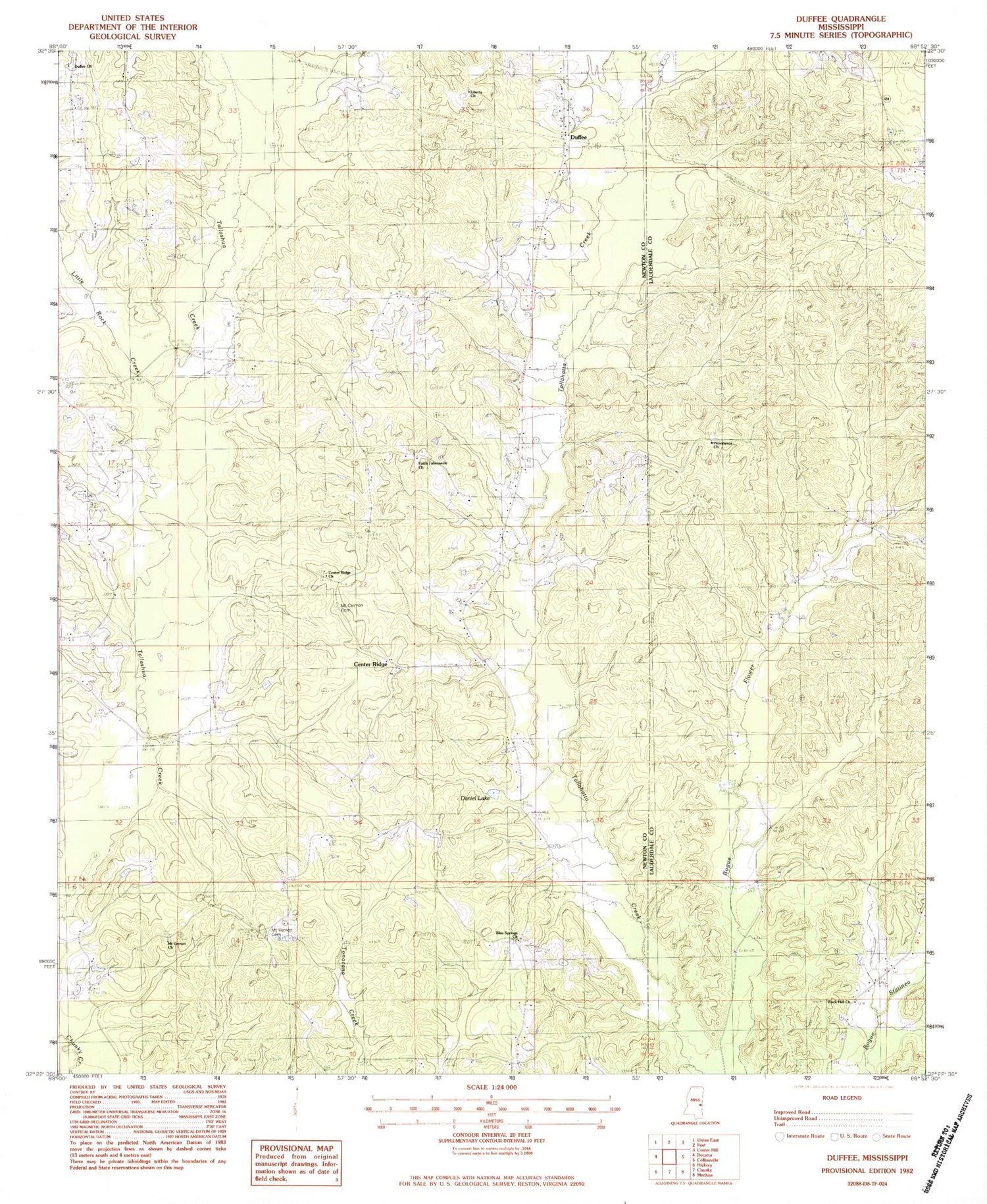
Historical USGS topographic quad map of Duffee in the state of Mississippi. Map scale may vary for some years, but is generally around 1:24,000. Print size is approximately 24" x 27"
This quadrangle is in the following counties: Lauderdale, Newton.
The map contains contour lines, roads, rivers, towns, and lakes. Printed on high-quality waterproof paper with UV fade-resistant inks, and shipped rolled.
Contains the following named places: Blackwell School, Blue Springs Church, Center Ridge, Center Ridge Church, Center Ridge School, Daniel Lake, Duffee, Duffee Church, Duffee Volunteer Fire Department, Evergreen, Faith Tabernacle Church, Liberty Church, Little Rock Creek, Mount Carmon Cemetery, Mount Carmon Church, Mount Vernon Cemetery, Mount Vernon Church, Mount Zion Church, Nanahuma Post Office, Oak Grove Church, Oak Grove School, Perota, Providence Church, Rock Hill Church, Sand Branch, Spring Chapel School, Thirteenth School