MyTopo
Classic USGS Duford South Carolina 7.5'x7.5' Topo Map
Couldn't load pickup availability
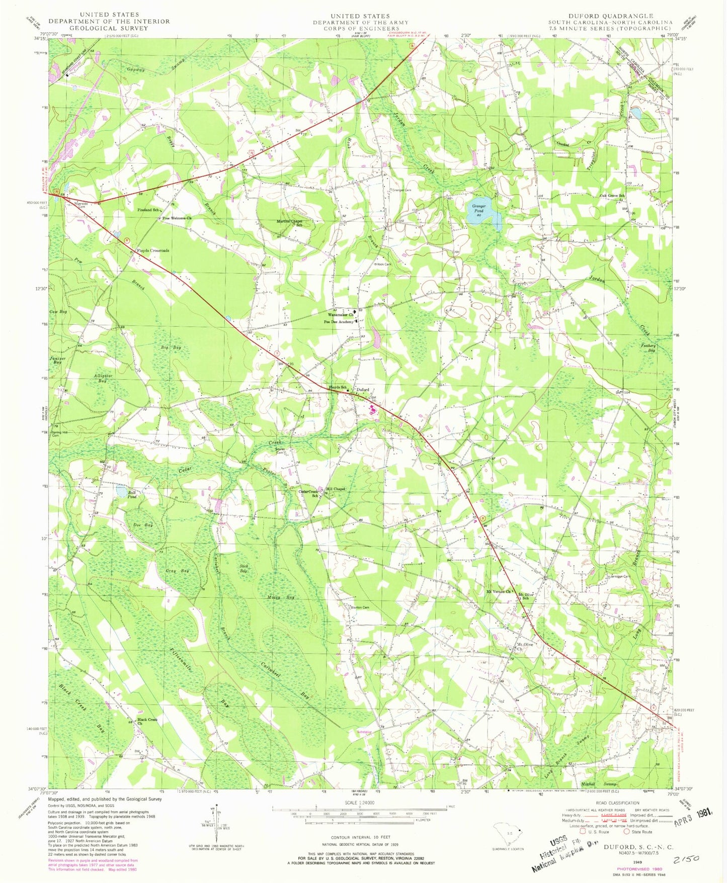
Historical USGS topographic quad map of Duford in the state of South Carolina. Map scale may vary for some years, but is generally around 1:24,000. Print size is approximately 24" x 27"
This quadrangle is in the following counties: Columbus, Horry.
The map contains contour lines, roads, rivers, towns, and lakes. Printed on high-quality waterproof paper with UV fade-resistant inks, and shipped rolled.
Contains the following named places: Alligator Bay, Big Bay, Black Creek Bay, Black Creek Church, Blanton Cemetery, Bull Pond, Cartwheel Bay, Cartwheel Branch, Cedar Creek School, Clemons Pond, Clemons Pond Dam D-3611, Crooked Creek, Doe Bay, Duford, Fifteenmile Bay, Floyds Church, Floyds Crossroads, Floyds Crossroads Division, Floyds High School, Floyds School, Free Welcome Church, Grainger Mill, Granger Cemetery, Granger Pond, Gray Bay, Green Sea Airport, Green Sea Floyds Elementary School, Green Sea Floyds High School, Hill Chapel, Hook Branch, Hook Cemetery, Hooks Pond, Horry County Fire Department Station 25, Horry County Fire Department Station 38, Jernigan Cemetery, Long Branch, Long Branch Swamp, Martin Cemetery, Martin Pond, Martins Chapel School, Mears Pond, Mears Pond Dam D-3609, Mossy Bay, Mount Olive, Mount Olive Church, Mount Olive School, Mount Vernon Church, Oak Grove Church, Oak Grove School, Pee Dee Academy, Pew Branch, Pineland School, Poplar Branch, Riverside Cemetery, Soules Cemetery, South Carolina Noname 26001 D-3608 Dam, South Carolina Noname 26005 D-3610 Dam, Spring Hill Cemetery, Stick Bay, Strouds Mill, Wanamaker Church, Wannamaker, ZIP Code: 29581