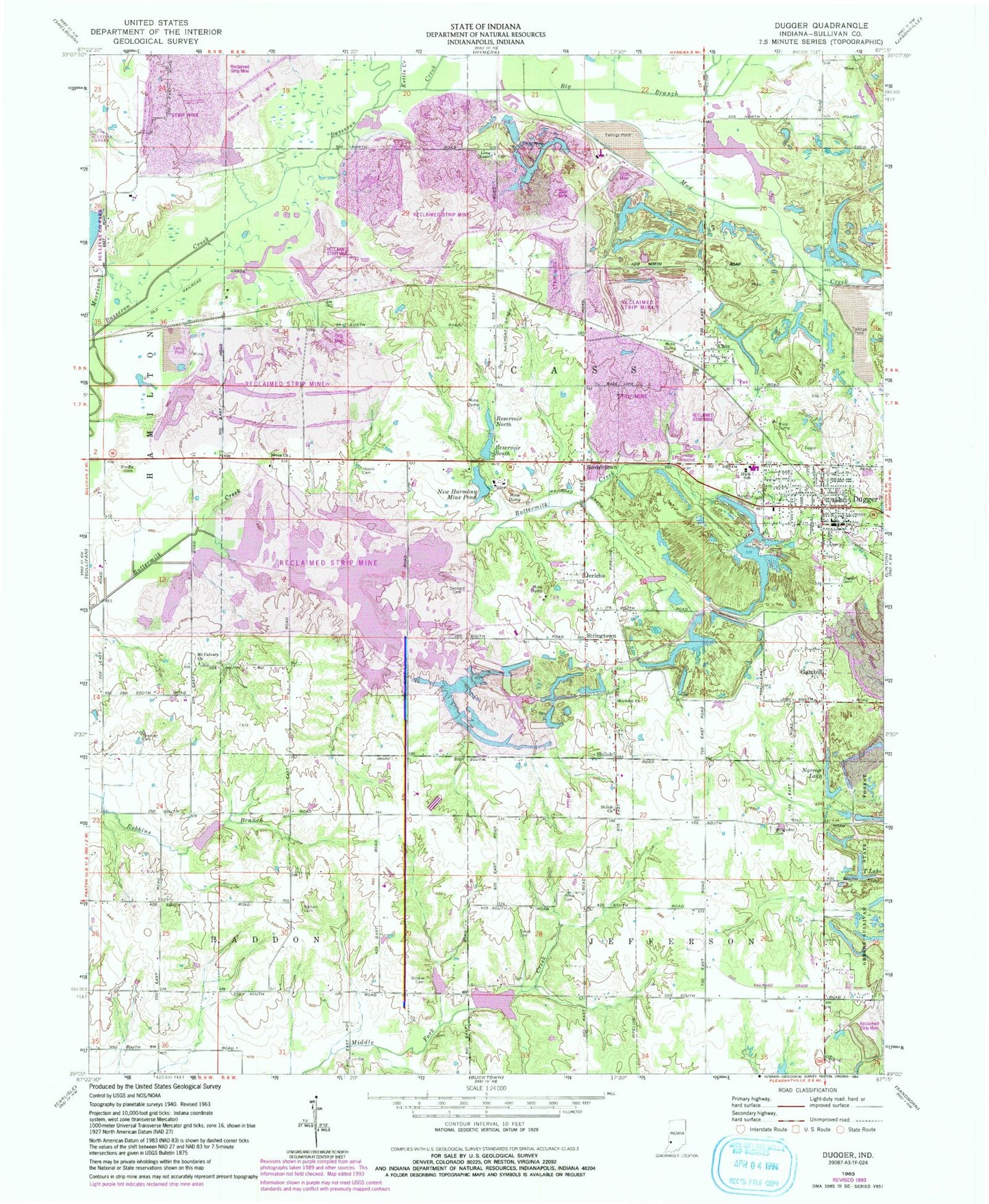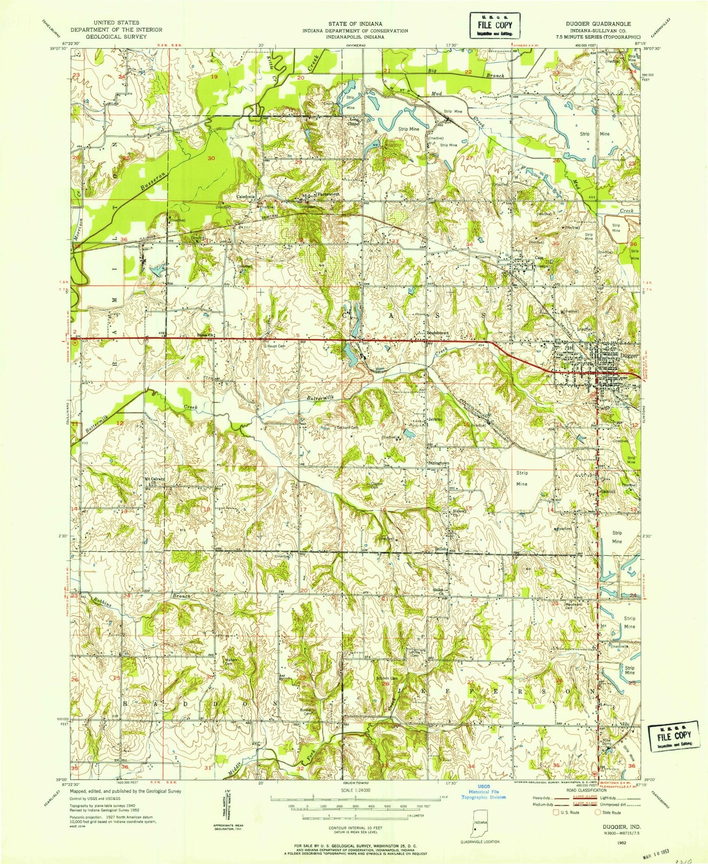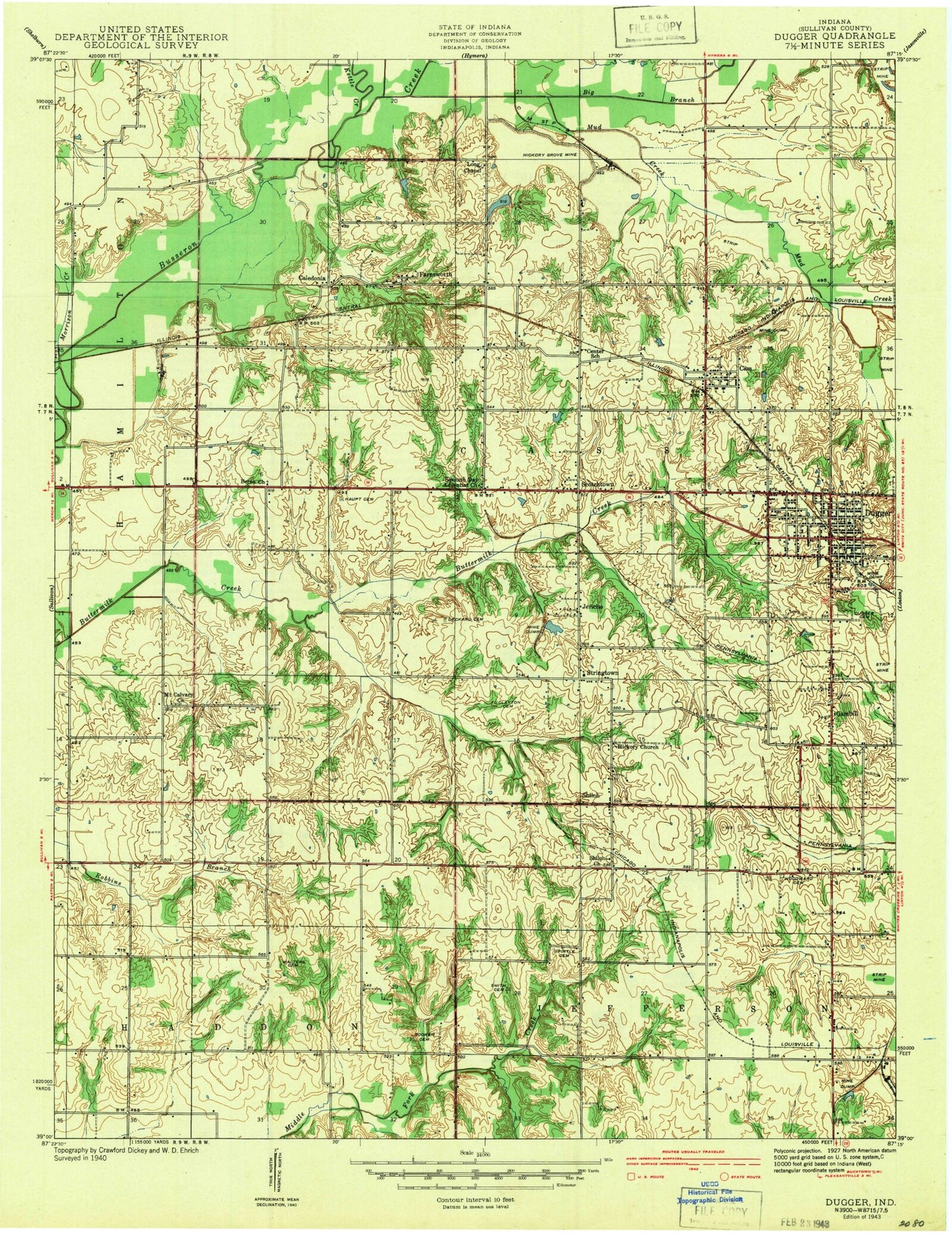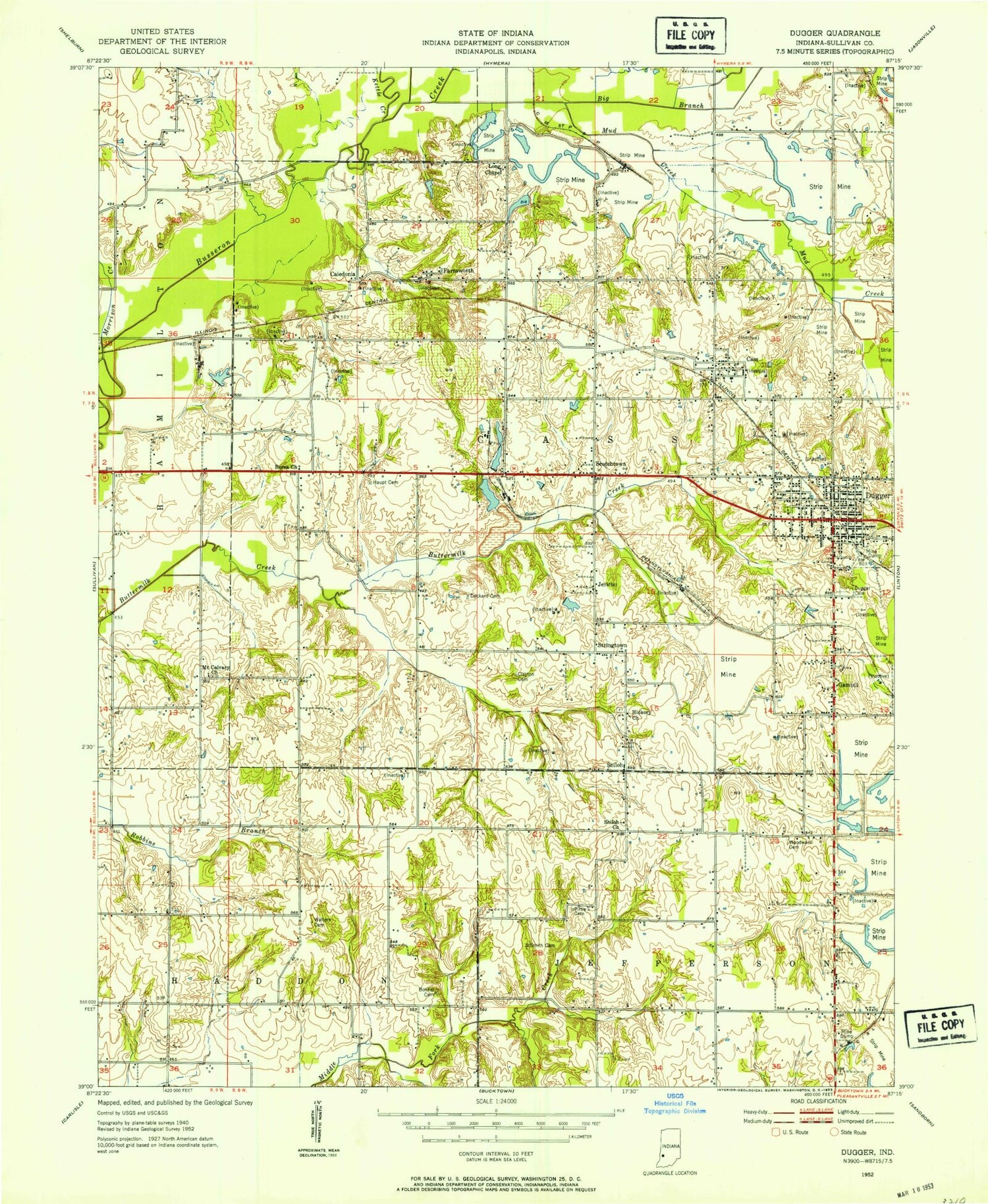

MyTopo
Classic USGS Dugger Indiana 7.5'x7.5' Topo Map
Couldn't load pickup availability
Historical USGS topographic quad map of Dugger in the state of Indiana. Map scale may vary for some years, but is generally around 1:24,000. Print size is approximately 24" x 27"
This quadrangle is in the following counties: Sullivan.
The map contains contour lines, roads, rivers, towns, and lakes. Printed on high-quality waterproof paper with UV fade-resistant inks, and shipped rolled.
Contains the following named places: Berea Church, Big Branch, Booker Cemetery, Brodie Cemetery, Busseron Dam Number B-2, Caledonia, Cass, Clayton Cemeteries, Deckard Cemetery, Dugger, Dugger Cemetery, Dugger Elementary School, Dugger Police Department, Dugger Post Office, Farnsworth, Gambill, Hickory Church, Houck Cemetery, Jericho, Kettle Creek, Long Chapel, Morrison Creek, Mount Calvary Church, Mud Creek, Narrow Lake, New Harmony Mine Pond, Pirtle Cemetery, Reservoir North, Reservoir South, Scotchtown, Shiloh, Shiloh Church, Smith Cemetery, Spencer Cemetery, Stringtown, Sullivan County Park, T Lake, Town of Dugger, Township of Cass, Union Fire Territory, Union High School, Walters Cemetery, Woodward Cemetery, ZIP Code: 47848