
MyTopo
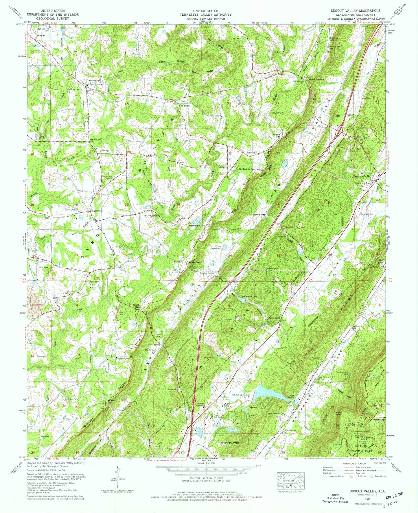
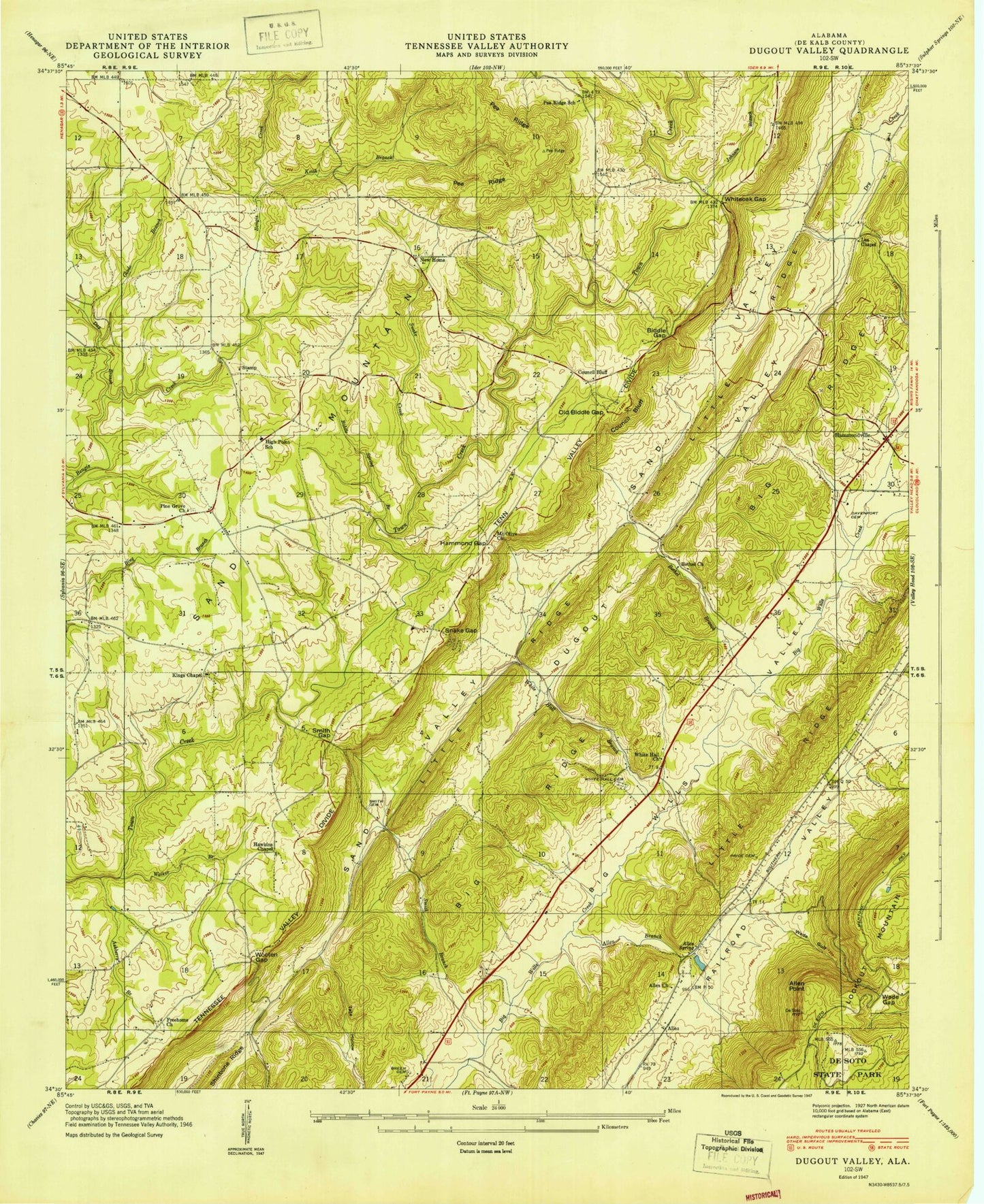
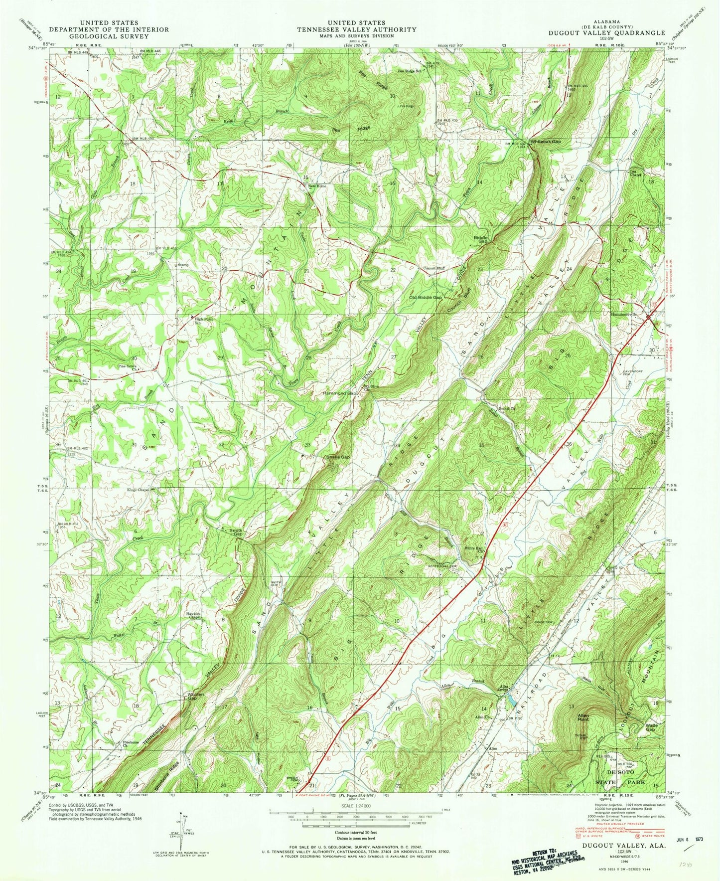
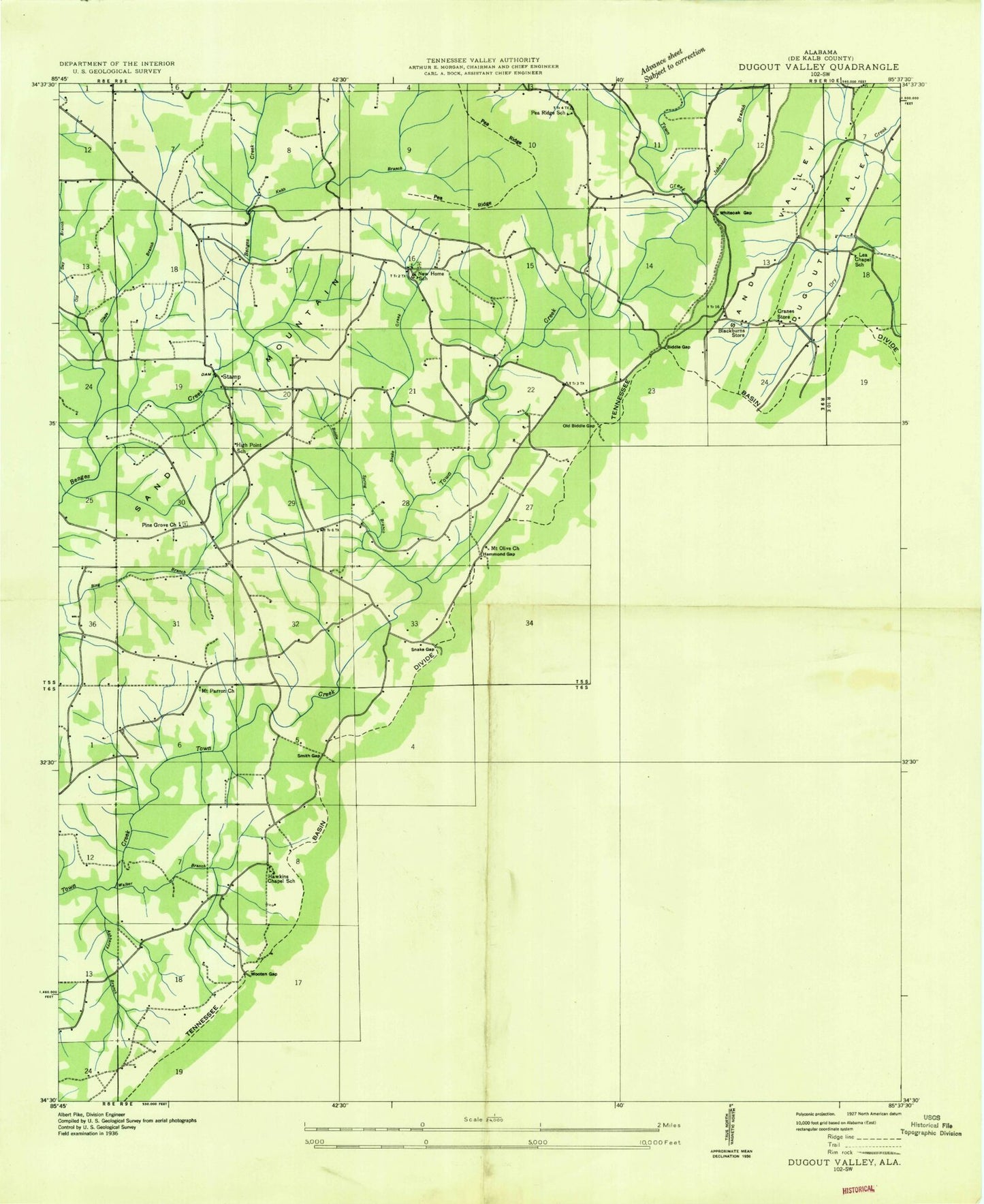
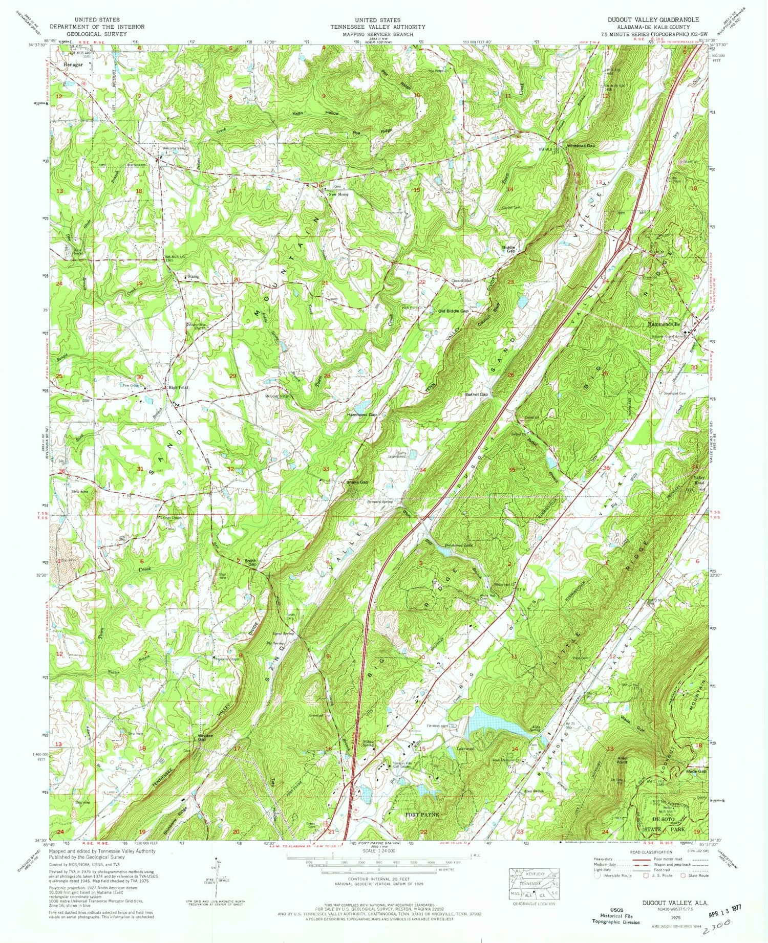
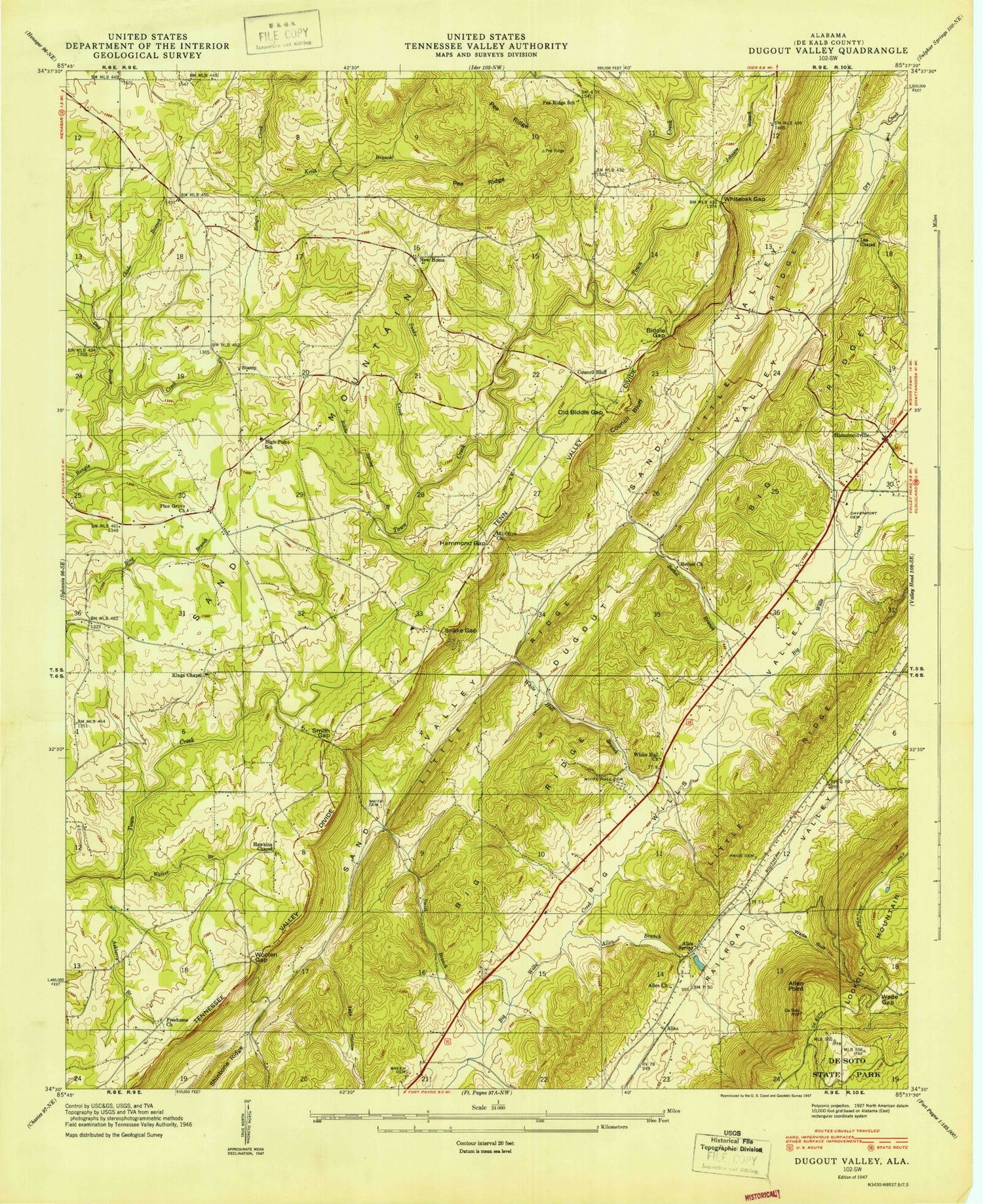
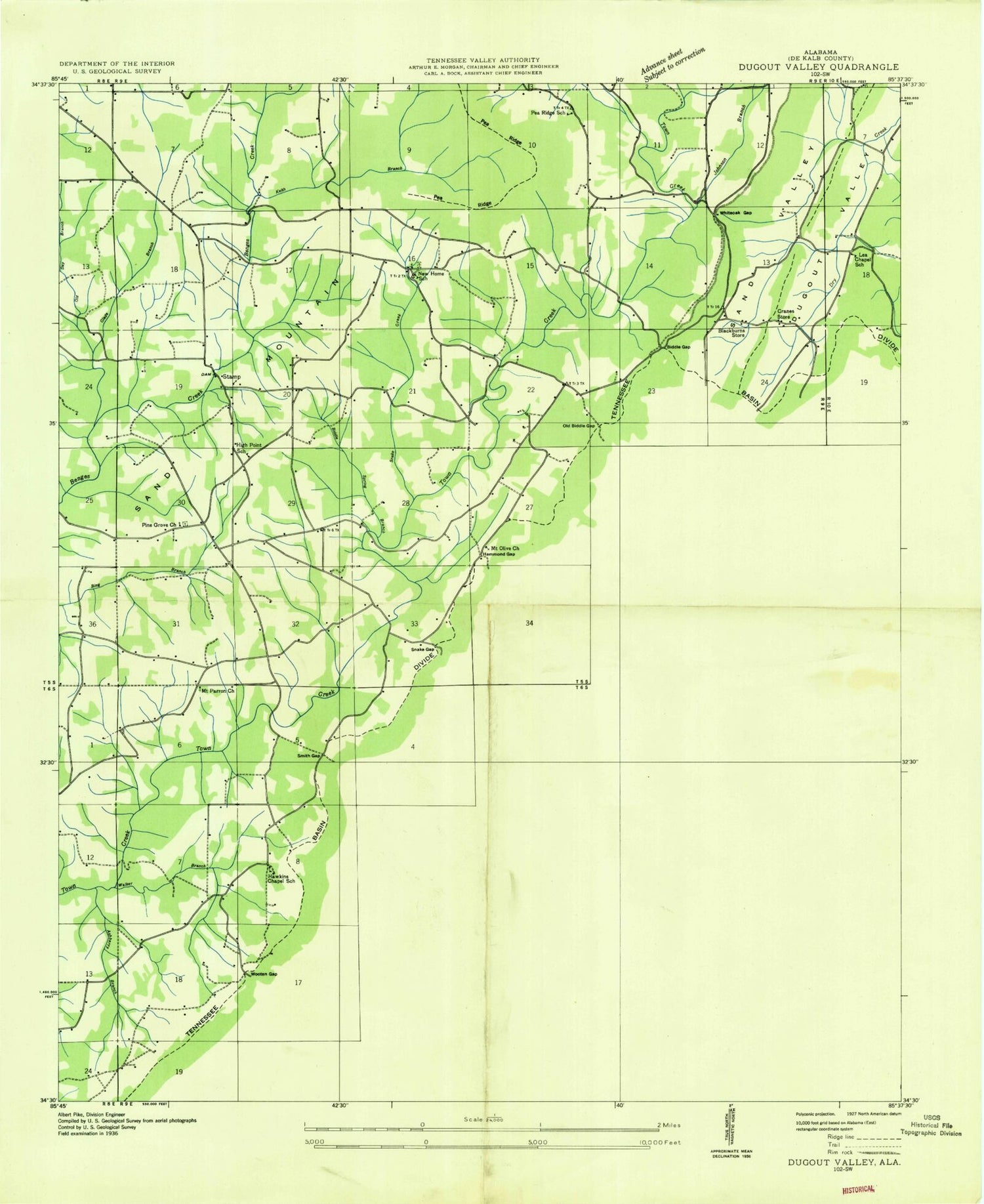
Classic USGS Dugout Valley Alabama 7.5'x7.5' Topo Map
Couldn't load pickup availability
Historical USGS topographic quad map of Dugout Valley in the state of Alabama. Map scale may vary for some years, but is generally around 1:24,000. Print size is approximately 24" x 27"
This quadrangle is in the following counties: DeKalb.
The map contains contour lines, roads, rivers, towns, and lakes. Printed on high-quality waterproof paper with UV fade-resistant inks, and shipped rolled.
Contains the following named places: Allen Branch, Allen Memorial Baptist Church, Allen Point, Allen Spring, Allen Switch, Ashberry Branch, Barnard Spring, Bethel Branch, Bethel Church, Bethel Gap, Biddle Gap, Biddle Spring Branch, Big Spring, Blackburns Store, Chambers Dam, Chambers Lake, Church of God, Cordell, Cordell Cemetery, Council Bluff, Council Bluff School, Cranes Store, Davenport Cemetery, Day Branch, Fort Payne City Lake, Fort Payne Dam, Glade Branch, Green Cemetery, Hammond Gap, Hammondville, Hammondville Branch, Hammondville Police Department, Hammondville Volunteer Fire Department, Hawkins Chapel, Hawkins Chapel School, Hawkins Dam, Hawkins Lake, Henagar Division, High Point, High Point Church of God, High Point School, House of Prayer Church, Johnson Branch, Keith Branch, Keith Hollow, Kings Chapel, Lakewood, Lea Chapel, Lea Chapel School, Lyons Spring, Mays Gulf, McCurdy Bridge, Mount Olive Church, New Home, New Home School, Old Biddle Gap, Pea Ridge, Pea Ridge Church, Pea Ridge School, Pells Chapel, Pine Grove Church, Prestwood Dam, Prestwood Lake, Price Cemetery, Smith Branch, Smith Cemetery, Smith Gap, Snake Creek, Snake Gap, Stamp, Terrapin Hills Golf Estates, Thomas Branch, Town of Hammondville, Wade Gap, Wade Gulf, Walker Branch, Welcome View Church, West Fork Bengis Creek, White Hall Branch, White Hall Cemetery, White Hall Church, Whiteoak Gap, Willow Spring, Wills Lake, Wooten Gap, ZIP Code: 35968