MyTopo
Classic USGS Dugway Range NE Utah 7.5'x7.5' Topo Map
Regular price
$16.95
Regular price
Sale price
$16.95
Unit price
per
Couldn't load pickup availability
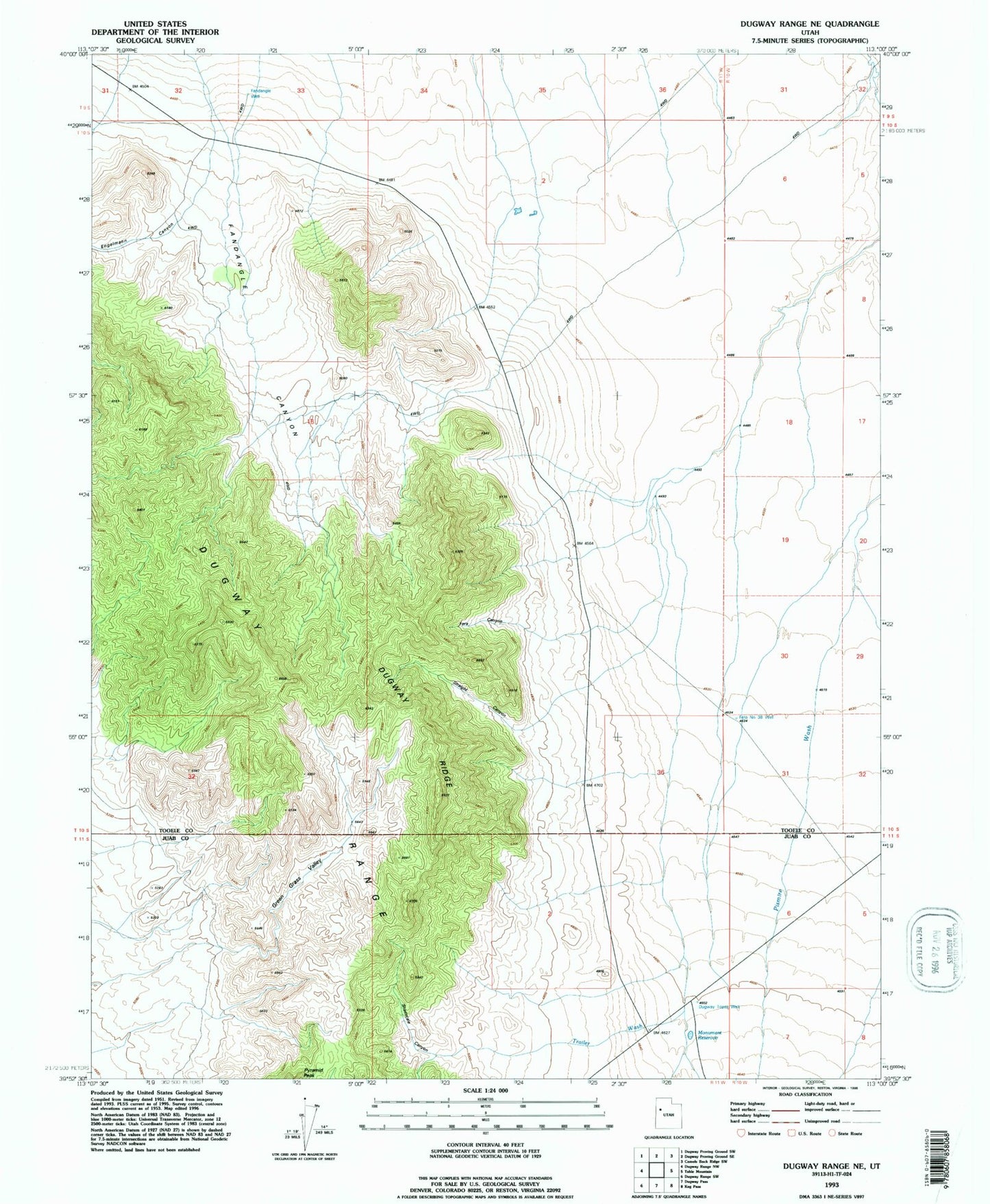
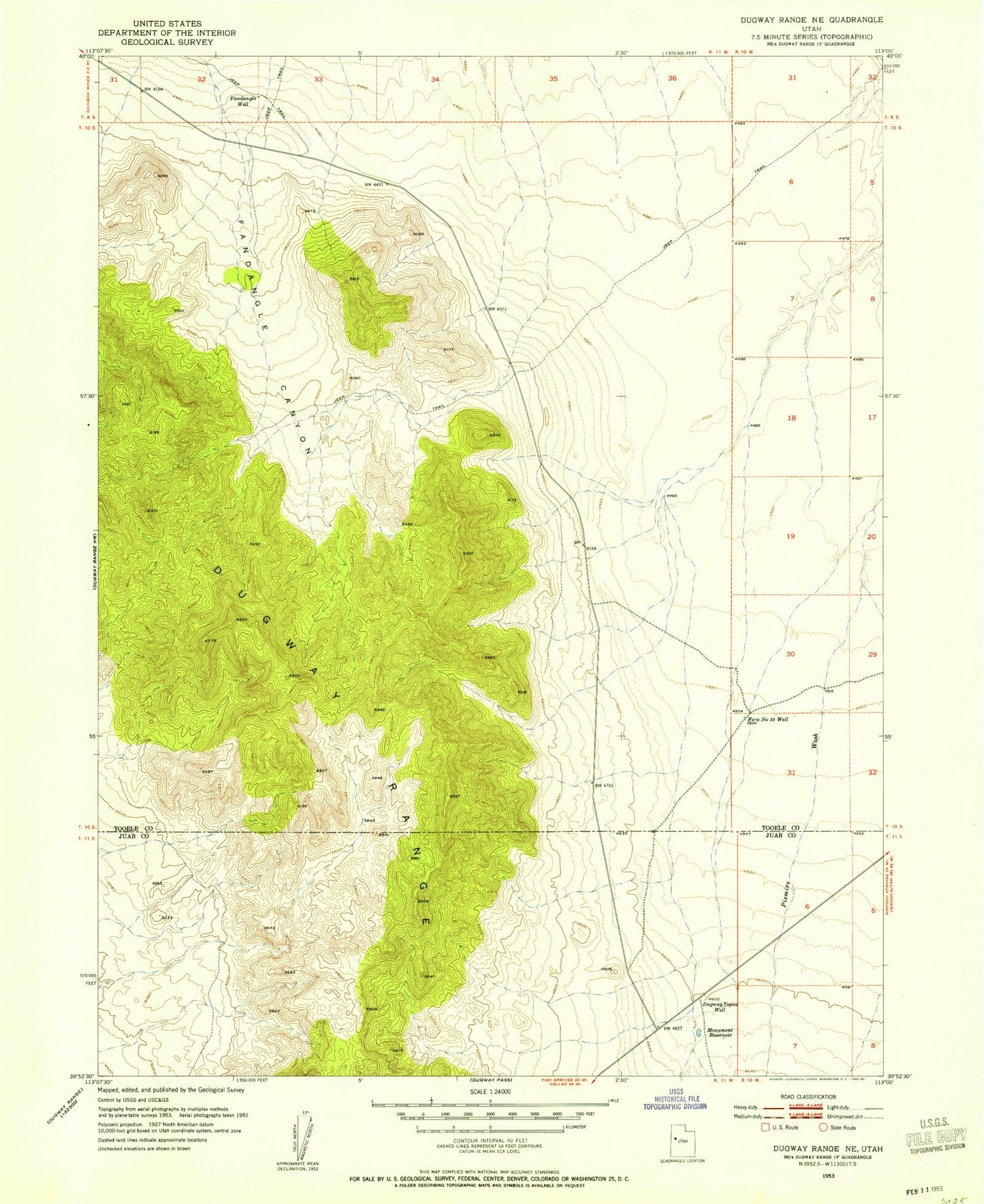
Historical USGS topographic quad map of Dugway Range NE in the state of Utah. Map scale may vary for some years, but is generally around 1:24,000. Print size is approximately 24" x 27"
This quadrangle is in the following counties: Juab, Tooele.
The map contains contour lines, roads, rivers, towns, and lakes. Printed on high-quality waterproof paper with UV fade-resistant inks, and shipped rolled.
Contains the following named places: Dugway Range, Dugway Ridge, Dugway Topaz Well, Engelmann Canyon, Fandangle Canyon, Fandangle Well, Fera Canyon, Fera Number 38 Well, Green Grass Valley, Monument Reservoir, Shadscale Canyon, Shadscale Canyon Trailer Wash, Straight Canyon, Trailer Wash