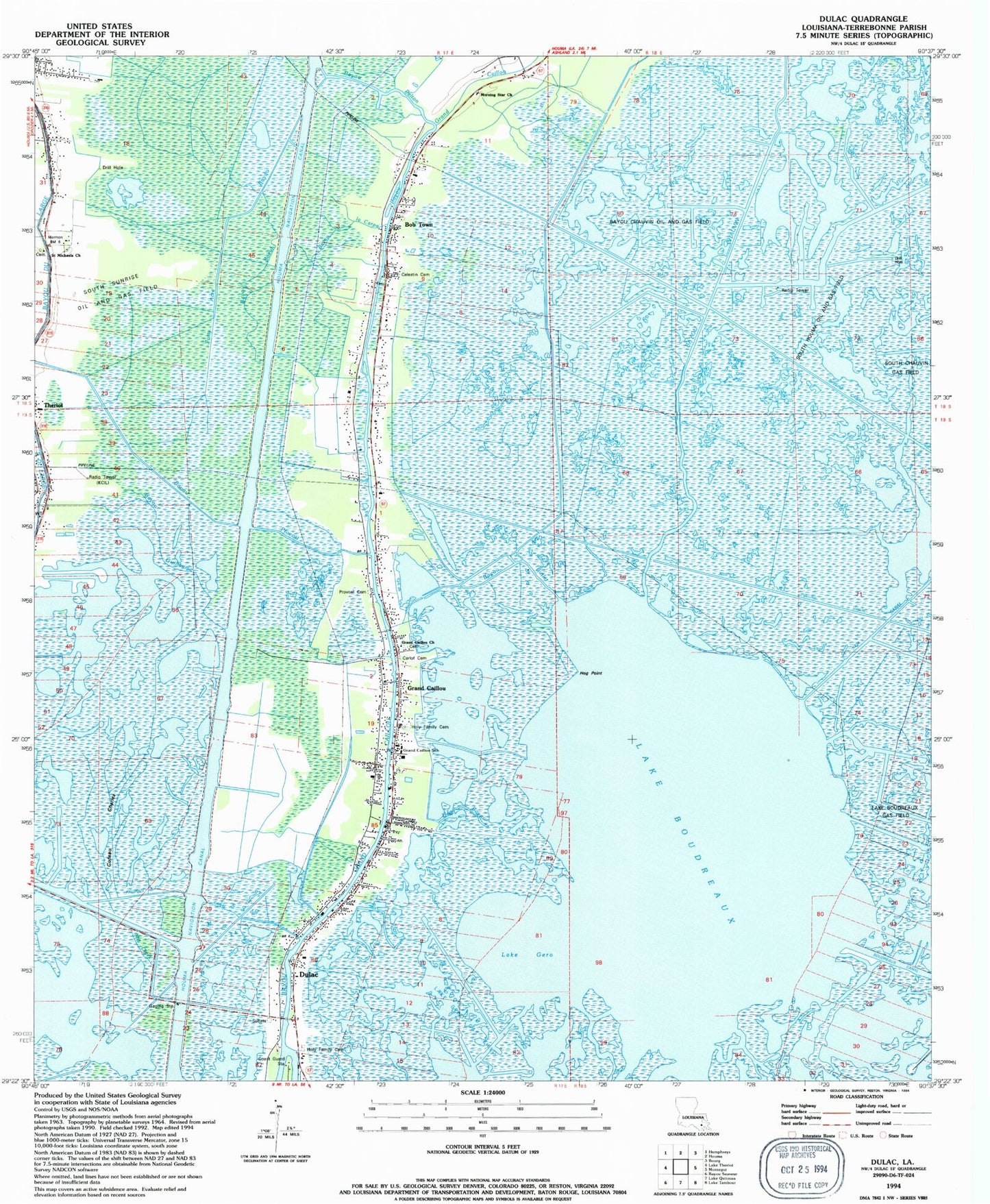
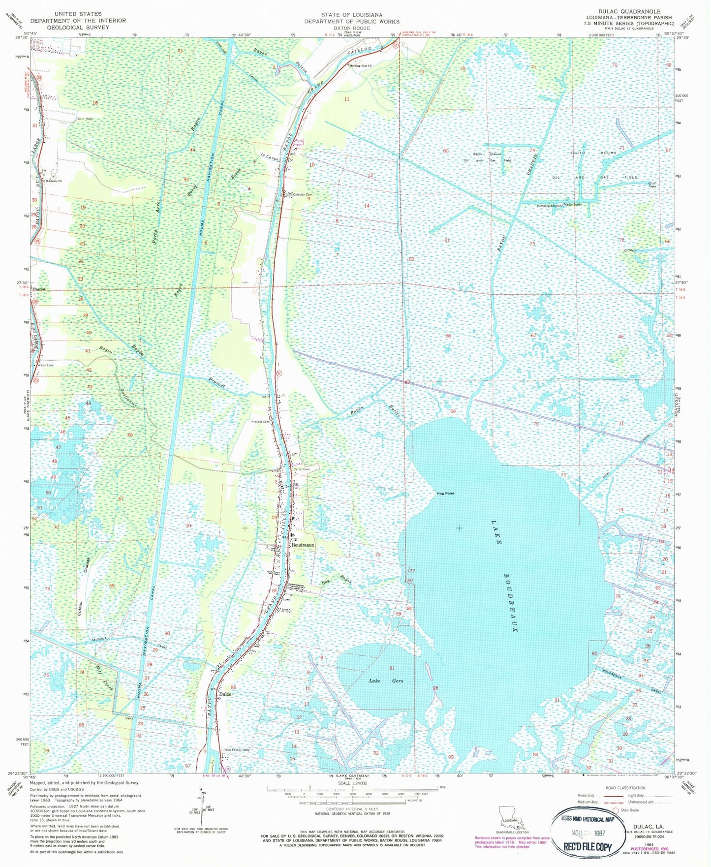
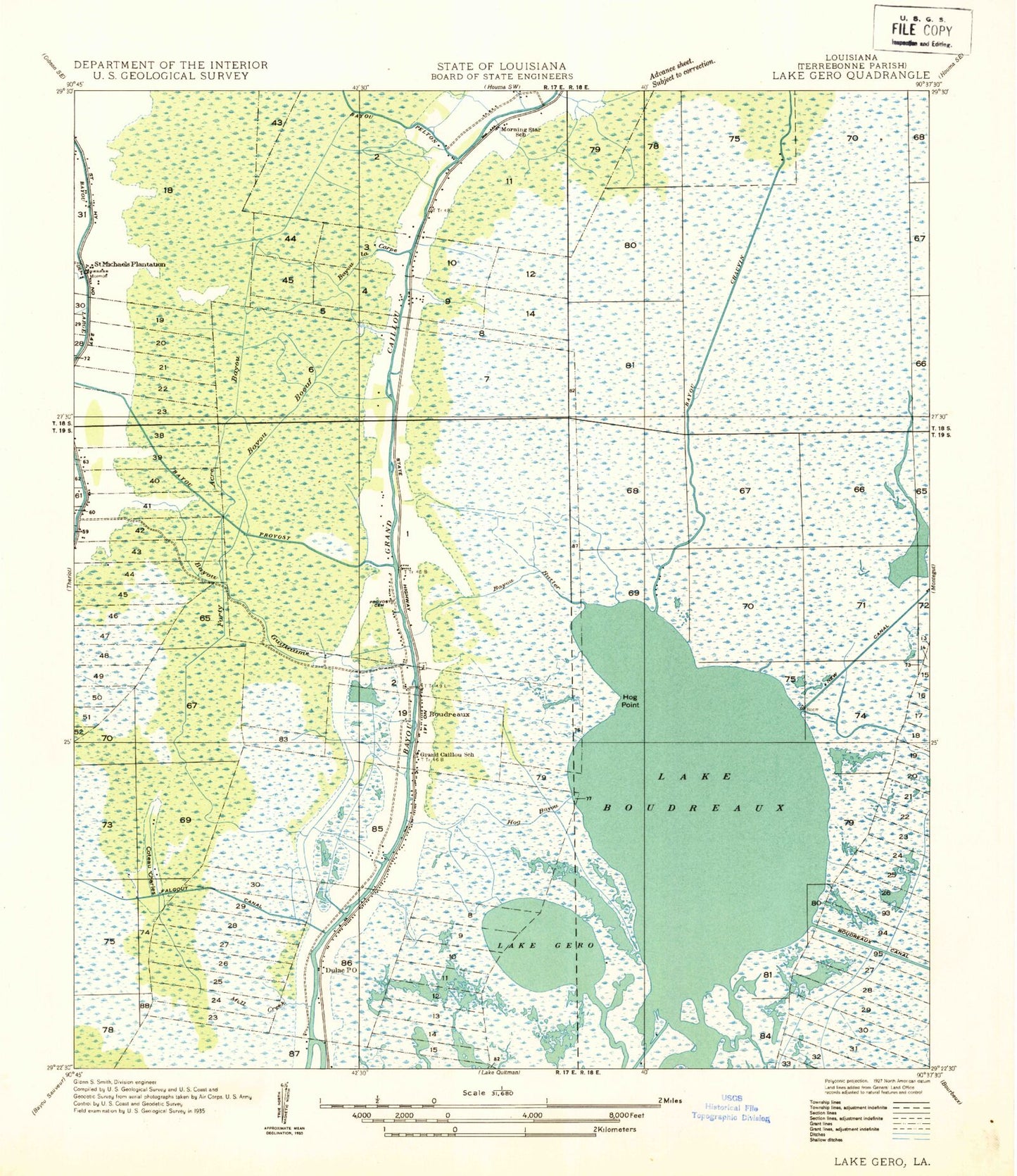
MyTopo
Classic USGS Dulac Louisiana 7.5'x7.5' Topo Map
Couldn't load pickup availability
Historical USGS topographic quad map of Dulac in the state of Louisiana. Map scale may vary for some years, but is generally around 1:24,000. Print size is approximately 24" x 27"
This quadrangle is in the following counties: Terrebonne.
The map contains contour lines, roads, rivers, towns, and lakes. Printed on high-quality waterproof paper with UV fade-resistant inks, and shipped rolled.
Contains the following named places: Bayou Boeuf, Bayou Butler, Bayou Chauvin, Bayou Chauvin Oil and Gas Field, Bayou Guillaume, Bayou La Carpe, Bayou Pelton, Bayou Provost, Bobtown, Boudreaux, Carlof Cemetery, Celestin Garden of Memory Cemetery, Coteau Charles, Dulac, Dulac Census Designated Place, Dulac Post Office, Faith Baptist Church, Forty Acre Bayou, Grand Caillou Elementary School, Grand Caillou Middle School, Grand Caillou Volunteer Fire Department Bobtown Station, Grand Caillou Volunteer Fire Department Central Station, Grand Caillou/Dulac State Designated Tribal Statistical Area, Hog Bayou, Hog Point, Holy Family Cemetery Number 1, Holy Family Church, Houma Navigation Canal, KCIL-FM (Houma), Lake Boudreaux, Lake Gero, Lake Gero Gas Field, Mill Creek, Morning Star Church, Morning Star School, New Canal, Parish Governing Authority District 8, Parish Governing Authority District H, Prevost Cemetery, Saint Michaels Church, Saint Michaels Plantation, Theriot Post Office, Ward Four