MyTopo
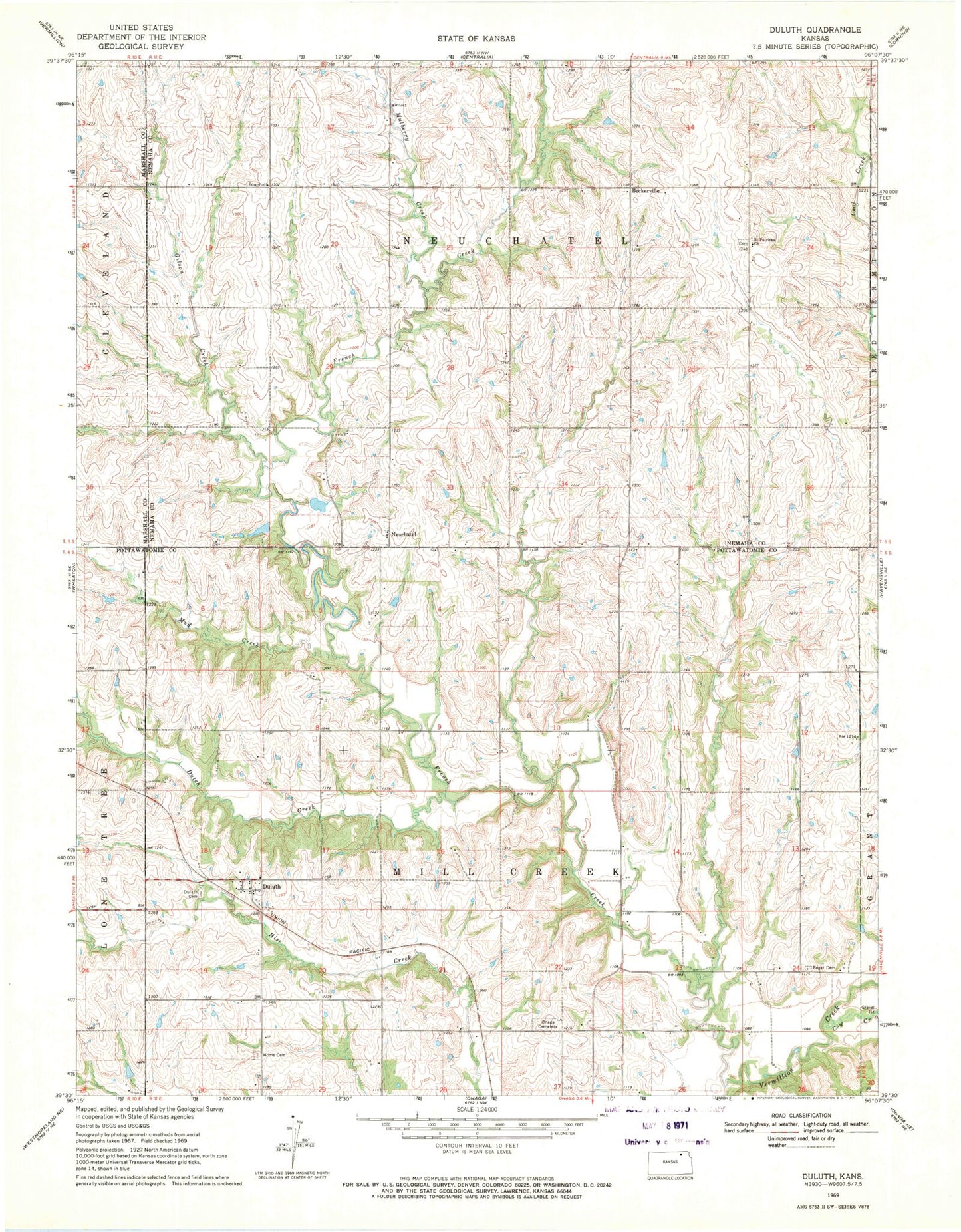
Classic USGS Duluth Kansas 7.5'x7.5' Topo Map
Couldn't load pickup availability
Historical USGS topographic quad map of Duluth in the state of Kansas. Map scale may vary for some years, but is generally around 1:24,000. Print size is approximately 24" x 27"
This quadrangle is in the following counties: Marshall, Nemaha, Pottawatomie.
The map contains contour lines, roads, rivers, towns, and lakes. Printed on high-quality waterproof paper with UV fade-resistant inks, and shipped rolled.
Contains the following named places: Beckerville, Cool Springs Golf Course, Cow Creek, Duluth, Dutch Creek, French Creek, Gilson Creek, Home Cemetery, Mud Creek, Mulberry Creek, Neuchatel, Neuchatel Cemetery, Onaga Cemetery, Regar Cemetery, Saint Patricks Cemetery, Saint Patricks Church, Saint Pauls Lutheran Cemetery, Saint Pauls Lutheran Church, Township of Mill Creek, Township of Neuchatel