MyTopo
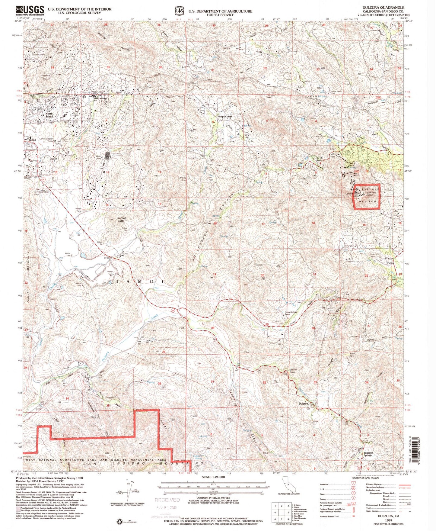
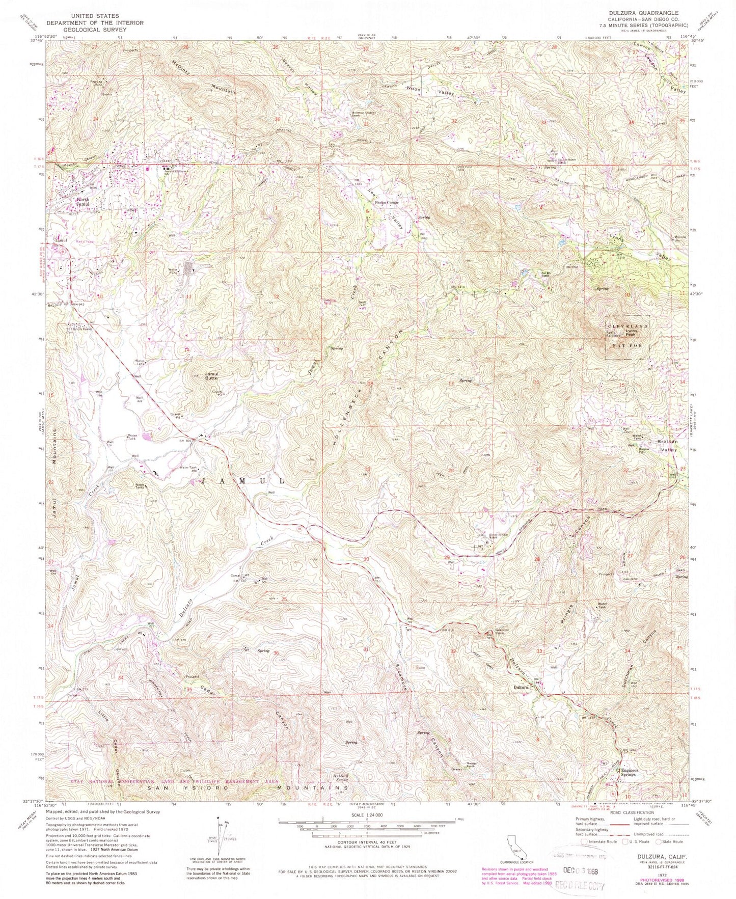
Classic USGS Dulzura California 7.5'x7.5' Topo Map
Couldn't load pickup availability
Historical USGS topographic quad map of Dulzura in the state of California. Typical map scale is 1:24,000, but may vary for certain years, if available. Print size: 24" x 27"
This quadrangle is in the following counties: San Diego.
The map contains contour lines, roads, rivers, towns, and lakes. Printed on high-quality waterproof paper with UV fade-resistant inks, and shipped rolled.
Contains the following named places: California Riding and Hiking Trail, Bratton Ranch, Bratton Valley, Cedar Canyon, Dulzura, Dulzura Creek, Dutchman Canyon, Hollenbeck Canyon, Honey Springs Ranch, Hubbard Spring, Jamul, Jamul Butte, Jamul Elementary School, Lawson Valley, Lee Valley, Little Cedar Canyon, Lyons Valley, McGinty Mountain, Mocogo Ranch, Mother Grundy Truck Trail, Mountain Shadows Ranch, North Jamul, Peg Leg Mine, Pringle Canyon, Saint Francis Xavier Cemetery, Skyline Ranch, Sycamore Canyon, Wisecarver Truck Trail, Wood Valley, Gasoline Curve, Engineer Springs, Lyons Peak, Phelps Corner, Camp Minnewawa (historical), Daley Ranch, Harper Ranch, Indian Church, Las Flores School (historical), Mellor Ranch, Diamond Jack Campground, Oak Grove Middle School, Skyline Ranch Campground, Jamul Division, Jamul Indian Village, Jamul Census Designated Place, Jamul Indian Village, Saint Pius X Catholic Church, Jamul Community Church, Lyons Peak Lookout, California Department of Forestry and Fire Protection District Station 30, California Department of Forestry and Fire Protection District Station 32 - Lyons Valley, California Department of Forestry and Fire Protection Jamul Fire Station 36, California Department of Forestry and Fire Protection District Station 37 - Deerhorn Valley, California Department of Forestry and Fire Protection Station 34 - Lee Valley, San Diego County Fire Station 36, Dulzura Post Office, Jamul Post Office