MyTopo
Classic USGS Dumas Arkansas 7.5'x7.5' Topo Map
Couldn't load pickup availability
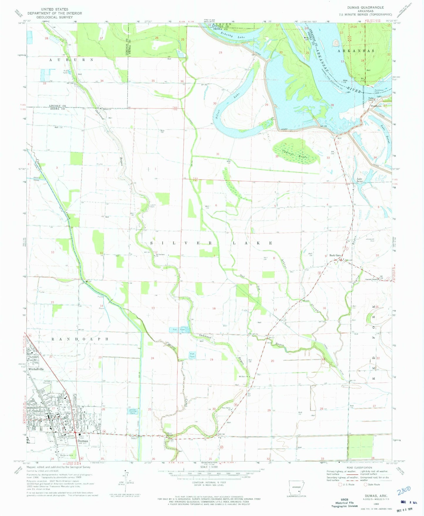
Historical USGS topographic quad map of Dumas in the state of Arkansas. Map scale may vary for some years, but is generally around 1:24,000. Print size is approximately 24" x 27"
This quadrangle is in the following counties: Arkansas, Desha, Lincoln.
The map contains contour lines, roads, rivers, towns, and lakes. Printed on high-quality waterproof paper with UV fade-resistant inks, and shipped rolled.
Contains the following named places: Atkins Slough, Back Gate, Bethel Church, Brookhaven Shopping Center, Calvary Missionary Baptist Church, Carter Shopping Center, Central Elementary School, City of Dumas, City of Mitchellville, Cypress Brake, Daniel Chapel Baptist Church, Dayton Bayou, Desha County Museum, Dumas, Dumas Church of Christ, Dumas Emergency Medical Services, Dumas Fire Department, Dumas High School, Dumas Junior High School, Dumas Nursing Center, Dumas Police Department, Dumas Post Office, Dumas Public Library, Echubby Lake, First Assembly of God Church, First Baptist Church of Dumas, First Delta Church, First United Methodist Church, Havis Chapel, Holy Child Catholic Church, Jerusalem Cemetery, Lake Lenox, Leach Cemetery, Memorial Park, Mitchellville, Mitchellville Fire Department, Mitchellville Police Department, Mount Zion Church, Mud Lake, Northside Baptist Church, Oak Log Bayou, Oaklawn, Oakwood Bayou, Pendleton, Pendleton Bend, Pendleton Ferry, Reed Elementary School, Saint Stevens Church, Silver Lake, Southeast Arkansas Law Enforcement Center, Southeast Arkansas Law Enforcement Center- Alcohol Tobacco And Firearms, Southeast Arkansas Law Enforcement Center - Desha County Sheriff Substation, Southeast Arkansas Law Enforcement Center- State Police Troop E, Township of Silver Lake