
MyTopo
Classic USGS Dumont South Iowa 7.5'x7.5' Topo Map
Couldn't load pickup availability
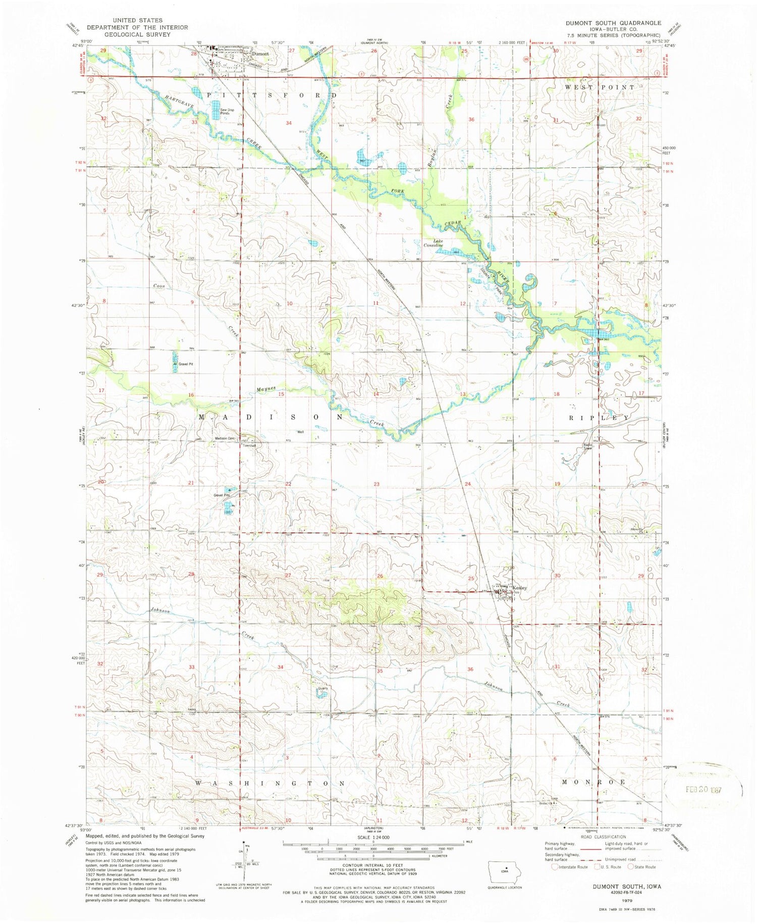
Historical USGS topographic quad map of Dumont South in the state of Iowa. Map scale may vary for some years, but is generally around 1:24,000. Print size is approximately 24" x 27"
This quadrangle is in the following counties: Butler.
The map contains contour lines, roads, rivers, towns, and lakes. Printed on high-quality waterproof paper with UV fade-resistant inks, and shipped rolled.
Contains the following named places: Bethel Reform Cemetery, Bethel Reform Church, Boylan Creek, Boylan Creek Wildlife Area, Butler, Clutterville Post Office, Considene Lake Park, Coon Creek, Dumont, Dumont Historical Museum, Dumont Town Hall, Dumont Volunteer Ambulance Service, Farmers Co-op Elevator Company Elevator, Fort Sumter Rock, Hartgrave Creek, Hitesville Cemetery, Hitesville Gospel Hall, Hitesville Post Office, Island Grove Post Office, Kesley, Kesley Post Office, Lake Considine, Madison Township Cemetery, Maynes Creek, South Fork Park, Township of Madison, ZIP Code: 50625


