MyTopo
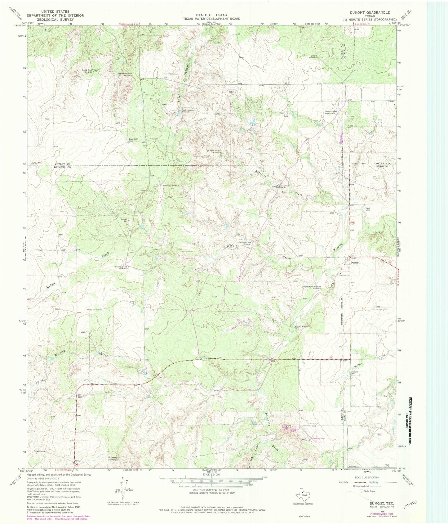
Classic USGS Dumont Texas 7.5'x7.5' Topo Map
Couldn't load pickup availability
Historical USGS topographic quad map of Dumont in the state of Texas. Map scale may vary for some years, but is generally around 1:24,000. Print size is approximately 24" x 27"
This quadrangle is in the following counties: Cottle, Dickens, King, Motley.
The map contains contour lines, roads, rivers, towns, and lakes. Printed on high-quality waterproof paper with UV fade-resistant inks, and shipped rolled.
Contains the following named places: Deep Well, Dillar Windmill, Dumont, Dumont Cemetery, Dumont Horse Pasture Windmill, Eighteen Creek, Eighteen Creek Windmill, Headquarters Windmill, McDuff Windmill, Middle Creek, Middle Creek Windmill, Sandy Well, Section Seven Windmill, Shinnery Draw, Shinnery Springs, South East Thief Hollow Windmill, South River Windmill, Southeast River Windmill, Thief Hollow Windmill, Threeway Windmill, Wildcat Draw