MyTopo
Classic USGS Dunaway Mountain Alabama 7.5'x7.5' Topo Map
Couldn't load pickup availability
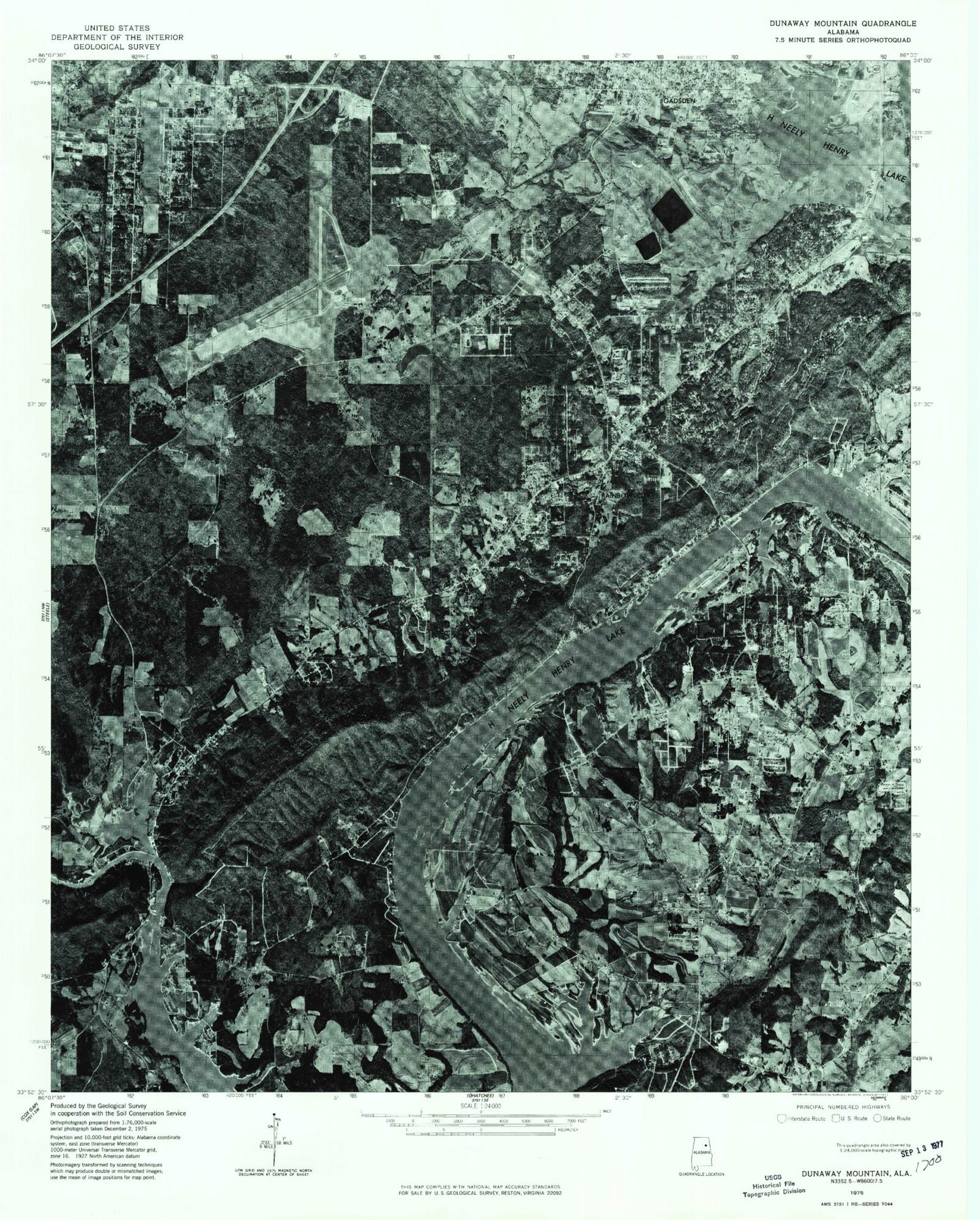
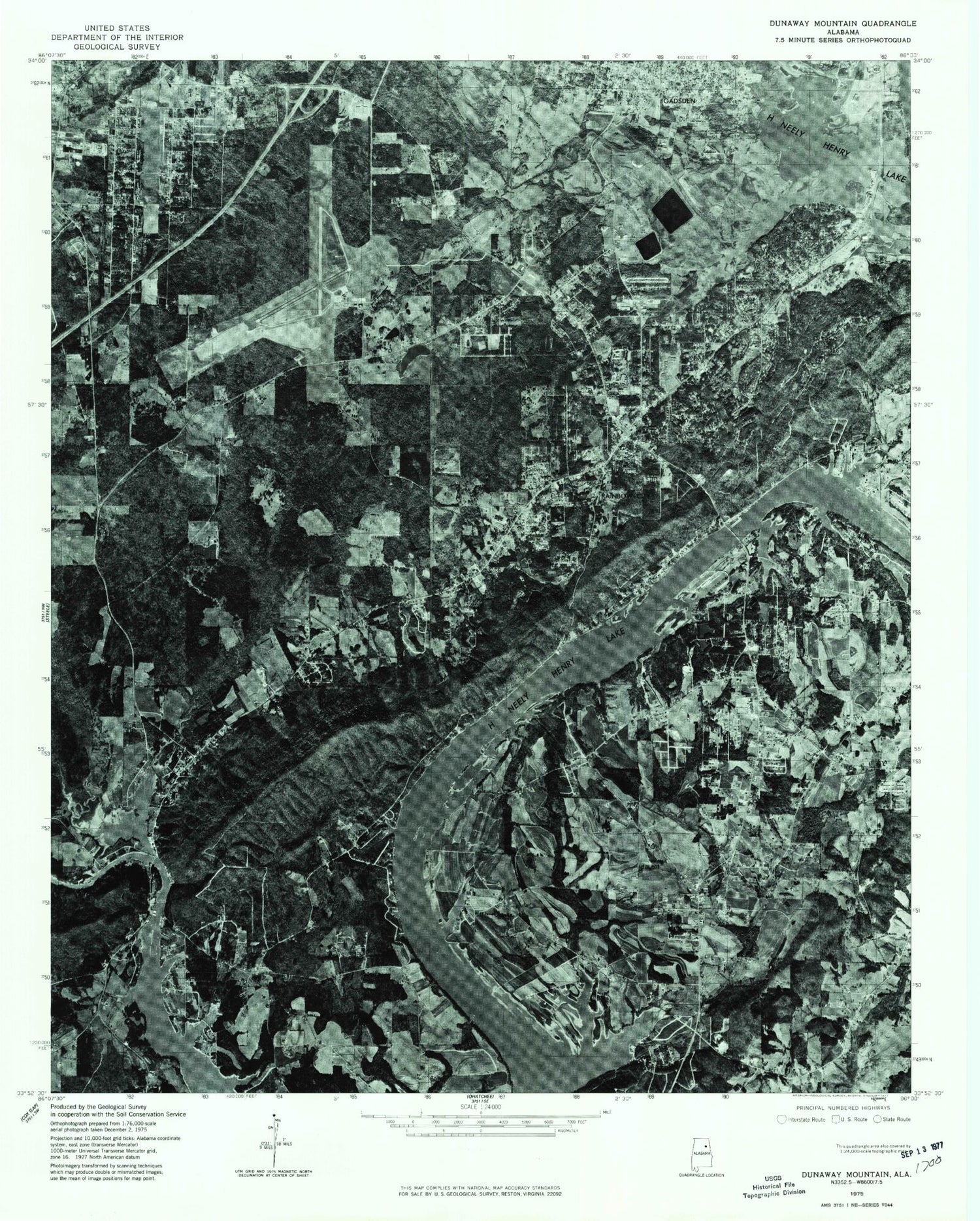
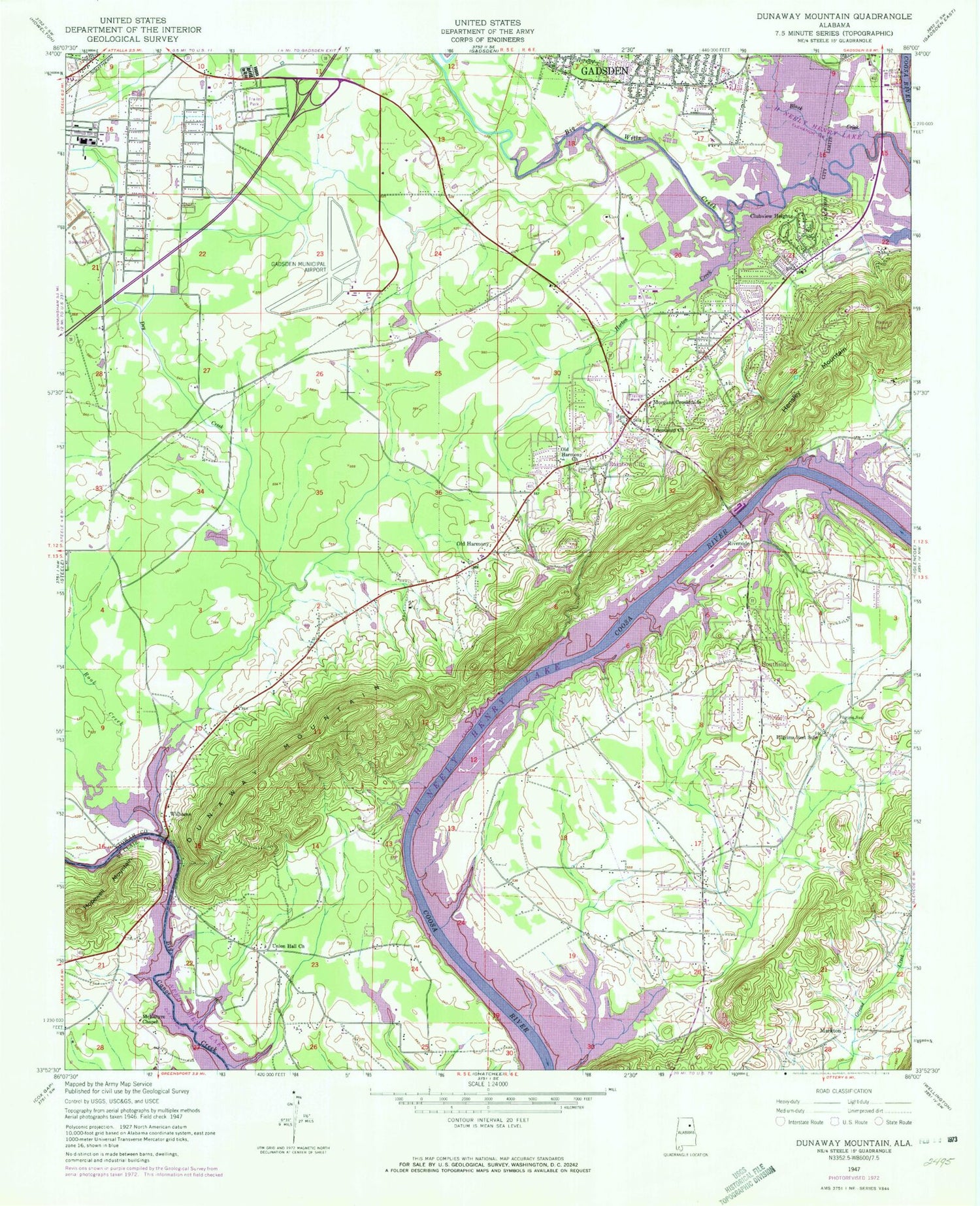
Historical USGS topographic quad map of Dunaway Mountain in the state of Alabama. Map scale may vary for some years, but is generally around 1:24,000. Print size is approximately 24" x 27"
This quadrangle is in the following counties: Etowah, St. Clair.
The map contains contour lines, roads, rivers, towns, and lakes. Printed on high-quality waterproof paper with UV fade-resistant inks, and shipped rolled.
Contains the following named places: Advantage Emergency Medical Services, Agricola Lake, Airport Industrial Park, Attalla City Park, Attalla Fire Department Station 2, Attalla Speedway, Aubury Bridge, Banks Park, Bethel Baptist Church, Big Lick, Big Wills Creek, Black Creek, Brannon Springs, Brannon Springs Missionary Baptist Church, Broughton Springs, Brown's Farms, Camp Siebert, Canoe Creek Marina, Cardwell Dam, Cardwell Lake, Cedar Bend, Chateau Charolais Lake, Church of God of Prophecy, City of Southside, Clubview Heights, Cooper Dam, Coopers Lake, Country Club Spring, Damascus Baptist Church, Dry Creek, Dunaway Mountain, Edgewood Baptist Church, Etowah County Vocational School, Etowah High School, Etowahton, Etowahton Post Office, Eura Brown Elementary School, Faith Baptist Church, First Church of God, First Methodist Church, Gadsden Country Club, Gadsden Division, Gadsden Fire Department Station 8, Gadsden Mall Shopping Center, Genie Drew Village Shopping Center, Gilbert Bridge, Gilberts Ferry, Green Valley Baptist Church, Gum Springs, H Neely Henry Lake, Hensley Mountain, Hopewell Mountain, Horton Creek, Jesse Dean Smith School, John S Jones Elementary School, Kimball Lake, Kimball Lake Dam, Lakeview Baptist Church, Lester, Listers Ferry, Markton, McCardney Ferry, McEntyre Chapel, Meadowbrook Baptist Church, Morgans Crossroads, Mount Hope Church, Mount Hope Methodist Church, Mount Zion Methodist Church, Northeast Alabama Regional Airport, Old Harmony, Old Harmony Baptist Church, Perman Dam, Permans Lake, Pilgrims Rest, Pilgrims Rest Cemetery, Pilgrims Rest Missionary Baptist Church, Pilgrims Rest School, Rainbow Church of Christ, Rainbow City, Rainbow City Church of God, Rainbow City Fire Department Station 1, Rainbow City Fire Department Station 2, Rainbow City First Baptist Church, Rainbow City Park, Rainbow Memorial Gardens, Rainbow Middle School, Rainbow Plaza Shopping Center, Rainbow Presbyterian Church, Revival Tabernacle Church, Riddles Bend Church, Riddles Bend School, Riverside, Rogers Mill, Rook Creek, Saint James School, Sibert Methodist Church, Siberton, Siberton Baptist Church, Siberton Park, Sipsey Valley School, South Eleventh Street Baptist Church, South Gadsden Baptist Church, Southside, Southside Baptist Church, Southside Elementary School, Southside Fire Department Station 1, Southside First Baptist Church, Southside High School, Southside Police Department, Southside United Methodist Church, Spurlock Spring, Sutton Bridge, Tabernacle Baptist Church, Trinity Lutheran Church, Union Chapel Baptist Church, WAAX-AM (Gadsden), Westminster Christian School, White Springs Baptist Church, Whortons Creek, Williams, WKFX-AM (Rainbow City), ZIP Codes: 35906, 35907