MyTopo
Classic USGS Duncanville Alabama 7.5'x7.5' Topo Map
Couldn't load pickup availability
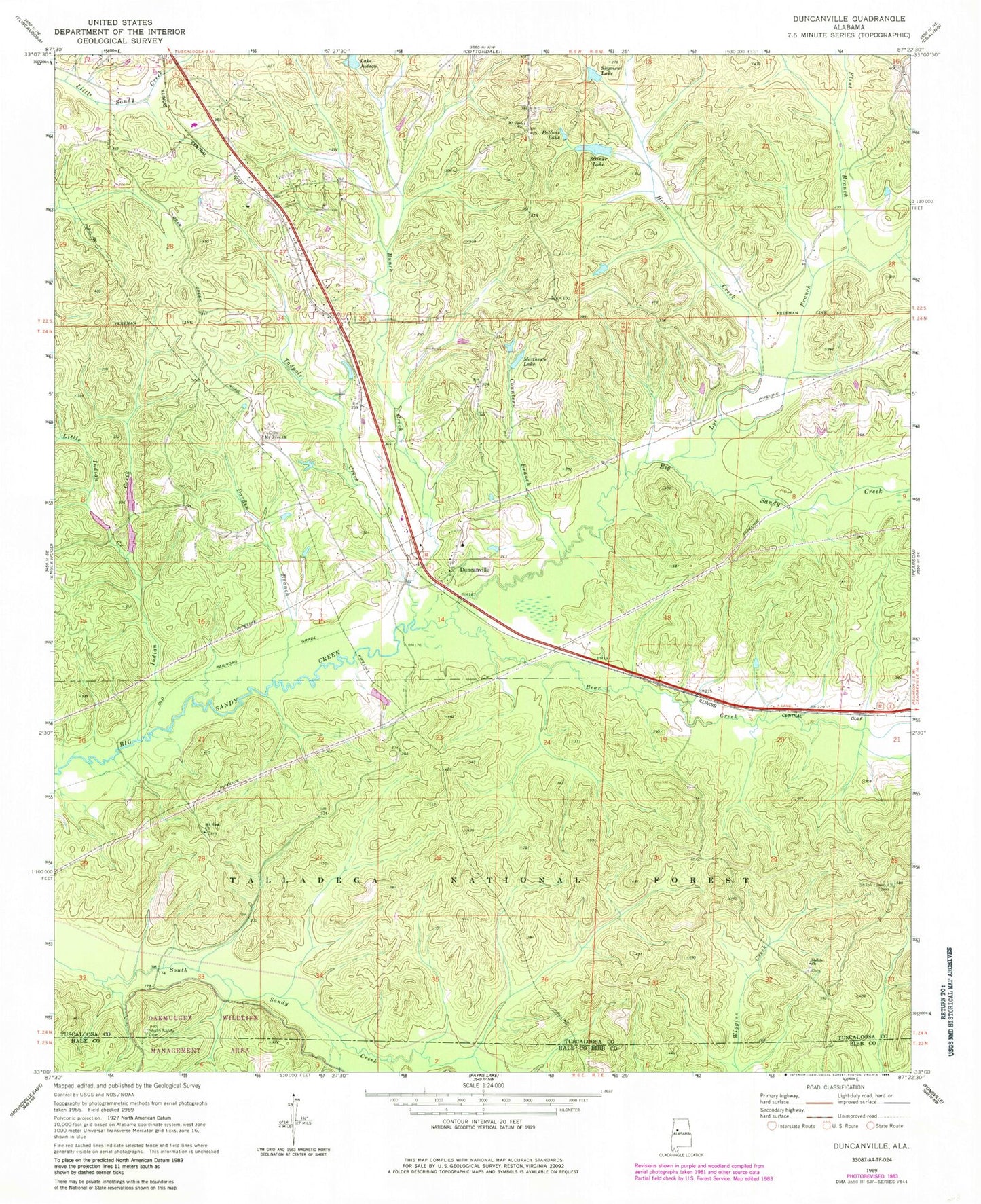
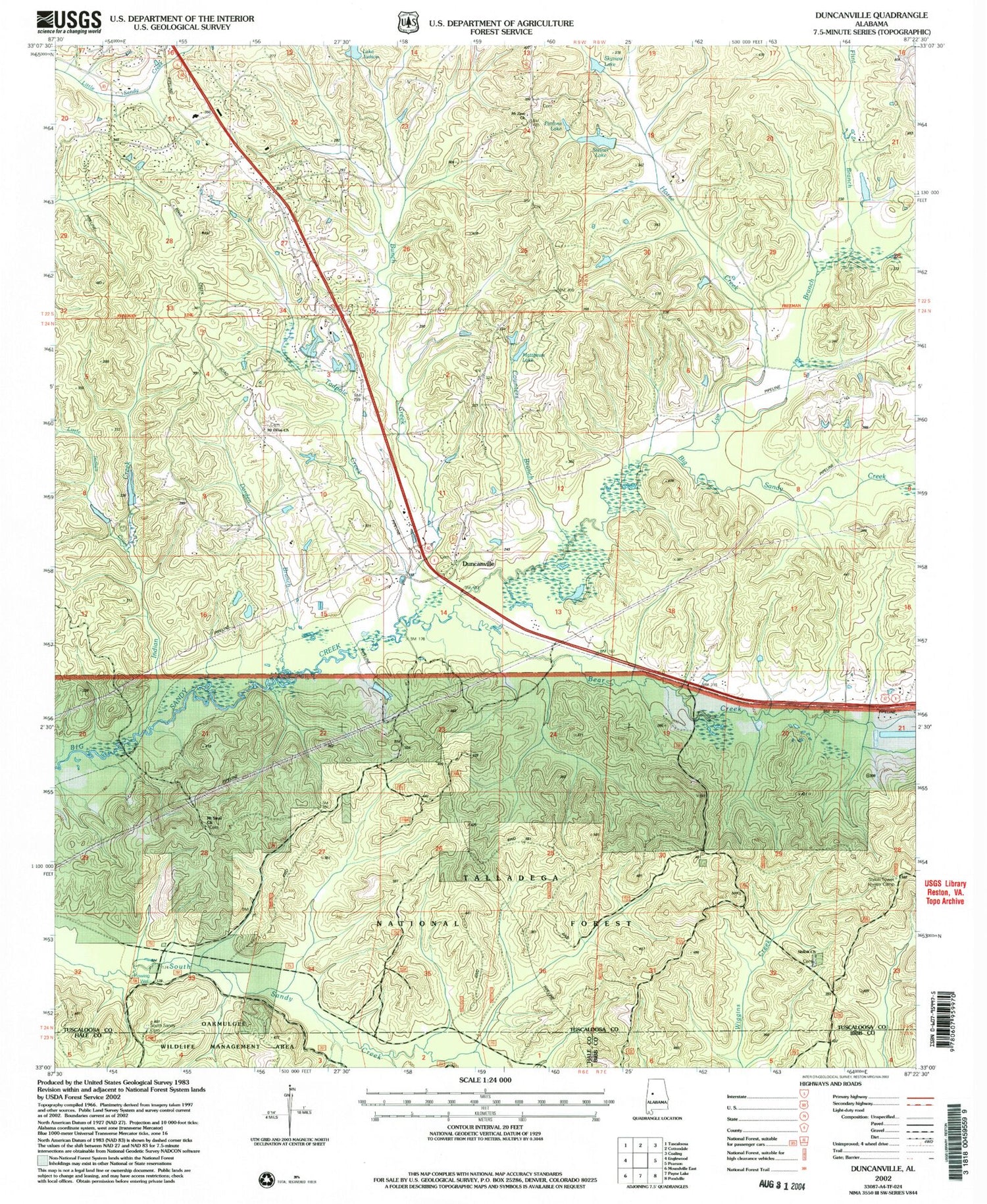
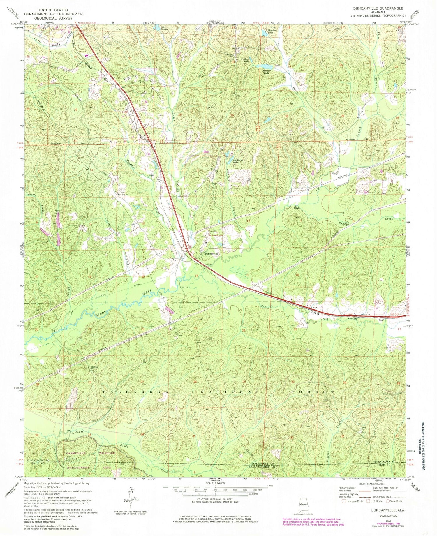
Historical USGS topographic quad map of Duncanville in the state of Alabama. Map scale may vary for some years, but is generally around 1:24,000. Print size is approximately 24" x 27"
This quadrangle is in the following counties: Bibb, Hale, Tuscaloosa.
The map contains contour lines, roads, rivers, towns, and lakes. Printed on high-quality waterproof paper with UV fade-resistant inks, and shipped rolled.
Contains the following named places: Allen School, Bear Creek, Big Sandy-Duncanville Division, Bunch Creek, Counters Branch, Darden Branch, Duncanville, Duncanville Baptist Church, Duncanville Cemetery, Duncanville Church, Duncanville Post Office, Duncanville United Methodist Church, Duncanville Volunteer Fire Department Monticello Station, Duncanville Volunteer Fire Department Southfork Station, Evergreen School, Flint Branch, Fosters Ferry, Griffin, Hewetts Mill, Horse Creek, Howell School, Indian Creek, Jackson Sod Farm, Lake Judson Dam, Little Indian Creek, Lye Branch, Matthews Lake, Maxwell Elementary School, Modina, Monticello Estates, Monticello Two, Mount Olive Cemetery, Mount Olive Church, Mount Olive School, Mount Sinai Cemetery, Mount Sinai Church, Mount Zion Baptist Church, Mount Zion Cemetery, Pattons Lake, Pearl, Phalin, Pleasant Hill Church, Raintree Country, Sand Mountain, Shady Grove Church, Shiloh Cemetery, Shiloh Lookout Tower, Shiloh Methodist Church, Skyview Lake, South Sandy Cemetery, South Sandy Church, Spring Hill Church, Steiner Lake, Steiner Lake Dam, Sycamore School, Tadpole Creek, WUAL-FM (Tuscaloosa), ZIP Code: 35456