MyTopo
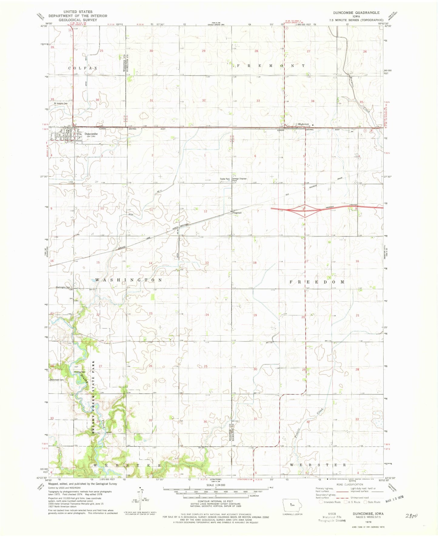
Classic USGS Duncombe Iowa 7.5'x7.5' Topo Map
Couldn't load pickup availability
Historical USGS topographic quad map of Duncombe in the state of Iowa. Map scale may vary for some years, but is generally around 1:24,000. Print size is approximately 24" x 27"
This quadrangle is in the following counties: Hamilton, Webster.
The map contains contour lines, roads, rivers, towns, and lakes. Printed on high-quality waterproof paper with UV fade-resistant inks, and shipped rolled.
Contains the following named places: Brushy Creek Dam, Brushy Creek Lake, Brushy Creek State Park, Brushy Creek Trail, Bushy Creek Campground, City of Duncombe, Duncombe, Duncombe City Hall, Duncombe Fire Department, Duncombe Police Department, Duncombe Post Office, Duncombe Public Library, Duncombe United Methodist Church, Flugstad, Flugstad Post Office, Gordon's Marsh Area, Highview, Highview Post Office, Ober and Scott Cemetery, Prairie Pond Wildlife Area, Russell's Grove Post Office, Saint Joseph Catholic Church, Saint Josephs Cemetery, Township of Freedom, Washington Cemetery