MyTopo
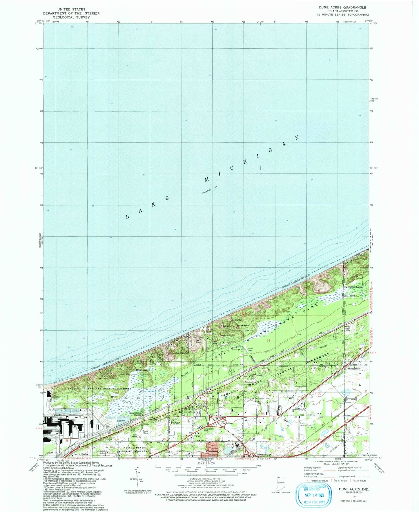
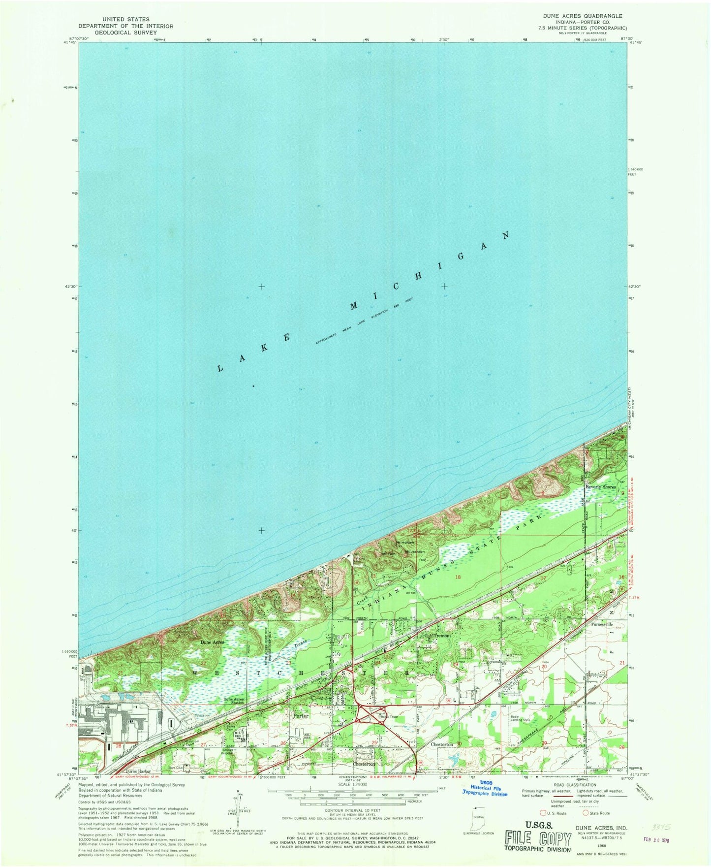
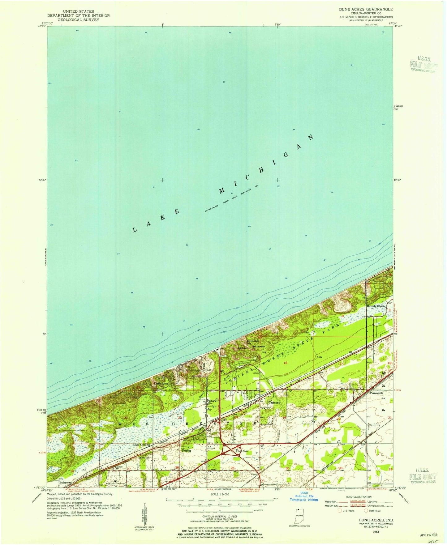
Classic USGS Dune Acres Indiana 7.5'x7.5' Topo Map
Couldn't load pickup availability
Historical USGS topographic quad map of Dune Acres in the state of Indiana. Typical map scale is 1:24,000, but may vary for certain years, if available. Print size: 24" x 27"
This quadrangle is in the following counties: Porter.
The map contains contour lines, roads, rivers, towns, and lakes. Printed on high-quality waterproof paper with UV fade-resistant inks, and shipped rolled.
Contains the following named places: Burstrom Cemetery, Dune Acres, Dune Acres Station, Dunes Creek, Furnessville, Mount Holden, Indiana Dunes State Park, Mount Jackson, Mount Tom, Tremont, Indiana Dunes National Park, Goodfellow Camp, Cowles Bog, Fairhaven Church, Fairhaven School, Furnessville Cemetery, Bailly Cemetery, Bodin Airport, Township of Westchester, Town of Dune Acres, Town of Porter, Weiland Ditch, Indiana Dunes National Lakeshore Headquarters - Fire Station, Mittal Steel Fire Department, Dune Acres Marshal's Office, Burstrom Cemetery, Dune Acres, Dune Acres Station, Dunes Creek, Furnessville, Mount Holden, Indiana Dunes State Park, Mount Jackson, Mount Tom, Tremont, Indiana Dunes National Park, Goodfellow Camp, Cowles Bog, Fairhaven Church, Fairhaven School, Furnessville Cemetery, Bailly Cemetery, Bodin Airport, Township of Westchester, Town of Dune Acres, Town of Porter, Weiland Ditch, Indiana Dunes National Lakeshore Headquarters - Fire Station, Mittal Steel Fire Department, Dune Acres Marshal's Office