MyTopo
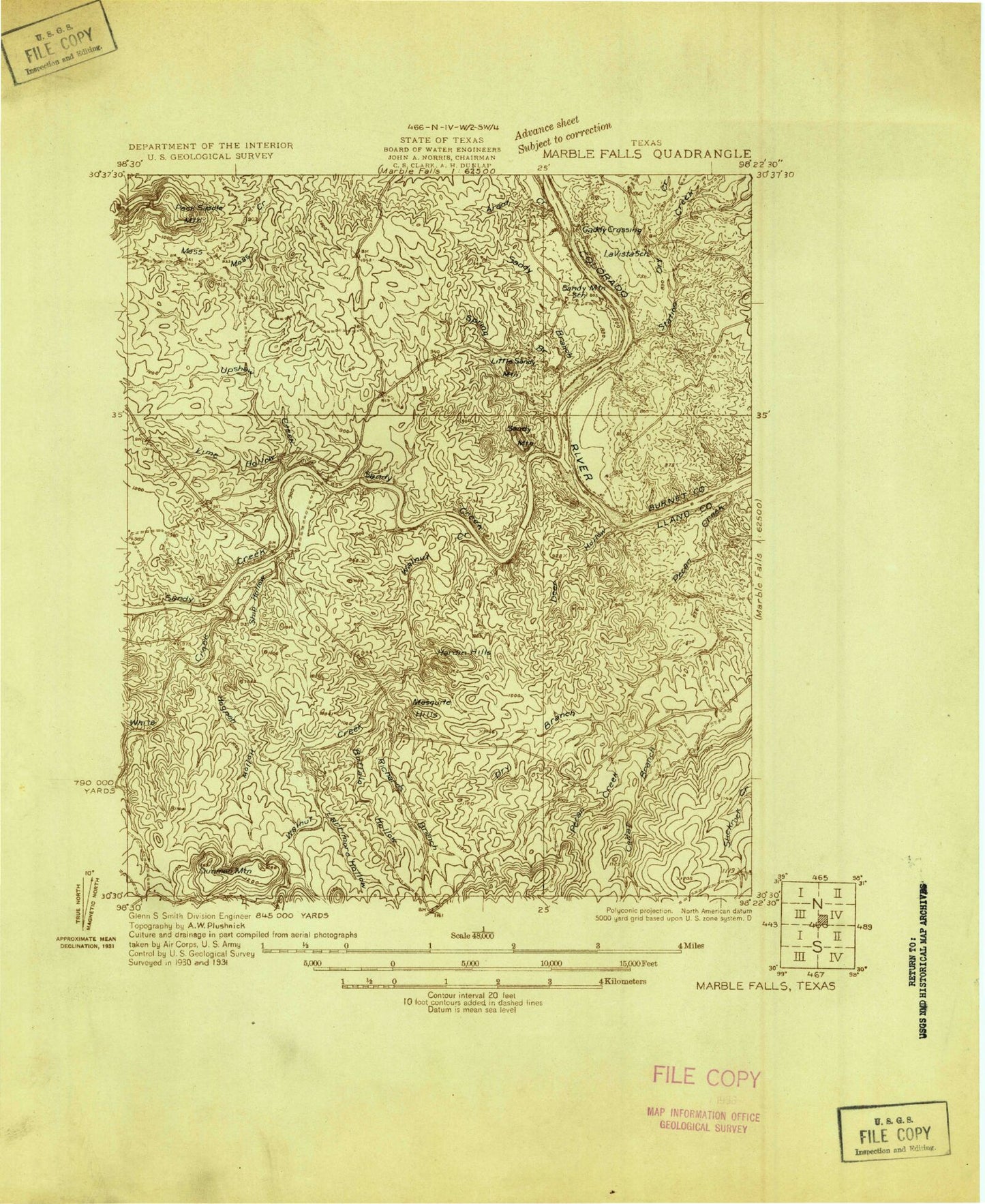
Classic USGS Dunman Mountain Texas 7.5'x7.5' Topo Map
Couldn't load pickup availability
Historical USGS topographic quad map of Dunman Mountain in the state of Texas. Map scale may vary for some years, but is generally around 1:24,000. Print size is approximately 24" x 27"
This quadrangle is in the following counties: Blanco, Burnet, Llano.
The map contains contour lines, roads, rivers, towns, and lakes. Printed on high-quality waterproof paper with UV fade-resistant inks, and shipped rolled.
Contains the following named places: Arant Creek, Barry Dam, Barry Lake, Blue Lake Subdivision Fire Station, Buffalo Hollow, Cedar Branch, City of Highland Haven, City of Horseshoe Bay, City of Sunrise Beach Village, Deer Hollow, Dry Branch, Dry Creek, Dunman Mountain, Freight Development Company Lake, Freight Development Company Lake Dam, Granite Shoals, Granite Shoals City Hall, Granite Shoals Police Department, Granite Shoals Post Office, Hardin Hills, Highland Haven, Hoerster Lake Area Medical Center, Hogpen Hollow, Horse Shoe Bay Post Office, Horseshoe Bay Fire Department Station 2, Larrimore Hollow, Lime Hollow, Little Sandy Mountain, Mesquite Hill, Our Lady of the Lake Church, Pecan Cemetery, Pecan Creek, Richards Branch, Sandy Branch, Sandy Creek, Sandy Harbor Subdivision Fire Station, Sandy Mountain, Sherwood Shores Church, Ship Hollow, Spring Branch, Station Creek, Sunrise Beach Airport, Sunrise Beach Baptist Church, Sunrise Beach Federated Church, Sunrise Beach Post Office, Sunrise Beach Village, Sunrise Beach Village City Hall, Sunrise Beach Village Hall, Sunrise Beach Village Police Department, Sunrise Beach Volunteer Fire Department, Upshaw Creek, Walnut Creek, West Walnut Creek, White Creek, Wolf Crossing Cemetery, ZIP Code: 78657