MyTopo
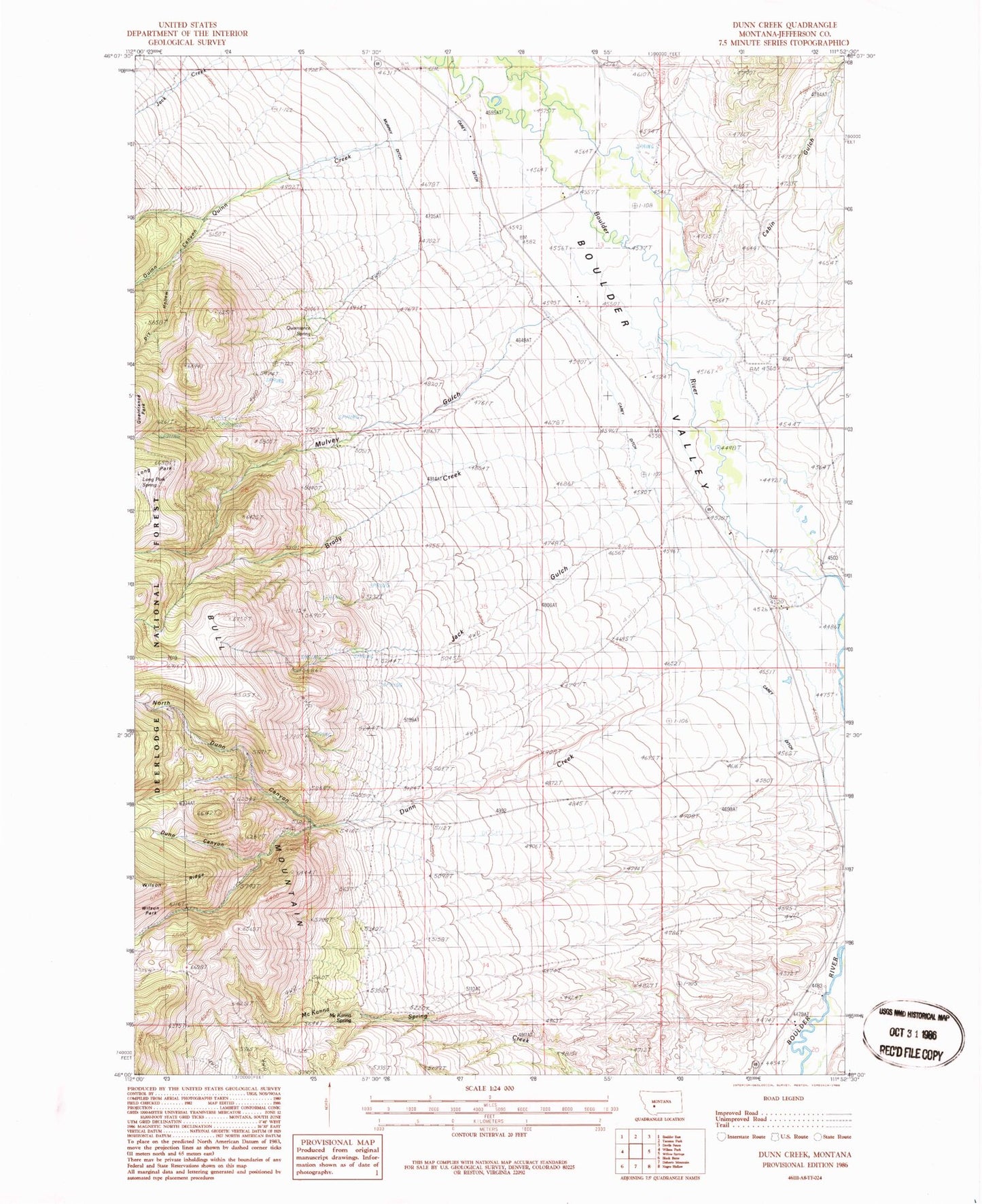
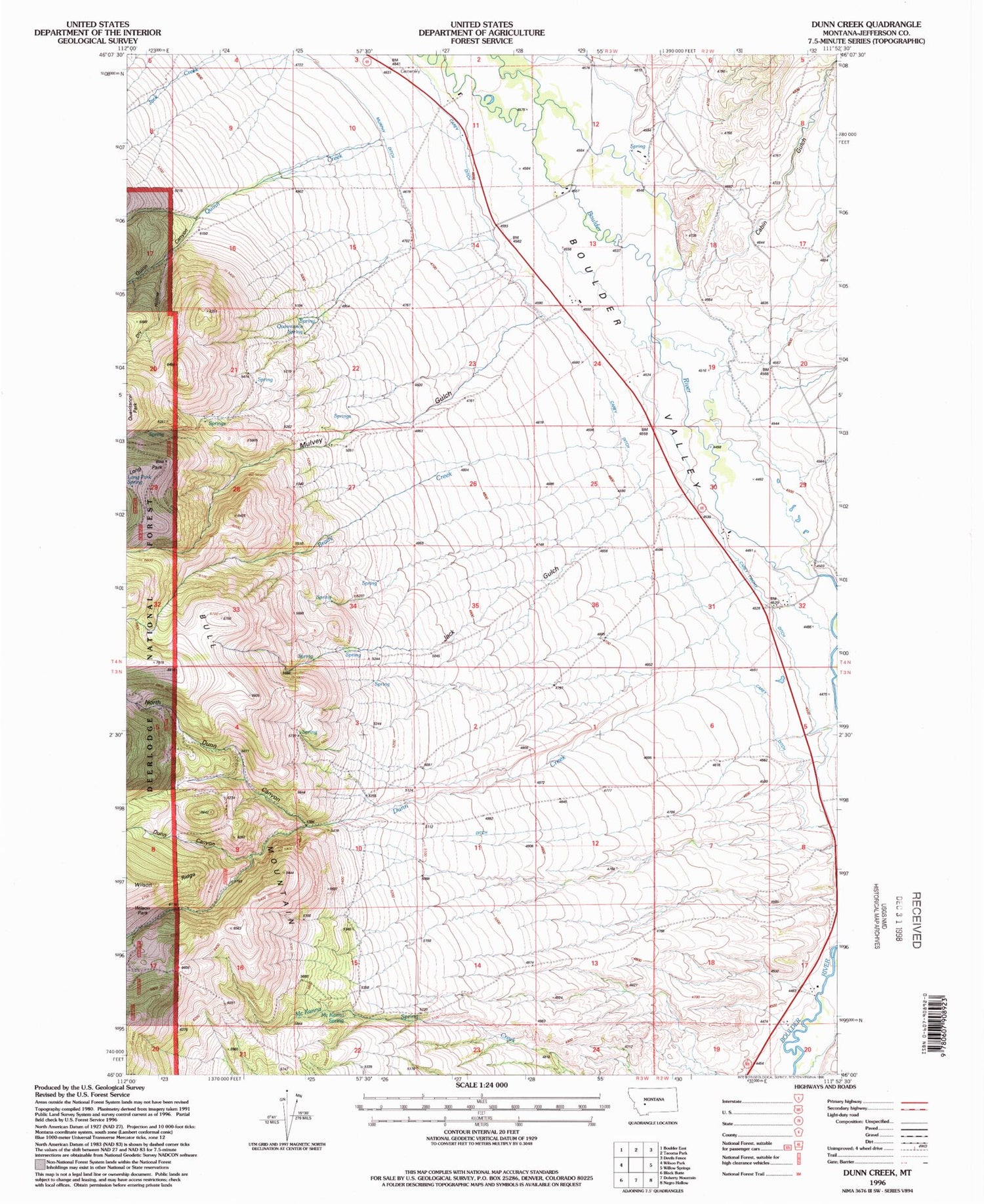
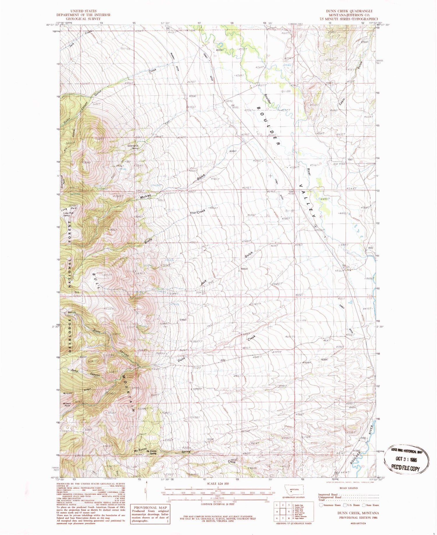
Classic USGS Dunn Creek Montana 7.5'x7.5' Topo Map
Couldn't load pickup availability
Historical USGS topographic quad map of Dunn Creek in the state of Montana. Map scale may vary for some years, but is generally around 1:24,000. Print size is approximately 24" x 27"
This quadrangle is in the following counties: Jefferson.
The map contains contour lines, roads, rivers, towns, and lakes. Printed on high-quality waterproof paper with UV fade-resistant inks, and shipped rolled.
Contains the following named places: 03N02W06ABA_01 Well, 04N02W30CABA01 Well, 04N02W30CBCB01 Well, 04N02W30DADD01 Well, 04N03W14BC__01 Well, 04N03W25ABAB01 Well, Boulder Valley, Boulder Valley Cemetery, Boulder Valley Church, Brady Creek, Bull Mountain Rural Fire District Station 2, Cabin Gulch, Carey Ditch, Clagett Post Office, Dry Creek, Dry Hollow, Dunn Canyon, Dunn Creek, Jack Gulch, Long Park Spring, McKanna Spring, Mulvey Gulch, Murphy Ditch, Murphy Quaintance Ditch, North Dunn Canyon, Quaintance Ranch, Quaintance Spring, Quinn Creek, Weber Post Office, Weber School