MyTopo
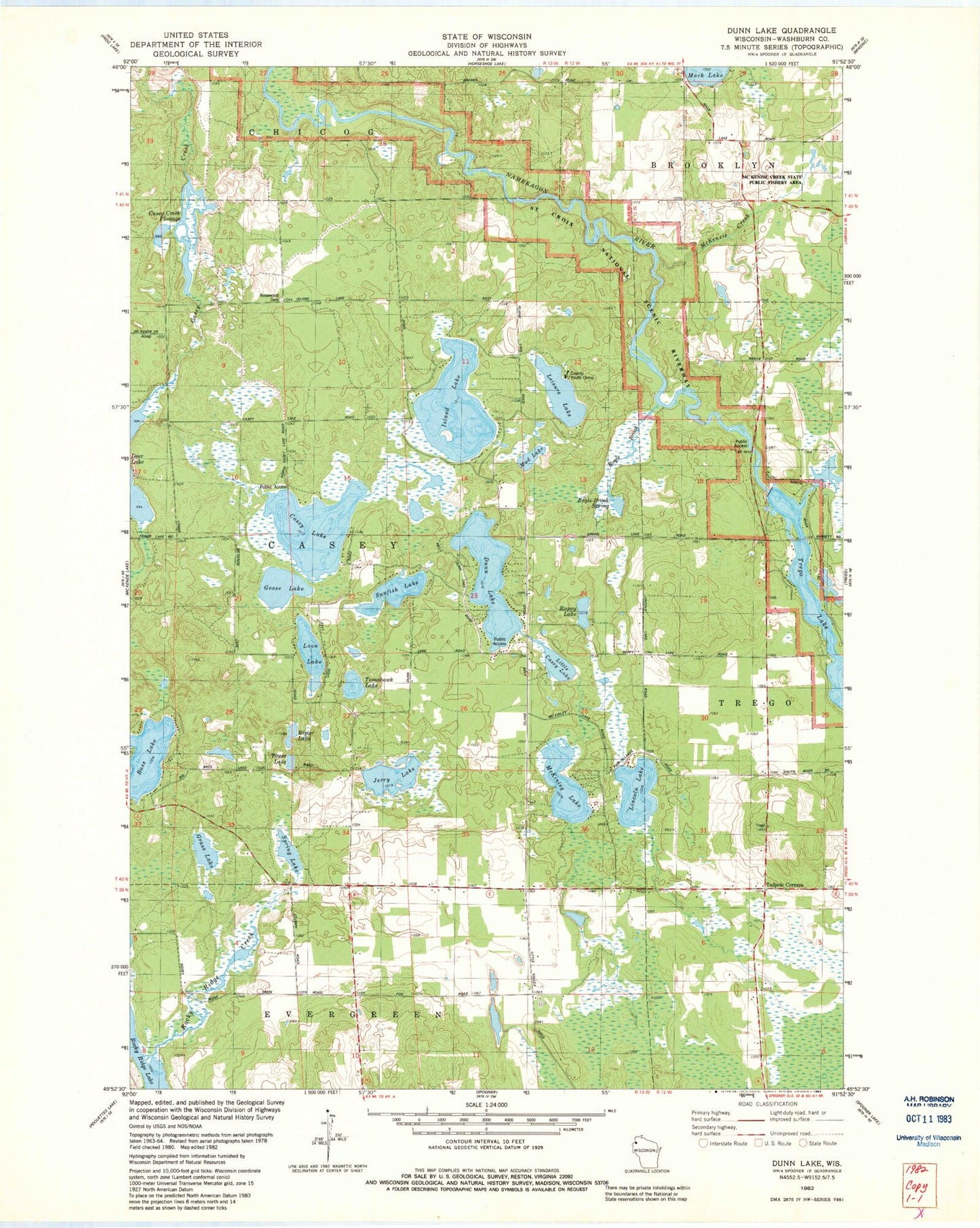
Classic USGS Dunn Lake Wisconsin 7.5'x7.5' Topo Map
Couldn't load pickup availability
Historical USGS topographic quad map of Dunn Lake in the state of Wisconsin. Map scale may vary for some years, but is generally around 1:24,000. Print size is approximately 24" x 27"
This quadrangle is in the following counties: Washburn.
The map contains contour lines, roads, rivers, towns, and lakes. Printed on high-quality waterproof paper with UV fade-resistant inks, and shipped rolled.
Contains the following named places: Bass Lake, Boyle Brook, Boyle Brook Spring, Casey Creek Flowage, Casey Lake, Conroy Ford 3WR374 Dam, Dunn Lake, Goose Lake, Grass Lake, Island Lake, Jerry Lake, Leisure Lake, Lincoln Lake, Little Casey Lake, Loon Lake, McKenzie Creek, McKenzie Creek State Public Fishery Area, McKinley Lake, Mud Lake, Rappy Lake, Rigler Lake, Rocky Ridge Creek, Rocky Ridge Lake, Rosewood Cemetery, Schulze-Spooner Airport, Spring Lake, Sunfish Lake, Tadpole Corners, Tomahawk Lake, Tower Lake, Town of Casey, Trego Dam, Trego Hydro Generating Station, Trego Lake, Trego WP220 Dam, Washburn County Youth Camp, ZIP Code: 54801