MyTopo
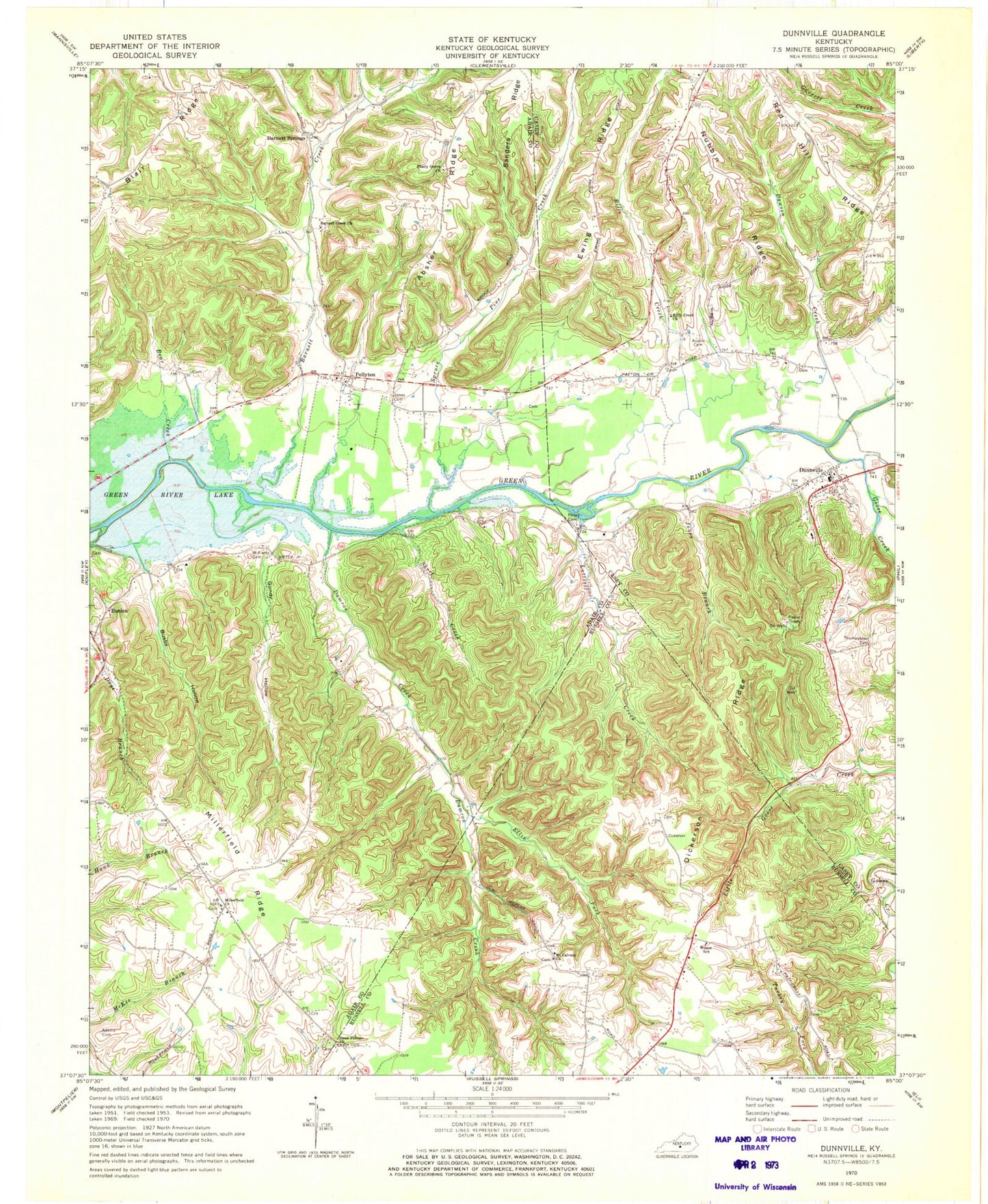
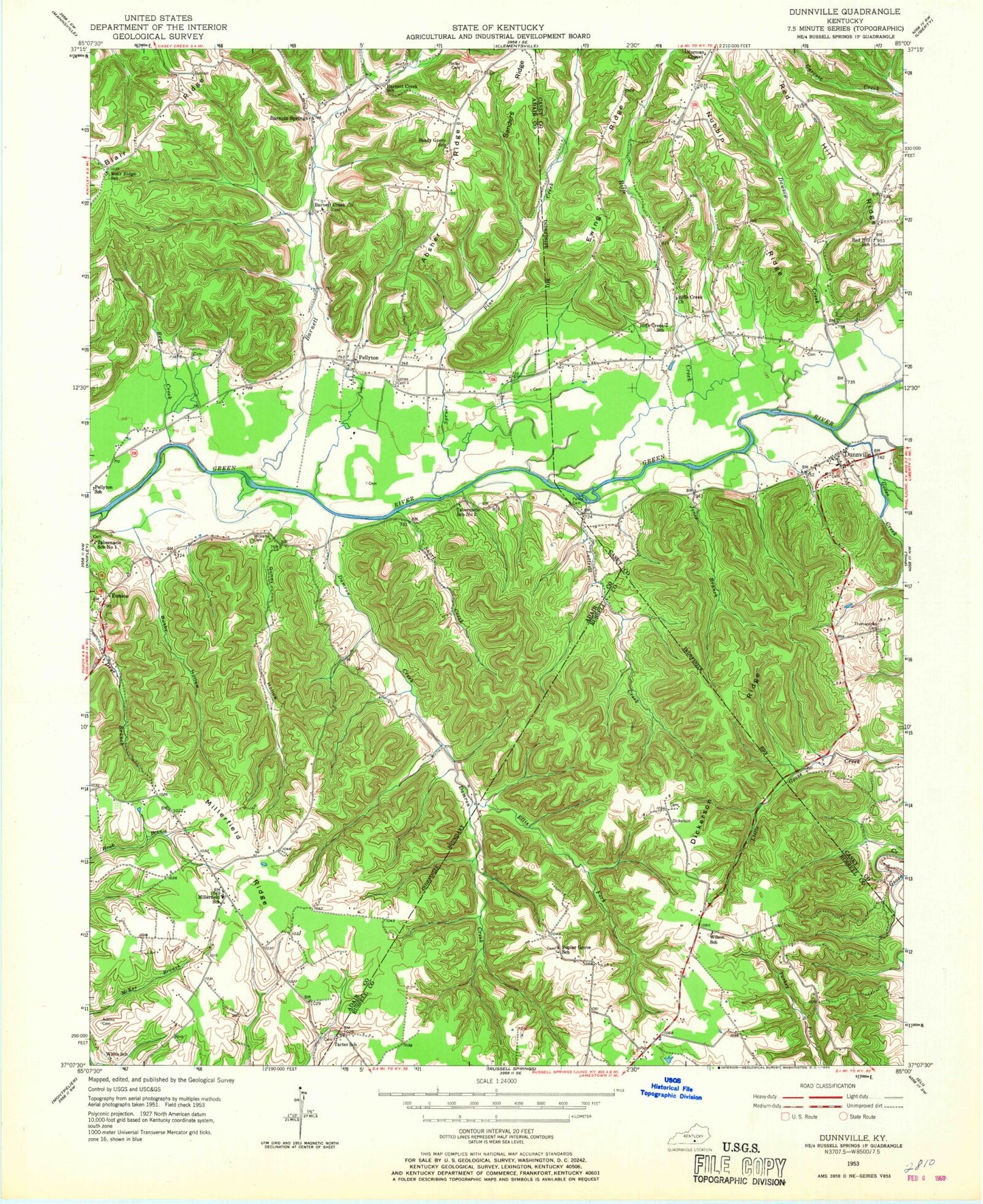
Classic USGS Dunnville Kentucky 7.5'x7.5' Topo Map
Couldn't load pickup availability
Historical USGS topographic quad map of Dunnville in the state of Kentucky. Map scale may vary for some years, but is generally around 1:24,000. Print size is approximately 24" x 27"
This quadrangle is in the following counties: Adair, Casey, Russell.
The map contains contour lines, roads, rivers, towns, and lakes. Printed on high-quality waterproof paper with UV fade-resistant inks, and shipped rolled.
Contains the following named places: Absher Ridge, Adkins Cemetery, Austin Cemetery, Barnett Creek, Barnett Creek Church, Barnett Springs, Bear Creek, Busby Hollow, Damron Creek, Dawson Creek, Dickerson Ridge, Dunnville, Dunnville Post Office, Dunnville School, Dunnville Volunteer Fire Department, Ellis Fork, Eunice, Ewing Ridge, Good Tidings Church, Goose Creek, Gundy Hollow, Hatfield Cemetery, Heiter Cemetery, Jones Branch, Jones Cemetery, Luttrell Creek, Millerfield, Millerfield Church, Millerfield Ridge, Mount Calvary Church, Normans Chapel United Brethren Church, Nubbin Ridge, Pellyton, Pellyton Volunteer Fire Department, Red Hill, Red Hill Ridge, Red Hill School, Rice Cemetery, Rife Creek Post Office, Riffe Creek, Riffe Creek School, Rifle Creek Church, Sanders Ridge, Shady Grove Church, Short Creek, Spruce Pine Creek, Thomastown Cemetery, Williams Cemetery, Wilson School, ZIP Code: 42528