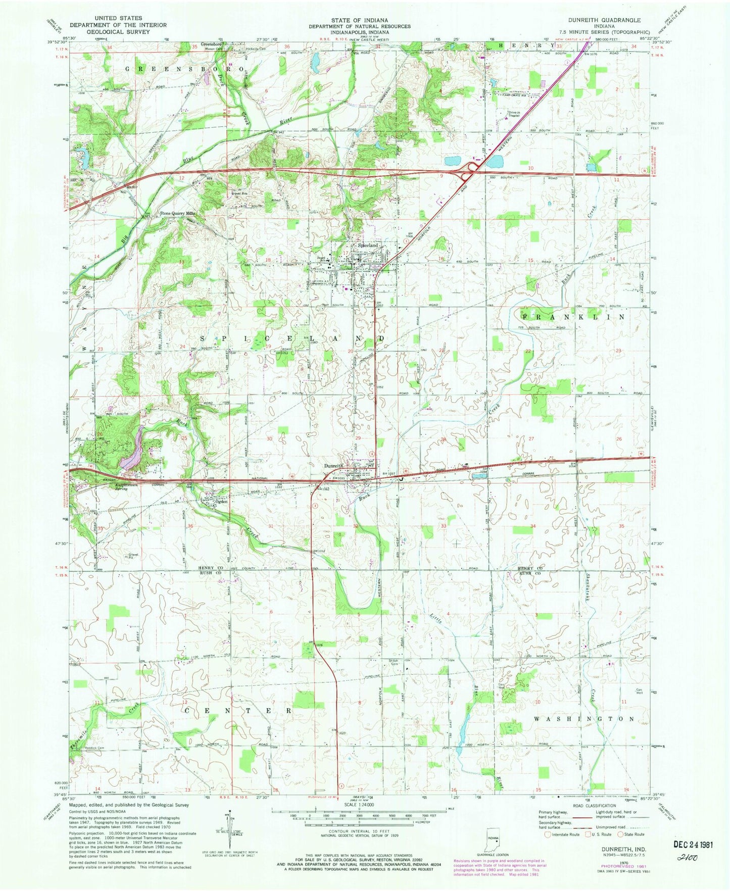
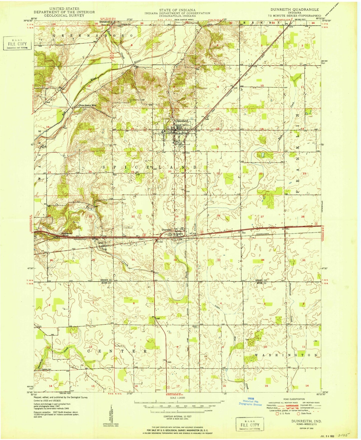
MyTopo
Classic USGS Dunreith Indiana 7.5'x7.5' Topo Map
Couldn't load pickup availability
Historical USGS topographic quad map of Dunreith in the state of Indiana. Map scale may vary for some years, but is generally around 1:24,000. Print size is approximately 24" x 27"
This quadrangle is in the following counties: Henry, Rush.
The map contains contour lines, roads, rivers, towns, and lakes. Printed on high-quality waterproof paper with UV fade-resistant inks, and shipped rolled.
Contains the following named places: Circle Grove Cemetery, Duck Creek, Dunreith, Dunreith Fire Department, Dunreith Post Office, Hicksite Cemetery, Knightstown Spring, Lake Haven, Lake Haven Dam, Mason Cemetery, Ogden, Reddick Cemetery, Shiloh Cemetery, Spiceland, Spiceland Elementary School, Spiceland Police Department, Spiceland Post Office, Spiceland Volunteer Fire Department, Stone Quarry Mills, Ten Creek, Town of Dunreith, Town of Spiceland, Township of Spiceland, ZIP Codes: 47337, 47385