MyTopo
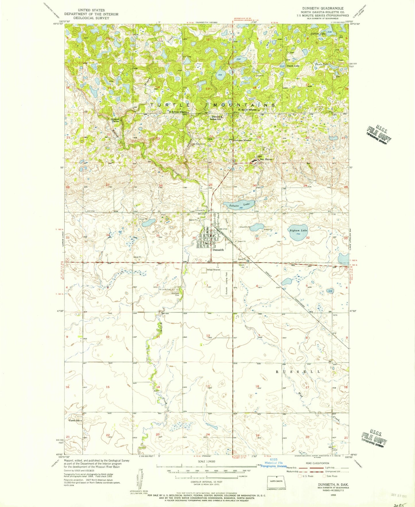
Classic USGS Dunseith North Dakota 7.5'x7.5' Topo Map
Couldn't load pickup availability
Historical USGS topographic quad map of Dunseith in the state of North Dakota. Map scale may vary for some years, but is generally around 1:24,000. Print size is approximately 24" x 27"
This quadrangle is in the following counties: Rolette.
The map contains contour lines, roads, rivers, towns, and lakes. Printed on high-quality waterproof paper with UV fade-resistant inks, and shipped rolled.
Contains the following named places: Bigham Lake, Carlisle Lake, City of Dunseith, Currie School, Dunseith, Dunseith City Hall, Dunseith Community Nursing Home, Dunseith Day Elementary School, Dunseith Elementary School, Dunseith Fire Department, Dunseith High School, Dunseith Landing Field, Dunseith Post Office, East Dunseith, East Dunseith Census Designated Place, Holy Cross catholic Cemetery, Indian Creek, Log House Information Center, Mineral Creek, Riverside Cemetery, Saint Louis Cemetery, Saint Mary's Cemetery, Saint Marys Mission, Saint Sylvan Cemetery, Saint Sylvan Mission, San Haven, Schutte Lake, Smith Lake, Sunrise View Cemetery, Thorn Lake, Township of Russell, Wee'l Turtle Statue, ZIP Code: 58329