MyTopo
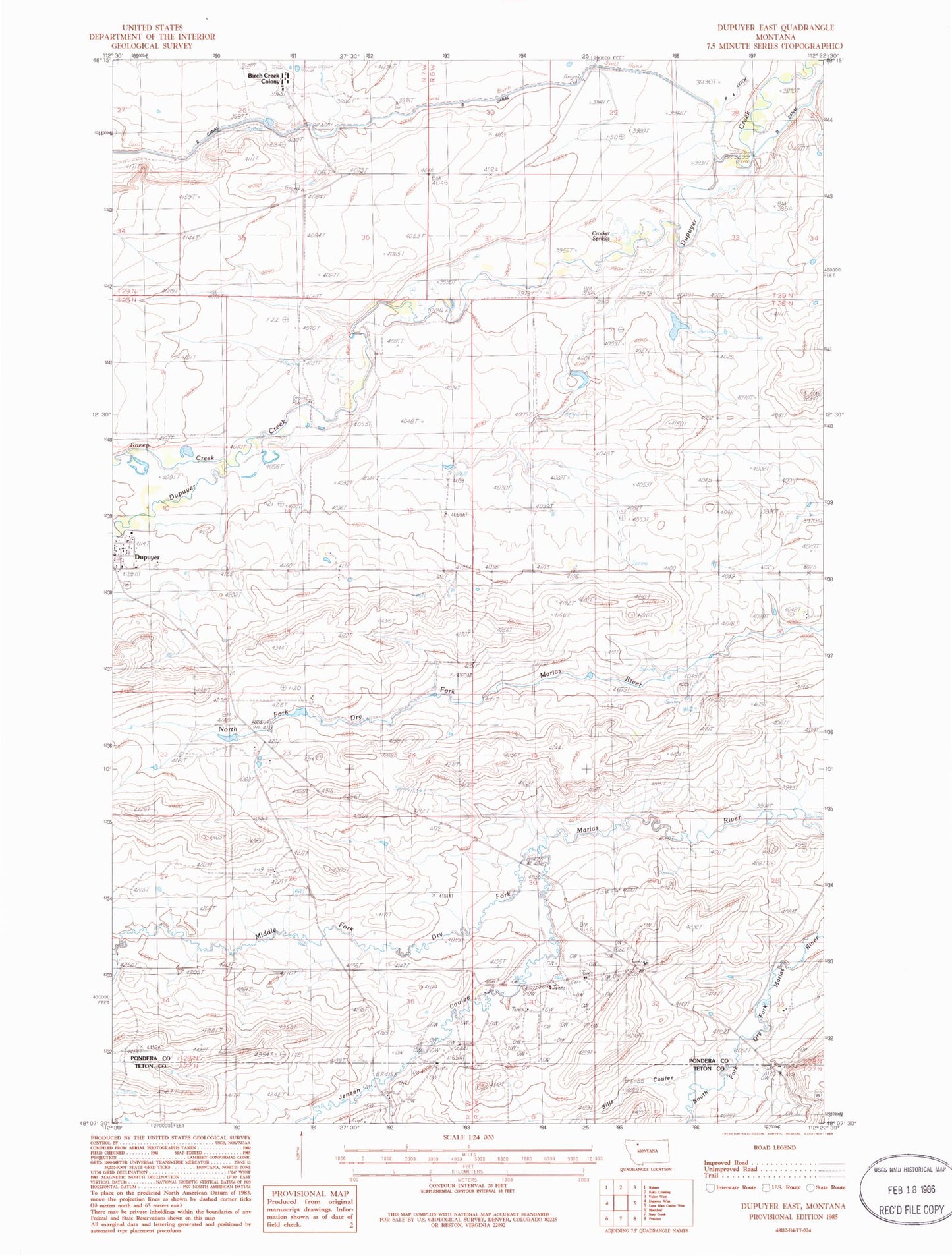
Classic USGS Dupuyer East Montana 7.5'x7.5' Topo Map
Couldn't load pickup availability
Historical USGS topographic quad map of Dupuyer East in the state of Montana. Map scale may vary for some years, but is generally around 1:24,000. Print size is approximately 24" x 27"
This quadrangle is in the following counties: Pondera, Teton.
The map contains contour lines, roads, rivers, towns, and lakes. Printed on high-quality waterproof paper with UV fade-resistant inks, and shipped rolled.
Contains the following named places: Angell Ranch, Bills Coulee, Birch Creek Colony, Birch Creek Colony Census Designated Place, Birch Creek Colony School, Broadhead, Campbell Ranch, Crocker Springs, D Canal, Dupuyer, Dupuyer Baptist Church, Dupuyer Census Designated Place, Dupuyer Methodist Church, Dupuyer School, Hay Coulee, Hines Ranch, Holy Cross Catholic Church, Jensen Coulee, Kitty Milk Dam, Perkins Ranch, Perrins School, Pondera Colony Census Designated Place, Sheep Creek, Soberup Ranch, Woods Coulee, ZIP Code: 59432