MyTopo
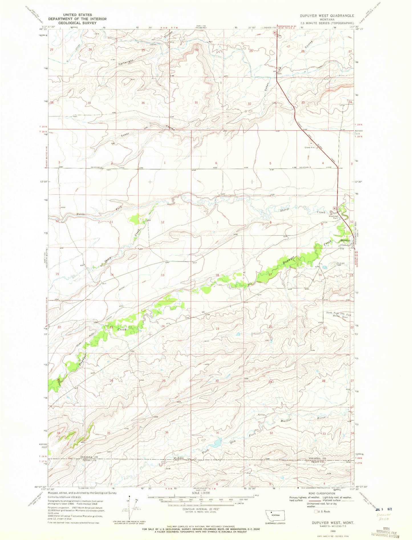
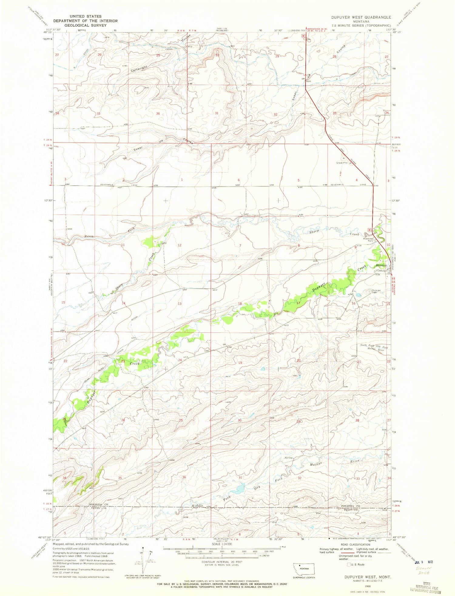
Classic USGS Dupuyer West Montana 7.5'x7.5' Topo Map
Regular price
$16.95
Regular price
Sale price
$16.95
Unit price
per
Couldn't load pickup availability
Historical USGS topographic quad map of Dupuyer West in the state of Montana. Map scale may vary for some years, but is generally around 1:24,000. Print size is approximately 24" x 27"
This quadrangle is in the following counties: Pondera, Teton.
The map contains contour lines, roads, rivers, towns, and lakes. Printed on high-quality waterproof paper with UV fade-resistant inks, and shipped rolled.
Contains the following named places: B Canal, Chief Mountain and Old North Trail Historical Marker, Dean Burd Leach Ditch, Dupuyer Cemetery, Dupuyer Historical Marker, Dupuyer Post Office, Dupuyer Volunteer Fire Department, Hagers Coulee, Jones Coulee, North Fork Sheep Creek, Scott Ranch Dam