MyTopo
Classic USGS Durand North Wisconsin 7.5'x7.5' Topo Map
Couldn't load pickup availability
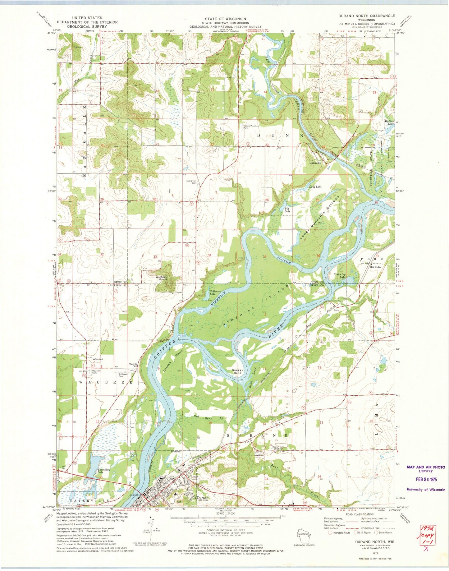
Historical USGS topographic quad map of Durand North in the state of Wisconsin. Map scale may vary for some years, but is generally around 1:24,000. Print size is approximately 24" x 27"
This quadrangle is in the following counties: Dunn, Pepin.
The map contains contour lines, roads, rivers, towns, and lakes. Printed on high-quality waterproof paper with UV fade-resistant inks, and shipped rolled.
Contains the following named places: Bear Creek, Bear Lake, Big Lake, Browning Lake, Buck Knob Airport, Burke School, Caddie Woodlawn Park, City of Durand, Cranes Bend, Dry Brook, Dunnville, Durand, Durand City Volunteer Fire Department, Durand Middle / High School, Durand Municipal Ambulance Service, Durand Post Office, Evergreen Cemetery, Faith Lutheran Church, Hay Creek School, Ingram School, Long Lake, Lower Dunnville Bottoms, Nine Mile Island State Natural Area, Ninemile Island, Ninemile Slough, Oak Grove School, Old Bear Creek, Red Cedar, Red Cedar River, Saint Johns Lutheran Church, Schlosser Field, Schlosser Lake, Snaggy Bend, Thompson Lake, Thompson Lake Christian School, Town of Durand, Town of Waubeek, Wallace Lake, Waubeek Cemetery, Waubeek Mound, Waubeek School, Woods Corner School, WRDN-AM (Durand), Yellow Bank, ZIP Code: 54737