MyTopo
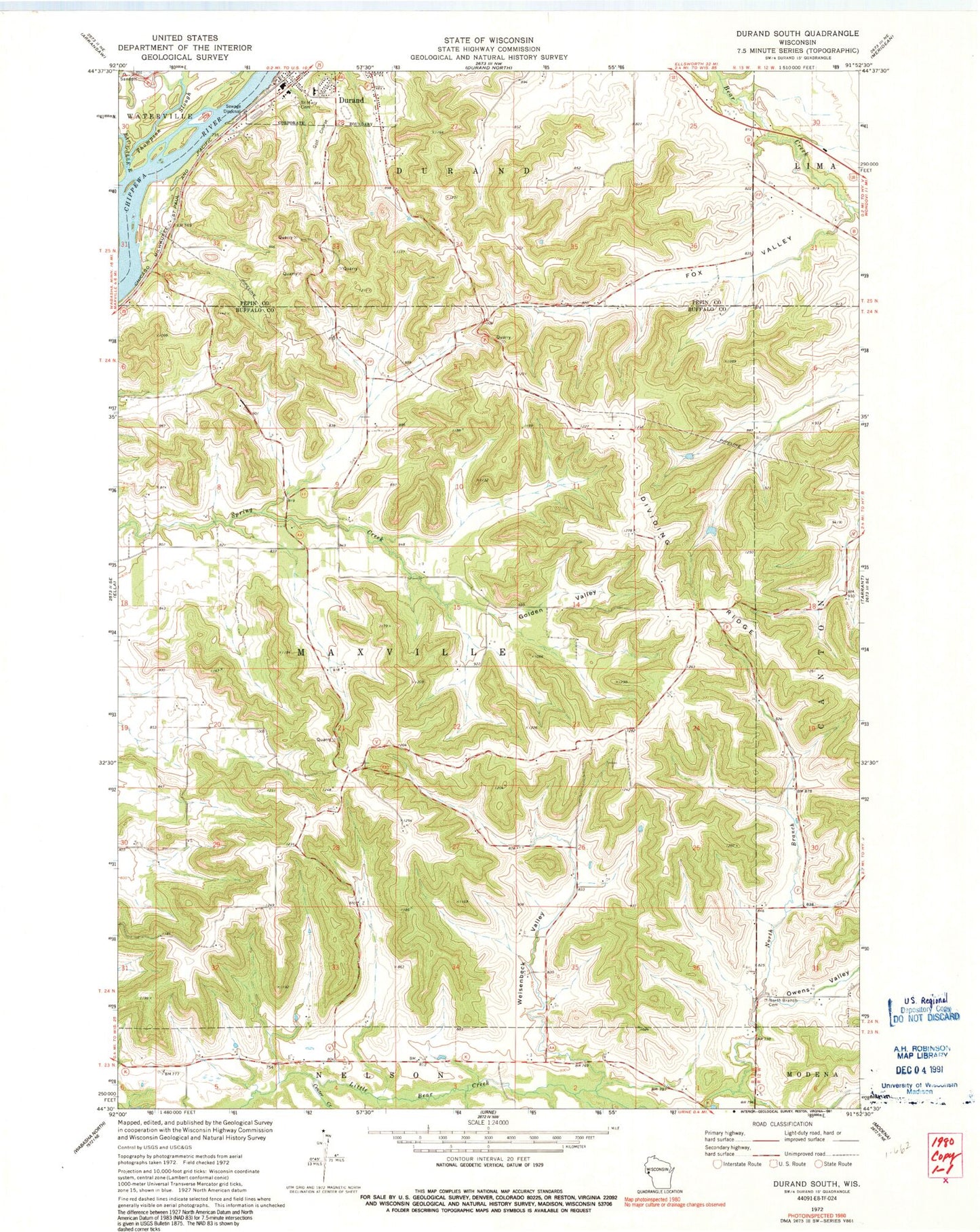
Classic USGS Durand South Wisconsin 7.5'x7.5' Topo Map
Couldn't load pickup availability
Historical USGS topographic quad map of Durand South in the state of Wisconsin. Map scale may vary for some years, but is generally around 1:24,000. Print size is approximately 24" x 27"
This quadrangle is in the following counties: Buffalo, Pepin.
The map contains contour lines, roads, rivers, towns, and lakes. Printed on high-quality waterproof paper with UV fade-resistant inks, and shipped rolled.
Contains the following named places: Assumption Catholic School, Burnside School, Center Creek, Chippewa Valley Hospital, Chippewa Valley Hospital Heliport, Dividing Ridge, Durand Police Department, Eau Galle River, Fox Valley, Golden Valley, Homestead Farms, Laneville, Limekiln Bluff, Maxville Bluff School, Newton School, North Branch Cemetery, North Branch School, Norway Creek, Oak Hill School, Owens Valley, Pepin County Sheriff's Office, Saint Mary's Cemetery, Spring Creek School, Stanley Valley, Thompson Slough, Town of Maxville, Traun Bluff School, Weisenbeck Valley, WRDN-AM (Durand), WRDN-FM (Durand), ZIP Code: 54736