MyTopo
Classic USGS Durand Georgia 7.5'x7.5' Topo Map
Couldn't load pickup availability
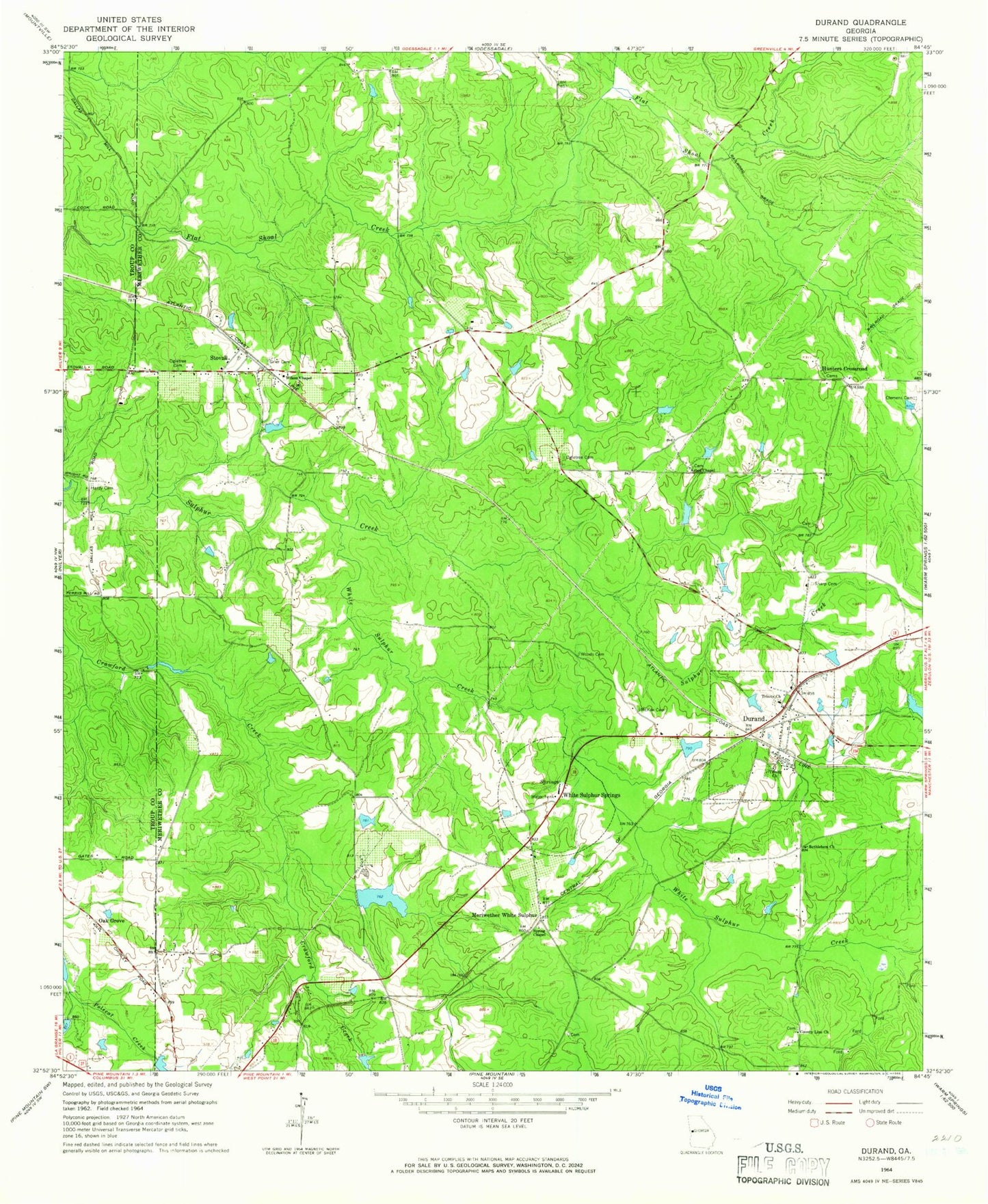
Historical USGS topographic quad map of Durand in the state of Georgia. Map scale may vary for some years, but is generally around 1:24,000. Print size is approximately 24" x 27"
This quadrangle is in the following counties: Meriwether, Troup.
The map contains contour lines, roads, rivers, towns, and lakes. Printed on high-quality waterproof paper with UV fade-resistant inks, and shipped rolled.
Contains the following named places: Arbor Chapel, Arbors Church Cemetery, Bethlehem Church, Caldwell-Williams Cemetery, Cameo, Clemens Cemetery, Coplan-Perry Cemetery, County Line, County Line Church, County Line Church Cemetery, Dallas Mill, Durand, Glanton Cemetery, Greer and Robertson Cemetery, Grier Cemetery, Hardy Cemetery, Hills Lake, Hills Lake Dam, Hunters Crossroad, McGees Pond, McKee Cemetery, Meriwether County Volunteer Fire Department Station 10, Meriwether County Volunteer Fire Department Station 8, Meriwether White Sulphur, Mitcham Dam, Mitcham Lake, Oak Grove, Ogletree Cemetery, Sharp Cemetery, Spring Chapel, Spring Chapel Cemetery, Stovall, Stovall Baptist Church, Tigner Cemetery, Tigners Cross Roads, Trinity Church, Trinity Church Cemetery, Tucker Cemetery, Vandegrift Dam, Warm Springs Division, White Sulphur Creek, White Sulphur Springs, Williamson Lake, Williamson Lake Dam, Wilson Chapel, Wilson Dickerson Cemetery, Woods Cemetery