MyTopo
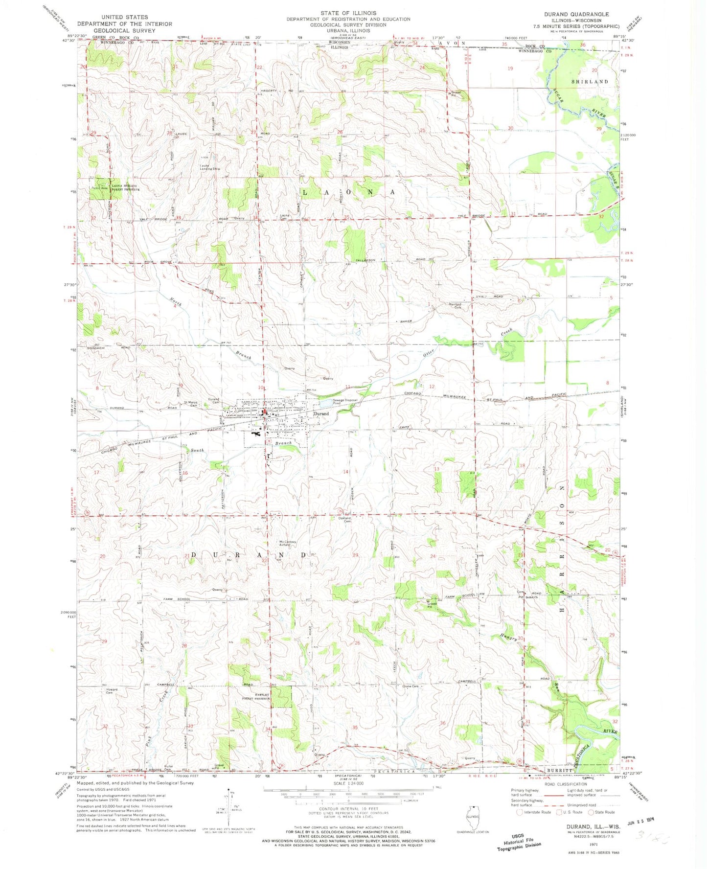
Classic USGS Durand Illinois 7.5'x7.5' Topo Map
Couldn't load pickup availability
Historical USGS topographic quad map of Durand in the states of Illinois, Wisconsin. Map scale may vary for some years, but is generally around 1:24,000. Print size is approximately 24" x 27"
This quadrangle is in the following counties: Rock, Winnebago.
The map contains contour lines, roads, rivers, towns, and lakes. Printed on high-quality waterproof paper with UV fade-resistant inks, and shipped rolled.
Contains the following named places: Bethel Cemetery, Bethel Church, Cleveland School, Crane Cemetery, Crane School, Crow School, Dobson School, Dolan School, Durand, Durand Cemetery, Durand City Hall, Durand Fire Department, Durand High School, Durand Post Office, Durand United Methodist Church, Fairview School, Farm Quarry Number 110, Farmingdale School, Fenlon Cemetery, Fenton School, Flying Z Ranch Airport, Gilman School, Hanford Cemetery, Hartley Forest Preserve, Hartley Memorial Woods Nature Preserve, Howard Cemetery, Hulse Cemetery, Hungry Run, Laona Center School, Laona Heights Forest Preserve, Laona Heights Nature Preserve, Laona Post Office, Laona Township Cemetery, McCartney Airport, North Branch Otter Creek, Oakland Cemetery, Raymond E Laube Airport, Saint Marys Cemetery, South Branch Otter Creek, Sugar River Alder Nature Preserve, Sweet School, Township of Durand, Township of Laona, Tyler Post Office, Union Church, Union School, Village of Durand, ZIP Code: 61024