
MyTopo
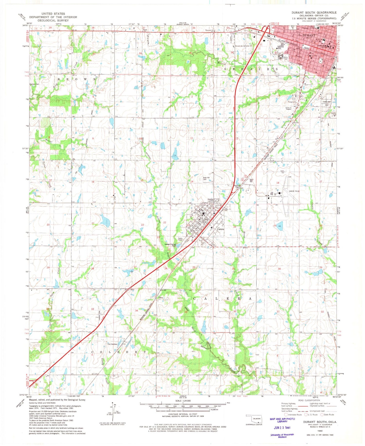
Classic USGS Durant South Oklahoma 7.5'x7.5' Topo Map
Couldn't load pickup availability
Historical USGS topographic quad map of Durant South in the state of Oklahoma. Map scale may vary for some years, but is generally around 1:24,000. Print size is approximately 24" x 27"
This quadrangle is in the following counties: Bryan.
The map contains contour lines, roads, rivers, towns, and lakes. Printed on high-quality waterproof paper with UV fade-resistant inks, and shipped rolled.
Contains the following named places: Boatner Field, Briarwood Shopping Center, Bryan Baptist Association, Bryan County Emergency Medical Services, Bryan County Jail, Bryan County Sheriff's Office, Calera, Calera Elementary School, Calera Fire Department Station 4 Headquarters, Calera Fire Department Station 5, Calera High School, Calera Police Department, Calera Post Office, Calvary Baptist Church, Church of Christ, City of Durant, Durant Division, Durant Fire Department Central Station, Durant Post Office, Durant Regional Airport - Eaker Field, Edwards Lake, Edwards Lake Dam, Family Worship Foursquare, First Assembly of God Church, First Baptist Church, First Christian Church, First Church of the Nazarene, First Pentecostal Church, First Presbyterian Church, First United Methodist Church, Gordon Lake, Gordon Lake Dam, Harris Lake, Harris Lake Dam, Harrison Cemetery, Highland Cemetery, Irving School, Kiamichi Technology Center, Kiamichi Technology Center Durant, Moore Creek, Naval Auxiliary Air Facility Durant, Olive, Our Savior Lutheran Church, Robert E Lee Elementary School, Rose Hill Cemetery, Saint Johns Episcopal Church, Seventh Day Adventist Church, Southern School of Beauty, Town of Calera, Washington Irving Elementary School, Webb Lake, Webb Lake Dam, Westside Church, ZIP Code: 74730


