
MyTopo
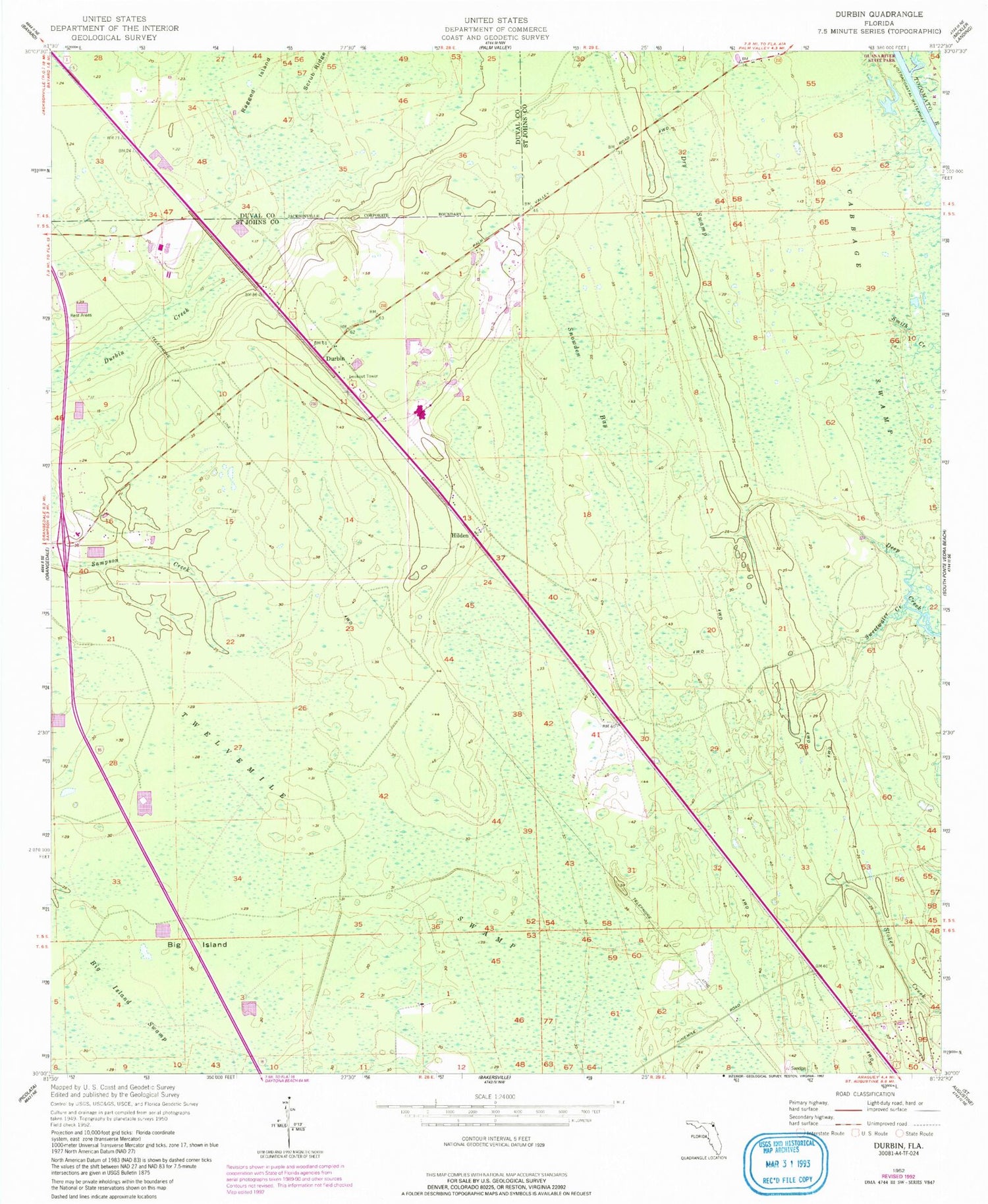
Classic USGS Durbin Florida 7.5'x7.5' Topo Map
Couldn't load pickup availability
Historical USGS topographic quad map of Durbin in the state of Florida. Typical map scale is 1:24,000, but may vary for certain years, if available. Print size: 24" x 27"
This quadrangle is in the following counties: Duval, St. Johns.
The map contains contour lines, roads, rivers, towns, and lakes. Printed on high-quality waterproof paper with UV fade-resistant inks, and shipped rolled.
Contains the following named places: Clarksville, Christopher Minchen Grant, Charles and George Clarke Grant, Big Island, Dry Swamp, Durbin, Hilden, Snowden Bay, Sweetwater Creek, Twelvemile Swamp, Allen D Nease Senior High School, Julington Creek Elementary School, Durbin Tower, Fort Moosa (historical), WUVU-FM (Saint Augustine), Shagbark Golf Course, Nocatee Census Designated Place


