MyTopo
Classic USGS Durham Arkansas 7.5'x7.5' Topo Map
Couldn't load pickup availability
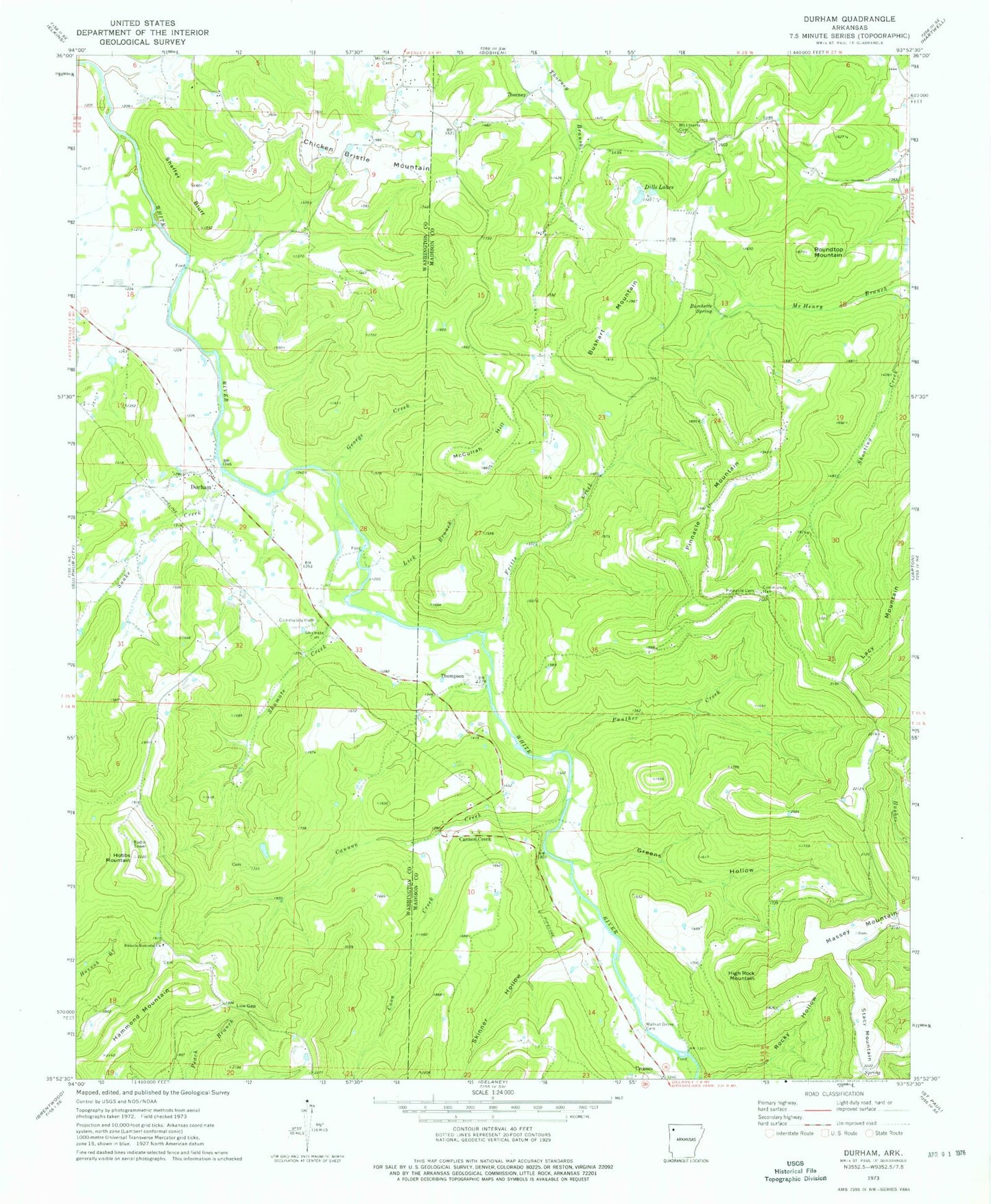
Historical USGS topographic quad map of Durham in the state of Arkansas. Map scale may vary for some years, but is generally around 1:24,000. Print size is approximately 24" x 27"
This quadrangle is in the following counties: Madison, Washington.
The map contains contour lines, roads, rivers, towns, and lakes. Printed on high-quality waterproof paper with UV fade-resistant inks, and shipped rolled.
Contains the following named places: Accident School, Blackland Cove, Burchette Spring, Bushart Mountain, Cannon Creek, Chicken Bristle Mountain, Coon Creek, Dills Lakes, Durham, Durham Post Office, Enterprise School, Fritts Creek, George Creek, Greens Hollow, Hammond Mountain, High Rock Mountain, Hobbs Mountain, Lacy Mountain, Lick Branch, Low Gap, Massey Mountain, McCullah Hill, Mount Liberty Cemetery, Mountain View School, Nickells Memorial Church, Panther Creek, Pinnacle Cemetery, Pinnacle Mountain, Pinnacle School, Plain View School, Rocky Hollow, Roundtop Mountain, Shaffer Bluff, Shumate Cemetery, Shumate Church, Shumate Creek, Skinner Hollow, Snake Creek, Thompson, Thorney, Township of Durham, Township of White River, Walnut Grove Cemetery, ZIP Code: 72727