MyTopo
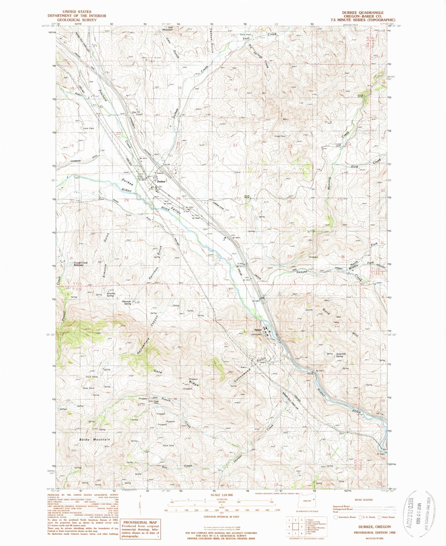
Classic USGS Durkee Oregon 7.5'x7.5' Topo Map
Couldn't load pickup availability
Historical USGS topographic quad map of Durkee in the state of Oregon. Map scale may vary for some years, but is generally around 1:24,000. Print size is approximately 24" x 27"
This quadrangle is in the following counties: Baker.
The map contains contour lines, roads, rivers, towns, and lakes. Printed on high-quality waterproof paper with UV fade-resistant inks, and shipped rolled.
Contains the following named places: Alder Creek, Baldy Mountain, Banks Ditch, Big Springs Creek, Buckhorn Gulch, Cannon Gulch, Cottonwood Gulch, Crandall Creek, Dry Gulch, Durkee, Durkee Cemetery, Durkee Creek, Durkee Post Office, Durkee Valley, French Creek, Gold Creek, Gold Hill, Gold Hill Spring, Gold Ridge, Gold Ridge Mine, Harrison Gulch, Harrison Spring, Hollowfield Canyon, Iron Gulch, Manning Creek, Middle Fork Swayze Creek, Moore Reservoir, Nelson, North Fork Swayze Creek, Plano Post Office, Plano School, Powell Creek Reservoir, Pritchard Creek, Rattlesnake Springs Wayside Park, Ray Creek, Shirttail Creek, Simonis Gulch, Simonis Spring, Swayze Creek, Trail Creek, ZIP Code: 97905