MyTopo
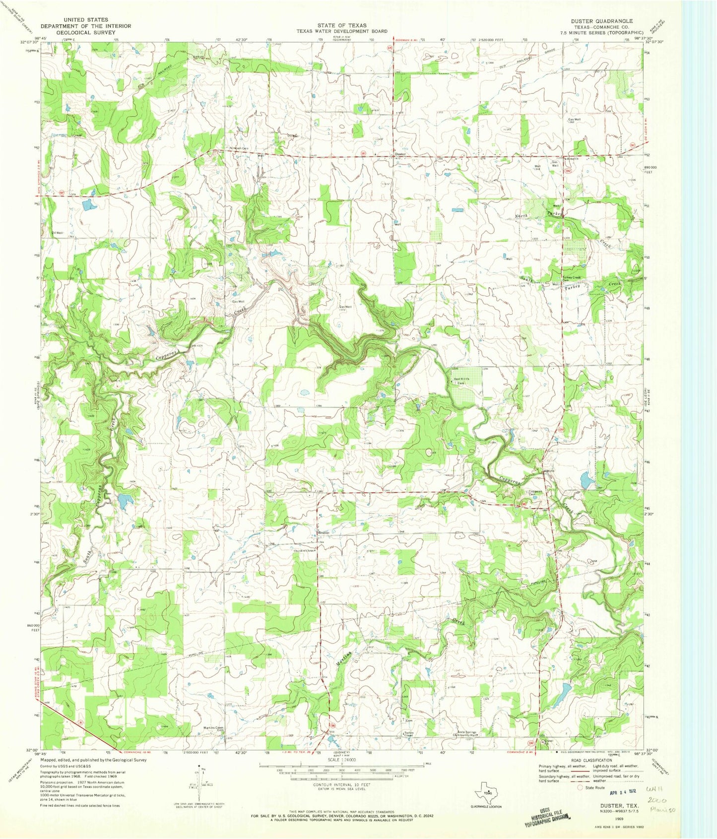
Classic USGS Duster Texas 7.5'x7.5' Topo Map
Couldn't load pickup availability
Historical USGS topographic quad map of Duster in the state of Texas. Map scale may vary for some years, but is generally around 1:24,000. Print size is approximately 24" x 27"
This quadrangle is in the following counties: Comanche.
The map contains contour lines, roads, rivers, towns, and lakes. Printed on high-quality waterproof paper with UV fade-resistant inks, and shipped rolled.
Contains the following named places: A T Gilchrest Dam, A T Gilchrest Lake, Beattie, Bethel Church, Bingham Dam, Bingham Lake, Charles Taylor Dam, Charles Taylor Reservoir, Copperas Cemetery, Donald A Nowlin Dam, Donald A Nowlin Reservoir, Duster, Dutton Dam, Dutton Lake, Huddleston Dam A, Huddleston Dam A Lake, Johnny Poynor Dam, Johnny Poynor Lake, Keith Dam, Keith Reservoir, Martins Creek, Martins Creek Cemetery, Nichols Dam, Nichols Lake, Ninevah Cemetery, Sand Hill Church, Soda Springs Community Hall, Soil Conservation Service Site 4 Dam, Soil Conservation Service Site 4 Reservoir, Soil Conservation Service Site 5 Reservoir, Soil Conservation Service Site 9 Dam, Soil Conservation Service Site 9 Reservoir, Soil Conservation Service Site Number 5 Dam, South Copperas Creek, Taylors Chapel, Turkey Creek Cemetery, Weatherby and Womack Dam, Weatherby and Womack Lake, Welch Lake, Welch Lake Dam, Wolfe Pecanlands Lake Number 1, Wolfe Pecanlands Lake Number 1 Dam