MyTopo
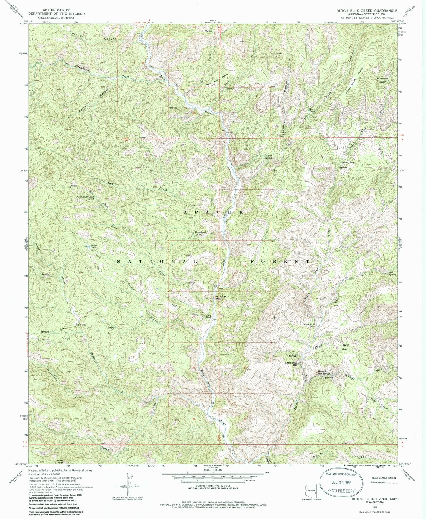
Classic USGS Dutch Blue Creek Arizona 7.5'x7.5' Topo Map
Couldn't load pickup availability
Historical USGS topographic quad map of Dutch Blue Creek in the state of Arizona. Typical map scale is 1:24,000, but may vary for certain years, if available. Print size: 24" x 27"
This quadrangle is in the following counties: Greenlee.
The map contains contour lines, roads, rivers, towns, and lakes. Printed on high-quality waterproof paper with UV fade-resistant inks, and shipped rolled.
Contains the following named places: Beeler Creek, Alder Peak, Ash Creek, Ash Spring, Auger Canyon, Auger Tank, Owl Creek, Benton Creek, Benton Tank, Board Canyon, Bonehead Basin, Bull Creek, Dutch Blue Creek, Government Mesa, H U Bar Box, H U Bar Ranch, Hannah Hot Spring, Hannah Springs Creek, Hobo Canyon, Horsehead Spring, Ladron Spring, Little Blue Box, North Bull Creek, North Bull Creek Tank, Oak Creek, Paint Rock Prairie, Rousensock Creek, Salt Basin, Squaw Creek, Strayhorse Creek, Sycamore Canyon, Thomas Creek, Tornado Canyon, White Rocks Cabin, Winter Cabin, Zuni Basin, Benton Falls Tank, Blue River One Hundred One Trail, Bonehead Spring, H U Bar Tank, Pasture Tank, Smith Cabin, Stray Horse Canyon Trail Twenty, Yellow Spring, Rousensock Canyon, Auger Creek, Shorty Spring, Syeamore Corral, Auger Corral, Ladrone Canyon, Lower Oak Creek Corral, Hammerhead Spring, Benton Creek Spring, Trap Corral, Bull Spring, Hu Bar Spring, Dead Mule Spring, Latherone Spring, Auger Creek Spring, Little Dutch Spring, Winter Cabin Spring, Hannah Spring Canyon Corral, Dutch Chimney Corral, Bench Spring, Mangrum Spring, Beeler Creek Corral, Al Creek Corral, Bull Basin Spring, Bull Basin Corral, Bear Trough Spring, VT Ranch, Yellow Springs, Bell Springs, Jack Rabbit Spring, VT Pasture Tank, Post Canyon