MyTopo
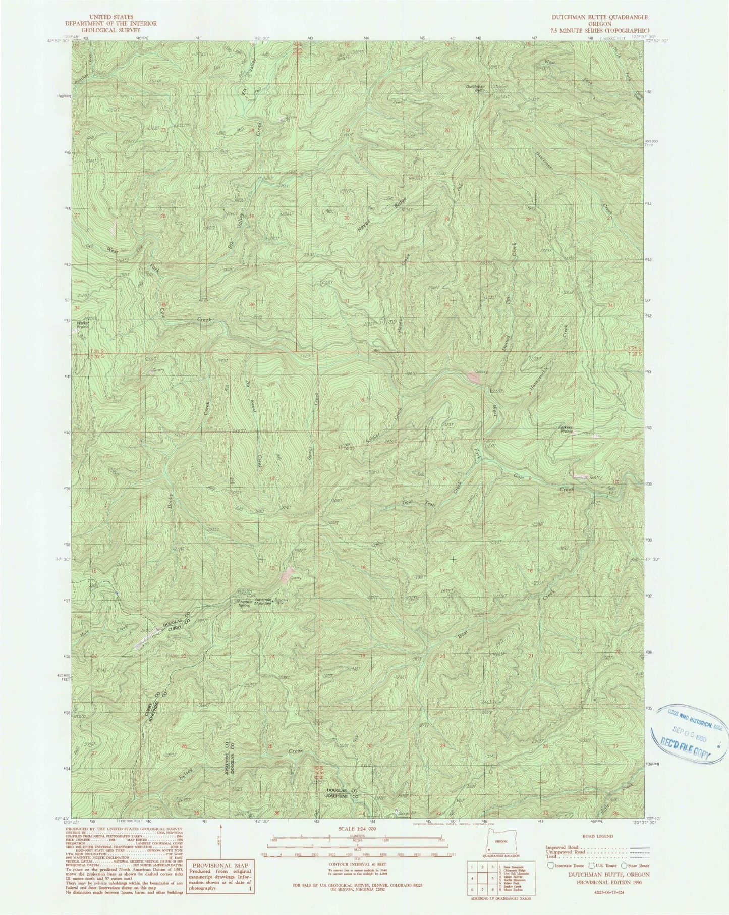
Classic USGS Dutchman Butte Oregon 7.5'x7.5' Topo Map
Couldn't load pickup availability
Historical USGS topographic quad map of Dutchman Butte in the state of Oregon. Map scale may vary for some years, but is generally around 1:24,000. Print size is approximately 24" x 27"
This quadrangle is in the following counties: Curry, Douglas, Josephine.
The map contains contour lines, roads, rivers, towns, and lakes. Printed on high-quality waterproof paper with UV fade-resistant inks, and shipped rolled.
Contains the following named places: Bear Creek, Bobby Creek, Calvert Peak Airport, Dutchman Butte, Elk Valley Creek, Goat Trail Creek, Hayes Creek, Hayes Ridge, Honeysuckle Creek, Jackass Prairie, Jacob Creek, Ninemile Camp, Ninemile Mountain, Ninemile Spring, No Sweat Creek, North Fork Darby Creek, Slotted Pen Creek, Soldier Creek, Sweat Creek, Walker Prairie, West Fork Darby Creek