MyTopo
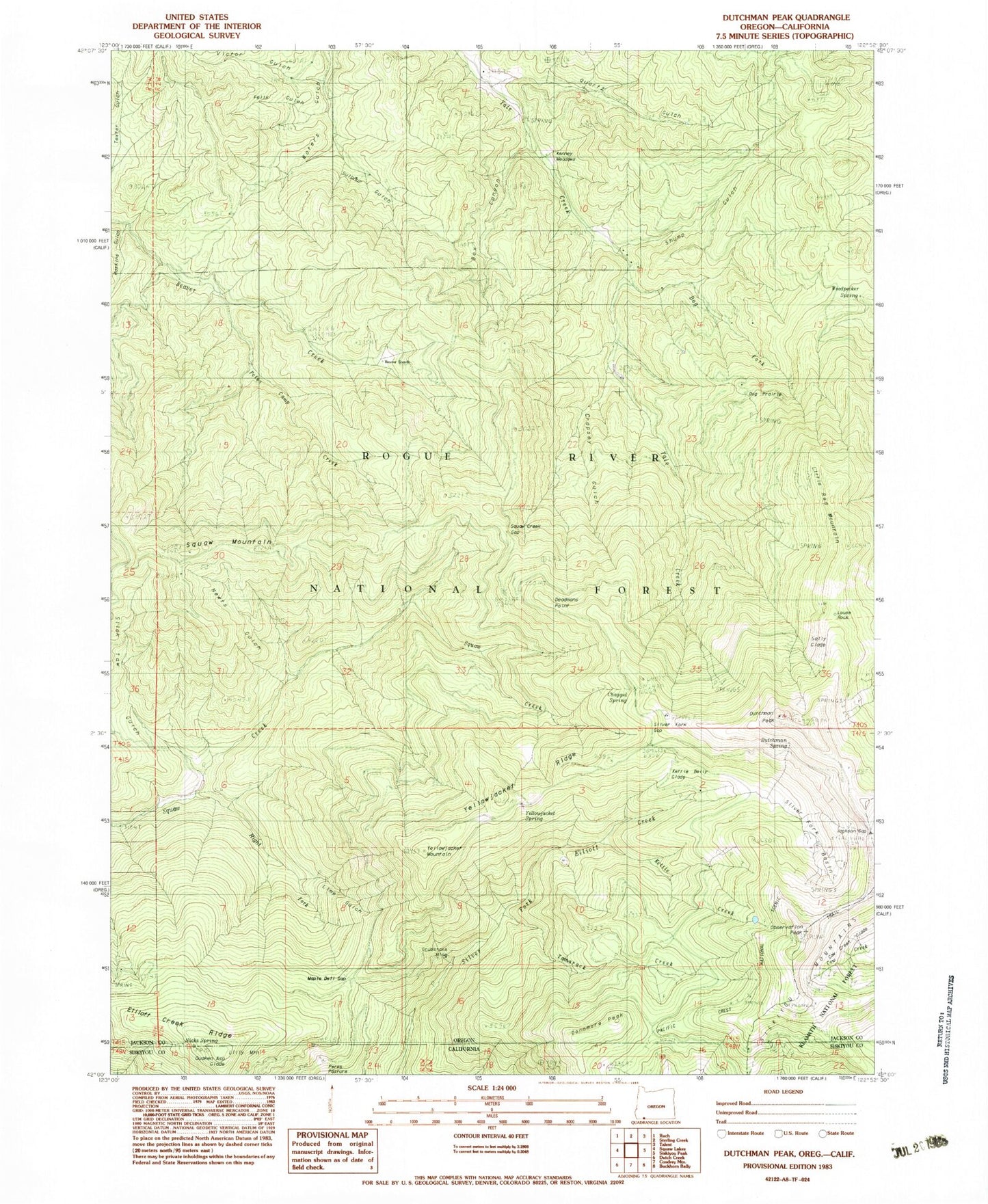
Classic USGS Dutchman Peak Oregon 7.5'x7.5' Topo Map
Couldn't load pickup availability
Historical USGS topographic quad map of Dutchman Peak in the states of Oregon, California. Map scale may vary for some years, but is generally around 1:24,000. Print size is approximately 24" x 27"
This quadrangle is in the following counties: Jackson, Siskiyou.
The map contains contour lines, roads, rivers, towns, and lakes. Printed on high-quality waterproof paper with UV fade-resistant inks, and shipped rolled.
Contains the following named places: Beaver Ranch, Box Canyon, Chappel Spring, Crapsey Gulch, Deadmans Point, Dog Fork, Dog Prairie, Donomore Peak, Dutchman Peak, Dutchman Peak Lookout, Dutchman Spring, Elliott Creek Ridge, Felix Gulch, Grubstake Mine, Haskins Gulch, Jackson Gap, Kenney Meadows, Kenney Meadows Picnic area, Kettle Belly Glade, Kettle Creek, Kettle Lake, Lilly Mountain, Lime Gulch, Little Red Mountain, Louse Rock, Maple Dell Gap, Newt Gulch, Nicks Spring, Observation Gap, Observation Peak, Pearce Gulch, Petes Camp Creek, Prince Gulch, Quaken Asp Glade, Quartz Gulch, Right Fork Squaw Creek, Sally Glade, Shump Gulch, Silver Fork Basin, Silver Fork Gap, Silver Fork Gap Point of Interest, Slick Taw Gulch, Squaw Creek Gap, Squaw Mountain, Sulphur Gulch, Sulphur Spring, Tamarack Creek, Victor Gulch, Woodpecker Spring, Yellowjacket Mountain, Yellowjacket Ridge, Yellowjacket Spring