MyTopo
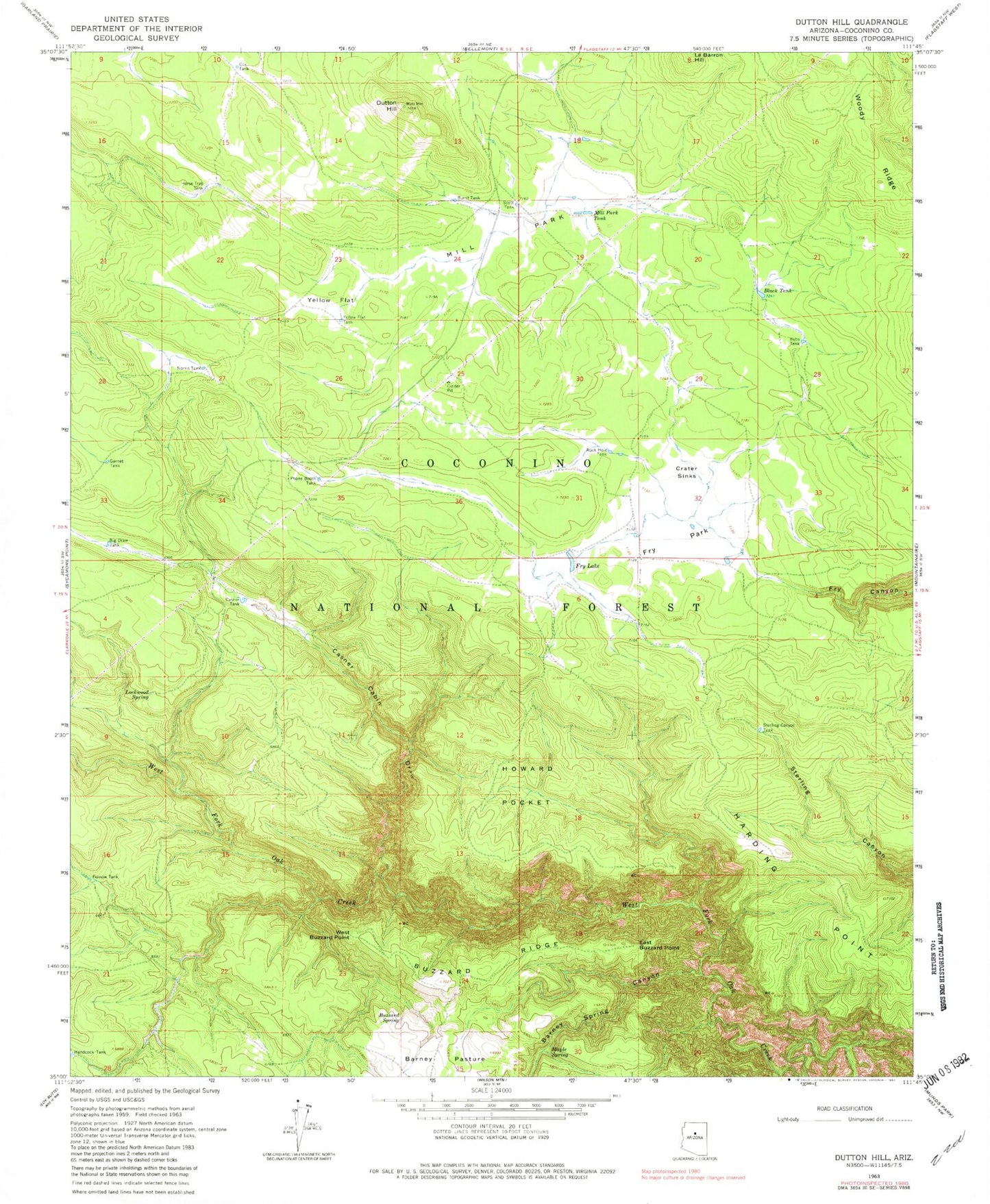
Classic USGS Dutton Hill Arizona 7.5'x7.5' Topo Map
Couldn't load pickup availability
Historical USGS topographic quad map of Dutton Hill in the state of Arizona. Typical map scale is 1:24,000, but may vary for certain years, if available. Print size: 24" x 27"
This quadrangle is in the following counties: Coconino.
The map contains contour lines, roads, rivers, towns, and lakes. Printed on high-quality waterproof paper with UV fade-resistant inks, and shipped rolled.
Contains the following named places: Barney Spring Canyon, Big Draw Tank, Black Tank, Bobs Tank, Burnt Tank, Buzzard Ridge, Buzzard Spring, Casner Cabin Draw, Casner Tank, Crater Sinks, Dutton Hill, East Buzzard Point, Fernow Tank, Fry Lake, Fry Park, Garnet Tank, Harding Point, Horse Trap Sink, Howard Pocket, Lockwood Spring, Mill Park, Mill Park Tank, Norris Tank, Phone Booth Tank, Rock Hole Tank, Scott Tank, Sterling Canyon Tank, West Buzzard Point, Woody Ridge, Yellow Flat, Yellow Flat Tank, Barney Ridge, Bill Tank, Black Pass Tank, Cecil Tank, Cox Tank, Howard Pocket Tank, Jack Tank, John Tank, Joy Tank, Kathy Tank, Lesslie Tank, Maple Spring, Mary Tank, Oak Creek Canyon Natural Area, Small Tank, Turkey Tank, VA Tank, Road Tank, Barney Tank, Jim Bean Tank, Cinder Pit Tank, Brown Tank, Sput Tank, Spud Tank, Timber Tank, Backward Tank, Draw Tank, Teacup Tank, Olive Tank, Liberty Tank, Orchard Tank, Falcon Tank, Pansy Tank, Pad Tank, Fox Tank, West Fork Tank, Diffused Tank, Harding Point Tank