
MyTopo
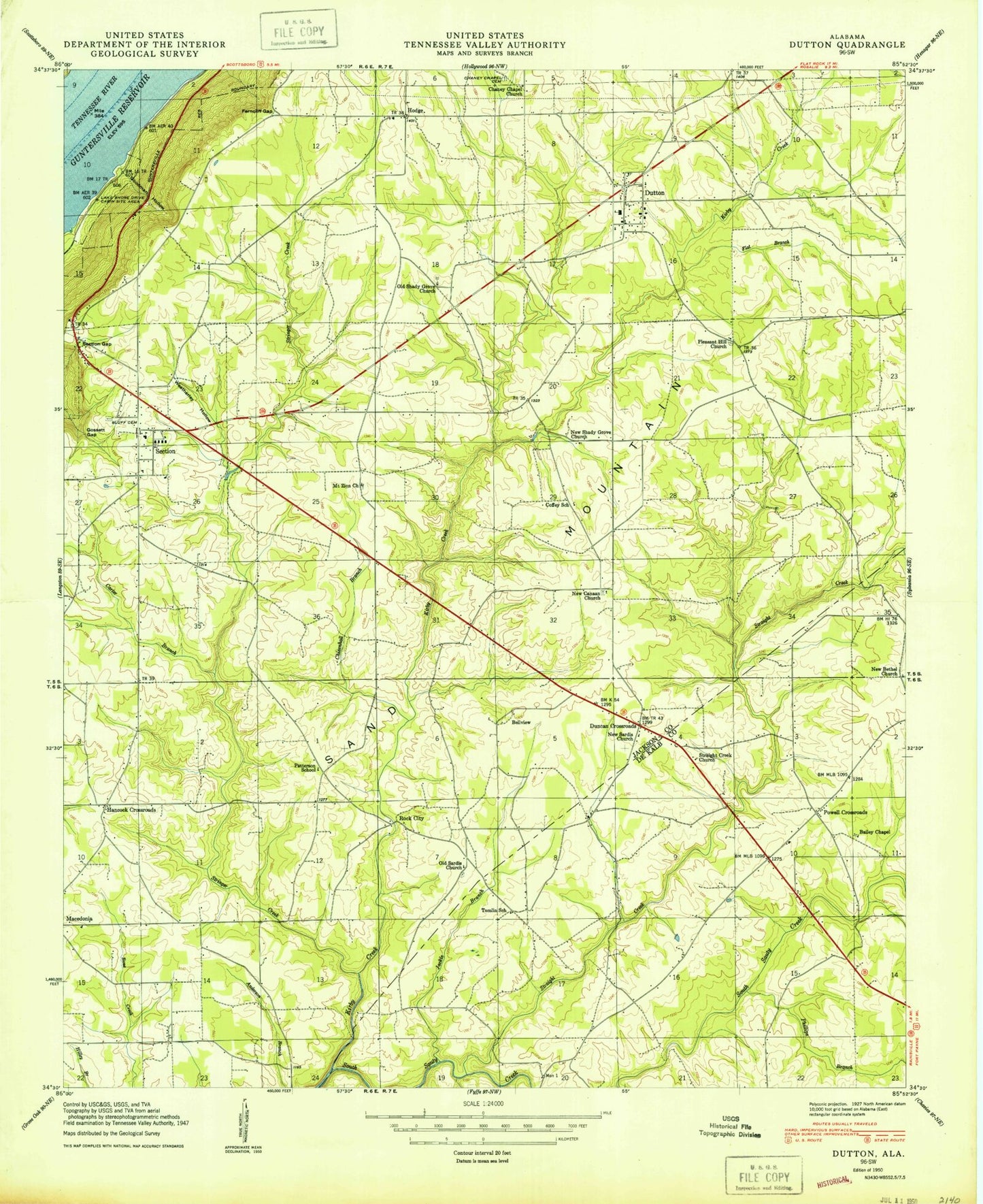
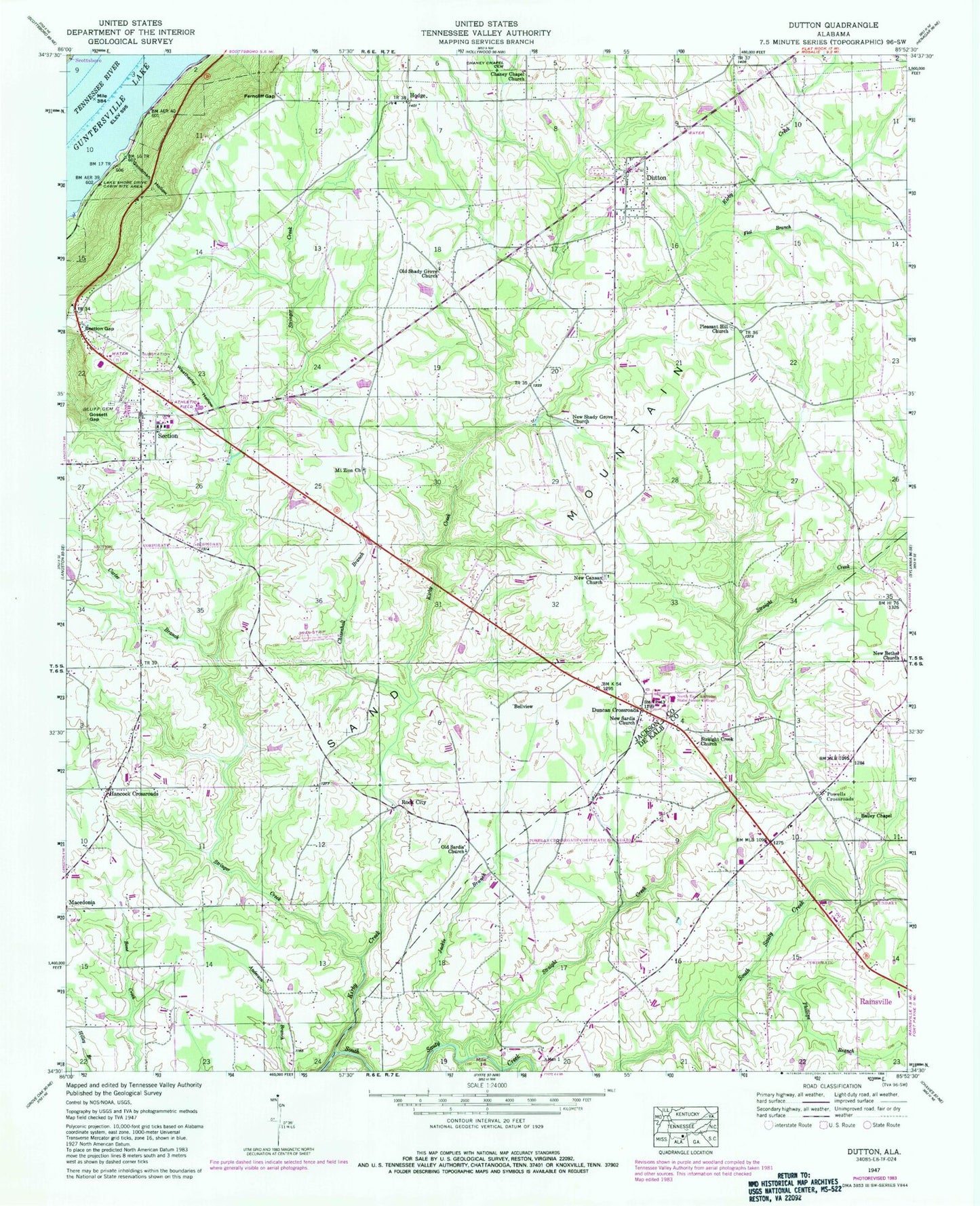
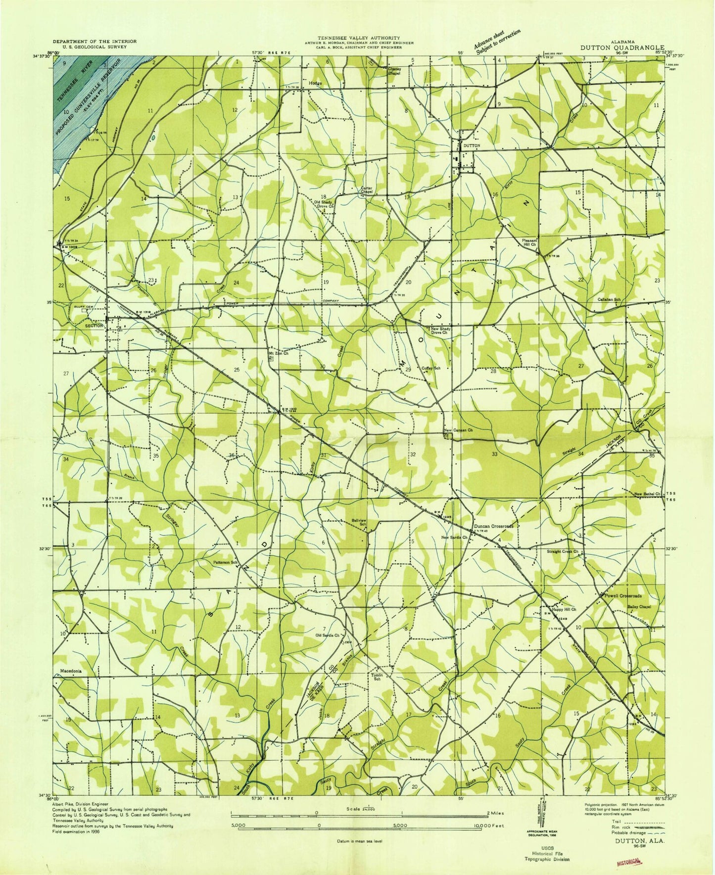
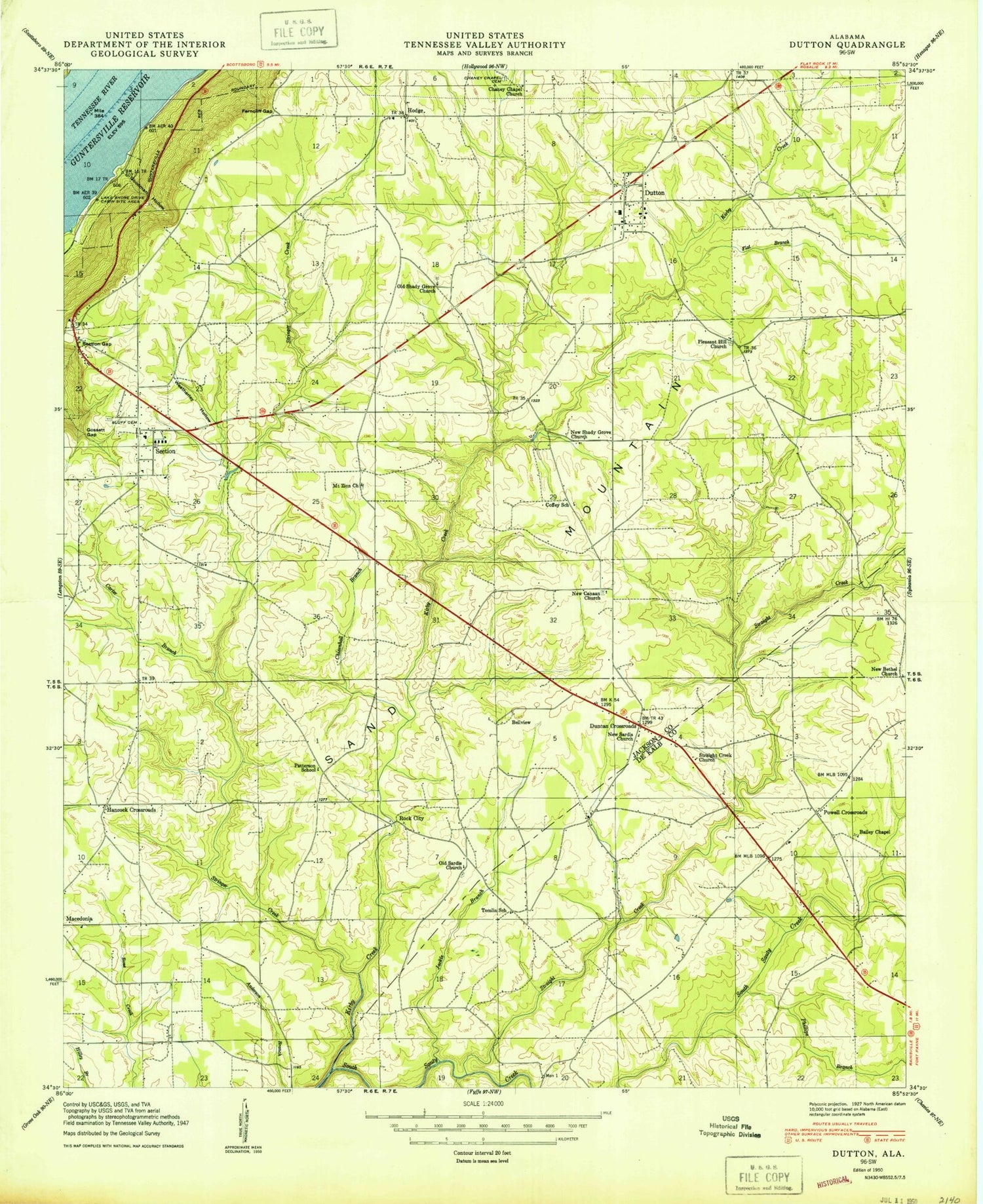
Classic USGS Dutton Alabama 7.5'x7.5' Topo Map
Couldn't load pickup availability
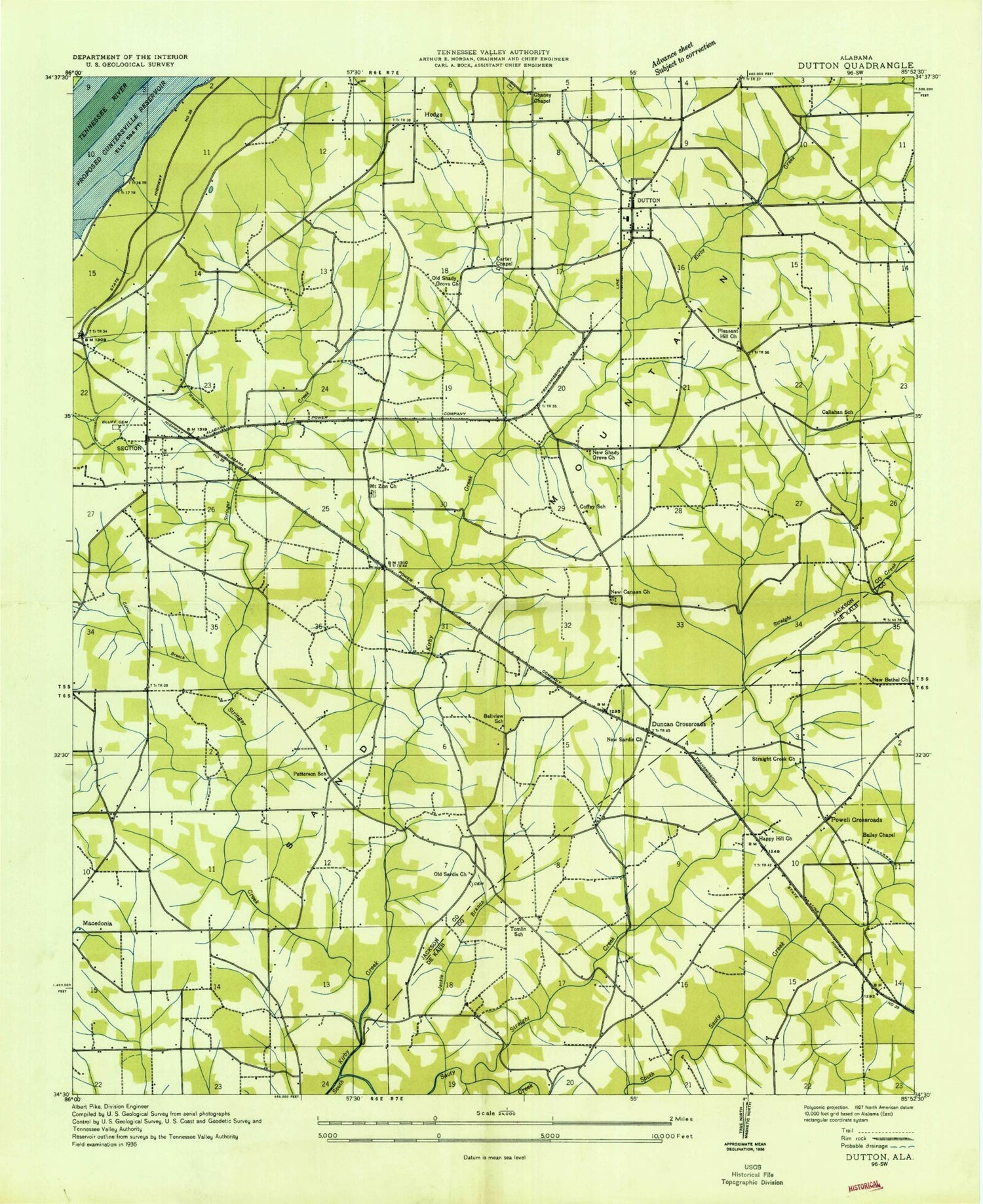
Historical USGS topographic quad map of Dutton in the state of Alabama. Map scale may vary for some years, but is generally around 1:24,000. Print size is approximately 24" x 27"
This quadrangle is in the following counties: DeKalb, Jackson.
The map contains contour lines, roads, rivers, towns, and lakes. Printed on high-quality waterproof paper with UV fade-resistant inks, and shipped rolled.
Contains the following named places: Bailey Chapel, Bellview, Bellview School, Bethany Church, Bluff Cemetery, Callahan School, Carter Branch, Carter Chapel, Chaney Chapel Cemetery, Chaney Chapel Church, Chisenhall Bar, Chisenhall Branch, Dawson School, Duncan Crossroads, Dutton, Dutton Post Office, Dutton Volunteer Fire Department, Ferncliff, Ferncliff Gap, Flat Branch, Flowers Saw Mill, Goodman Hollow, Gossett Gap, Hancock Church, Hancock Crossroads, Hannah, Happy Hill Church, Hodge, Hodge Church, Jackie Branch, Kirby Creek, Lake Shore Drive Cabin Site Area, Macedonia Volunteer Fire Department, Mount Zion Church, New Bethel Church, New Canaan Church, New Sardis Church, New Shady Grove Church, Northeast Alabama State Junior College, Old Brown Mill, Old Sardis Cemetery, Old Sardis Church, Old Shady Grove Church, Patterson School, Phillips Branch, Pleasant Hill Church, Powell Volunteer Fire Department, Powells Crossroads, Rock City, Sand Mountain Church, Section, Section Division, Section Gap, Section High School, Section Police Department, Section Post Office, Section United Methodist Church, Section Volunteer Fire Department, Straight Creek, Straight Creek Church, Stringer Creek, Stringers Mill, Talley, Tomlin School, Town of Dutton, Town of Powell, Town of Section, Weatherley Branch, Weatherley Hollow, White Mill, WKEA-FM (Scottsboro), ZIP Code: 35744