MyTopo
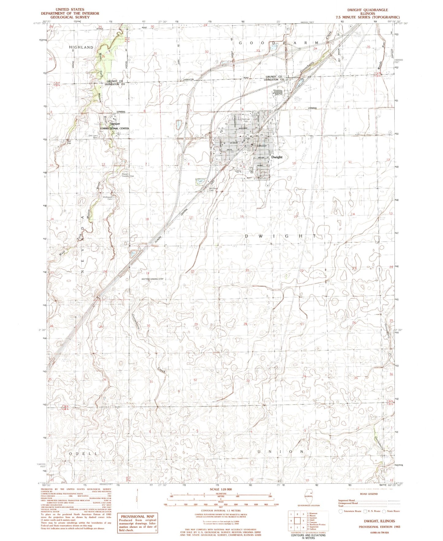
Classic USGS Dwight Illinois 7.5'x7.5' Topo Map
Couldn't load pickup availability
Historical USGS topographic quad map of Dwight in the state of Illinois. Map scale may vary for some years, but is generally around 1:24,000. Print size is approximately 24" x 27"
This quadrangle is in the following counties: Grundy, Livingston.
The map contains contour lines, roads, rivers, towns, and lakes. Printed on high-quality waterproof paper with UV fade-resistant inks, and shipped rolled.
Contains the following named places: Church of the Nazarene, Cleary School, Davis School, Dorman School, Dwight, Dwight Baptist Academy, Dwight Chicago and Alton Railroad Depot, Dwight Common School, Dwight Correctional Center, Dwight Country Club, Dwight Emergency Medical Services, Dwight Fire Protection District, Dwight High School, Dwight Lions Lake, Dwight Old Town Cemetery, Dwight Post Office, Dwight Sewage Works, Dwight United Methodist Church, Dwight Village Hall, Dwight Village Police Department, Emanuel Lutheran Church, Fallis School, First Baptist Church, First Congregational Church, Florence W Garrett Park, Gibbons School, Heritage Manor Nursing Home, Hoffman School, Jim & Peg Airport, Lone Maple School, McDowell Cemetery, Mount Olivet Cemetery, New Assembly of God Church, O Brien School, Oak Lawn Cemetery, Pioneer Gothic Church, Pound School, Prairie Creek Public Library, Prime School, Renfrew Park, Robert W Stephenson Memorial Swimming Pool, Saint Patricks Roman Catholic Church, Saint Peters Evangelical Lutheran Church, Sauer Airport, Stephenson School, Township of Dwight, Verdun School, Vickery School, Village of Dwight, Watters Airport, William Fox Developmental Center, WKDL-FM (Dwight), ZIP Code: 60420