
MyTopo
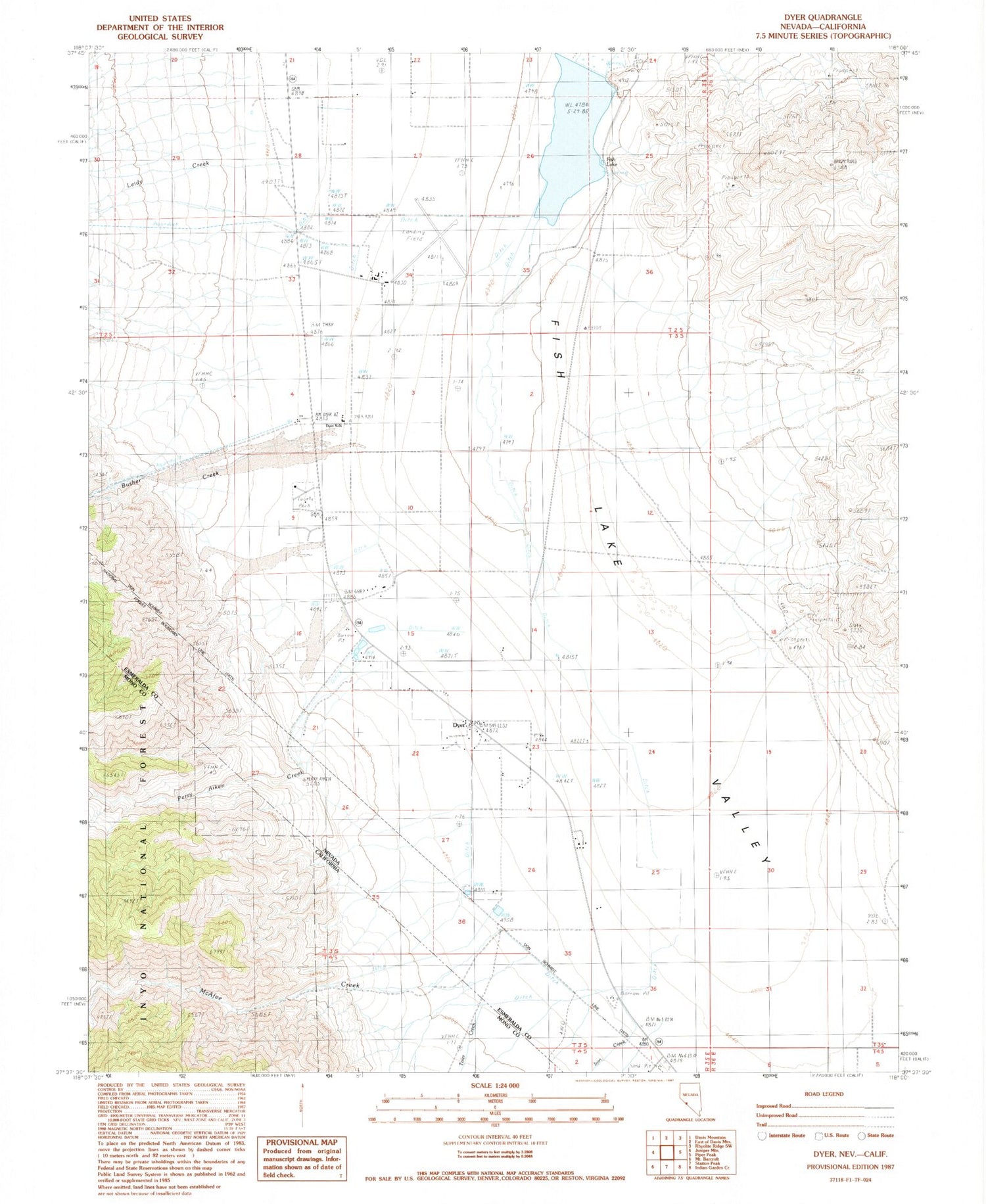
Classic USGS Dyer Nevada 7.5'x7.5' Topo Map
Couldn't load pickup availability
Historical USGS topographic quad map of Dyer in the states of Nevada, California. Map scale may vary for some years, but is generally around 1:24,000. Print size is approximately 24" x 27"
This quadrangle is in the following counties: Esmeralda, Mono.
The map contains contour lines, roads, rivers, towns, and lakes. Printed on high-quality waterproof paper with UV fade-resistant inks, and shipped rolled.
Contains the following named places: Bar Double 9 Ranch, Busher Creek, Circle L Ranch, Circle L Ranch Airport, Dyer, Dyer Census Designated Place, Dyer Elementary School, Dyer Mining District, Dyer Post Office, Fish Lake, Fish Lake Valley Ambulance Service, Fish Lake Valley Community Hall, Iron Creek, Leidy Creek, McAfee Creek, McAfee Ranch, Perry Aiken Creek, Toler Creek, Winkonley Ranch


