MyTopo
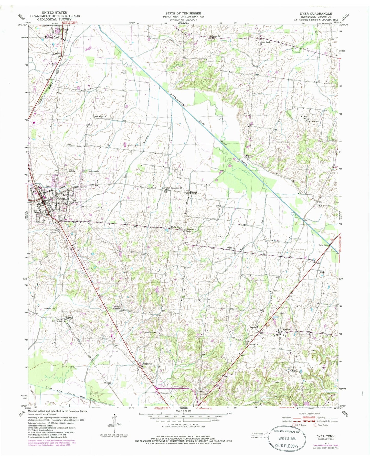
Classic USGS Dyer Tennessee 7.5'x7.5' Topo Map
Couldn't load pickup availability
Historical USGS topographic quad map of Dyer in the state of Tennessee. Map scale may vary for some years, but is generally around 1:24,000. Print size is approximately 24" x 27"
This quadrangle is in the following counties: Gibson.
The map contains contour lines, roads, rivers, towns, and lakes. Printed on high-quality waterproof paper with UV fade-resistant inks, and shipped rolled.
Contains the following named places: Barrons Corner, Beech Grove Cemetery, Beech Grove Church, Beech Grove School, Bobbitt Cemetery, Bucksnort Cemetery, Camp Creek, Cedar Grove School, Central View School, City of Dyer, Commissioner District 18, Commissioner District 19, District 11, District 23, District 7, Dyer, Dyer Church of Christ, Dyer City Hall, Dyer Cumberland Presbyterian Church, Dyer Division, Dyer Elementary School, Dyer Fire Department, Dyer High School, Dyer Police Department, Dyer Post Office, Dyer Rosenwald School, Fairview Baptist Church, First Baptist Church of Dyer, First Cumberland Presbyterian Church, First Methodist Church of Dyer, First Presbyterian Church of Dyer, Georgetown, Gibson County Fire Department Station 7, Gibson County High School, Gibson County Sheriff's Department, Good Luck, Griers Chapel, Griers Chapel Cemetery, Grizzard, Keas Cemetery, Keeley Cemetery, Laneview, Laneview Baptist Church, Laneview School, Mount Sinai Cemetery, Mount Sinai Church, Mount Zion Cemetery, Mount Zion Church, Mount Zion School, New Bethlehem Cemetery, New Bethlehem Church, New Hope Baptist Church, Oakwood Cemetery, Owen Branch, Pleasant Grove Cumberland Presbyterian Church, Poplar Grove, Poplar Grove Cemetery, Poplar Grove Church, Poplar Grove School, Rogers Branch, Salem Cemetery, Salem Church, Town of Rutherford, Union Cemetery, Union Church