MyTopo
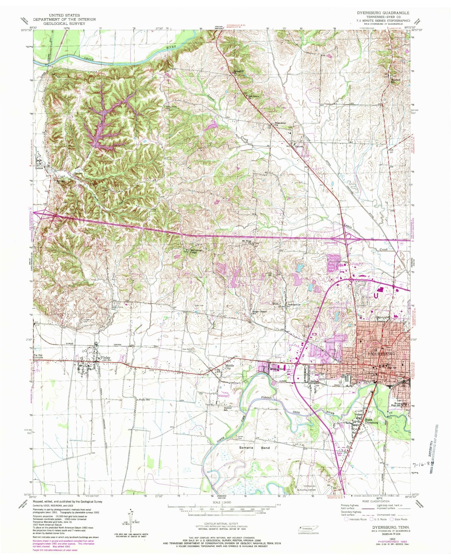
Classic USGS Dyersburg Tennessee 7.5'x7.5' Topo Map
Couldn't load pickup availability
Historical USGS topographic quad map of Dyersburg in the state of Tennessee. Map scale may vary for some years, but is generally around 1:24,000. Print size is approximately 24" x 27"
This quadrangle is in the following counties: Dyer.
The map contains contour lines, roads, rivers, towns, and lakes. Printed on high-quality waterproof paper with UV fade-resistant inks, and shipped rolled.
Contains the following named places: Alice Thurmond Primary School, Avery School, Baird-Dulany Hospital, Band Mill, Beech Grove Cemetery, Big Boy Junction, Bruce High School, Burgess Chapel Church, Burgie Chapel School, Calvary Hill Baptist Church, Carter Cemetery, Church of Christ, Church of God in Christ, Church of the Holy Angels, City of Dyersburg, Collins Chapel Methodist Church, Commissioner District 10, Commissioner District 6, Commissioner District 7, Crockett Creek, Crockett Creek Drainage Ditch, Dale F Glover Education Center, District 10, District 17, District 4, District 5, Dobbin School, Dyer County, Dyer County Central Elementary School, Dyer County Courthouse, Dyer County Health Department, Dyer County Sheriff's Office, Dyersburg, Dyersburg City Hall, Dyersburg Division, Dyersburg Fire Department Station 1, Dyersburg Fire Department Station 2, Dyersburg First Baptist Church, Dyersburg High School, Dyersburg Male and Female Academy, Dyersburg Middle School, Dyersburg Police Department, Dyersburg Police Department Bruce Neighborhood Precinct, Dyersburg Post Office, Dyersburg Regional Emergency Medical Services, Dyersburg Regional Medical Center, Dyersburg State Community College, E B Eller Administration Building, E H Lannom Jr Gymnasium, Evansville, Fairview Cemetery, Ferguson School, Finley, Finley Baptist Church, Finley Census Designated Place, Finley Elementary School, Finley Post Office, Finley School, Finley Volunteer Fire Department, First Assembly of God Church, First Christian Church, First Pentecostal Church, First Presbyterian Church, First United Methodist Church, Friendship, Friendship Church, Grace Presbyterian Church, Hicks Cemetery, Hillcrest Baptist Church, Holiness Church, Hopewell Cemetery, Hopewell Church, Hopewell School, Jenkins Cemetery, Jenkinsville, Jennie Walker Primary School, Lenox, Lenox Baptist Church, Lenox Census Designated Place, Lenox Post Office, Lewis Creek Drainage Ditch, Lewis Creek Tributary Lake 60-11, Lewis Creek Tributary Lake Site 60-11 Dam, Light Cemetery, McCullough Chapel Baptist Church, McCullough School, McIvers Grant Public Library, Middle City, Mount Hope, Mount Hope Church, Mount Zion Church, Nauvoo, Nauvoo School, Neely Chapel, Neely Chapel Cemetery, Neelys Chapel, New Bethel Cemetery, Oak Grove Cemetery, Oak Grove Church, OFDBA Dam Number 60-13, OFDBA Dam Number 60-6, OFDBA Lake Site Number 60-13, OFDBA Lake Site Number 60-6, Okeena Park, Old Dyer County Fairground, Peck Hollow, Peel Cemetery, Pilgrim Rest Baptist Church, Pioneer Lake Dam Number Five, Pioneer Lake Dam Number Four, Pioneer Lake Dam Number One, Pioneer Lake Dam Number Three, Pioneer Lake Dam Number Two, Pioneer Lake Number Five, Pioneer Lake Number Four, Pioneer Lake Number One, Pioneer Lake Number Three, Pioneer Lake Number Two, Pleasant Hill Cemetery, Possum Creek, Prices Temple Christian Methodist Episcopal Church, Ross United Methodist Church, Saint Marys Episcopal Church, Samaria Bend, Samaria School, Science Hill School, Seventh Day Adventist Church, South Dyersburg, Southside Baptist Church, Springhill Church, Tabernacle Baptist Church, The Church of Jesus Christ, WASL-FM (Dyersburg), Womack Temple Christian Methodist Episcopal Church, WTRO-AM (Dyersburg), ZIP Code: 38024


