MyTopo
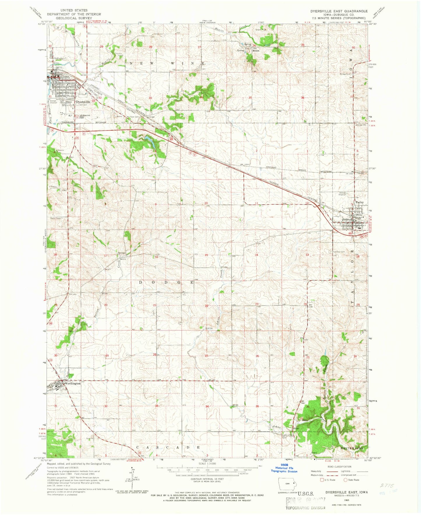
Classic USGS Dyersville East Iowa 7.5'x7.5' Topo Map
Couldn't load pickup availability
Historical USGS topographic quad map of Dyersville East in the state of Iowa. Map scale may vary for some years, but is generally around 1:24,000. Print size is approximately 24" x 27"
This quadrangle is in the following counties: Dubuque.
The map contains contour lines, roads, rivers, towns, and lakes. Printed on high-quality waterproof paper with UV fade-resistant inks, and shipped rolled.
Contains the following named places: Arquitt Post Office, Bakers Creek, Beckman Catholic High School, Bi - County Ambulance Incorporated, City of Dyersville, City of Farley, City of Worthington, Drexler Middle / Intermediate School, Dubuque County Library, Dyer-Botsford Victorian House and Doll Museum, Dyersville, Dyersville Fire Department, Dyersville Golf and Country Club, Dyersville Police Department, Dyersville Post Office, Evangelical Free Church, Fairview Cemetery, Farley, Farley City Park, Farley Post Office, Farley Racetrack, Farley Volunteer Fire Department, Field of Dreams, Hewitt Creek, Inwood Woodcarving Exhibit, Jehovahs Witnesses Congregation, Johns Creek Cemetery, M M Hoffman Public Library, McGee Cemetery, Mekee, Mount Hope Cemetery, National Farm Toy Museum, New Hope Lutheran Church, Preston Post Office, Reiff Ambulance Service, Rolling Knolls Golf Course, Saint Boniface Catholic Cemetery, Saint Josephs Catholic Church, Saint Paul School, Saint Pauls Catholic Church, Seton Catholic School Farley Center, Summit Village Dyersville Park, Township of Dodge, Worthington, Worthington Baptist Cemetery, Worthington City Hall, Worthington Community Fire Department, Worthington Memorial Hall, Worthington Post Office, ZIP Codes: 52046, 52078