MyTopo
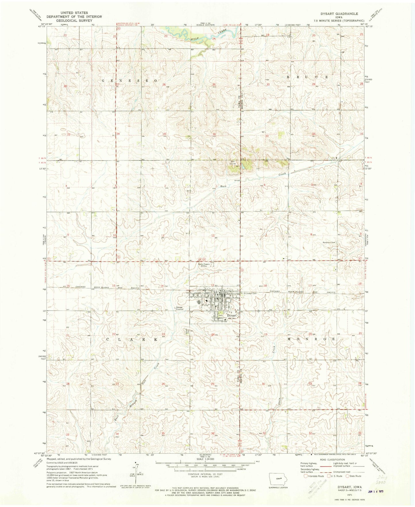
Classic USGS Dysart Iowa 7.5'x7.5' Topo Map
Couldn't load pickup availability
Historical USGS topographic quad map of Dysart in the state of Iowa. Map scale may vary for some years, but is generally around 1:24,000. Print size is approximately 24" x 27"
This quadrangle is in the following counties: Benton, Tama.
The map contains contour lines, roads, rivers, towns, and lakes. Printed on high-quality waterproof paper with UV fade-resistant inks, and shipped rolled.
Contains the following named places: Calvary Baptist Church, City of Dysart, Dysart, Dysart - Geneseo Elementary School, Dysart Assembly of God Church, Dysart Cemetery, Dysart Clinic, Dysart Country Club, Dysart Fairground, Dysart Fire Department, Dysart Library, Dysart Police Department, Dysart Post Office, Evergreen Post Office, KXEL-AM (Waterloo), Lelia Post Office, Mooreville, Mooreville Post Office, Rampton Cemetery, Saint Joseph Catholic Church, Saint Josephs Cemetery, Site of Former Mooreville Historical Marker, Sunnycrest Nursing Center, Township of Clark, Union Middle School, United Methodist Church, Zion Lutheran Church, ZIP Code: 52224