MyTopo
Classic USGS Dyson South Carolina 7.5'x7.5' Topo Map
Couldn't load pickup availability
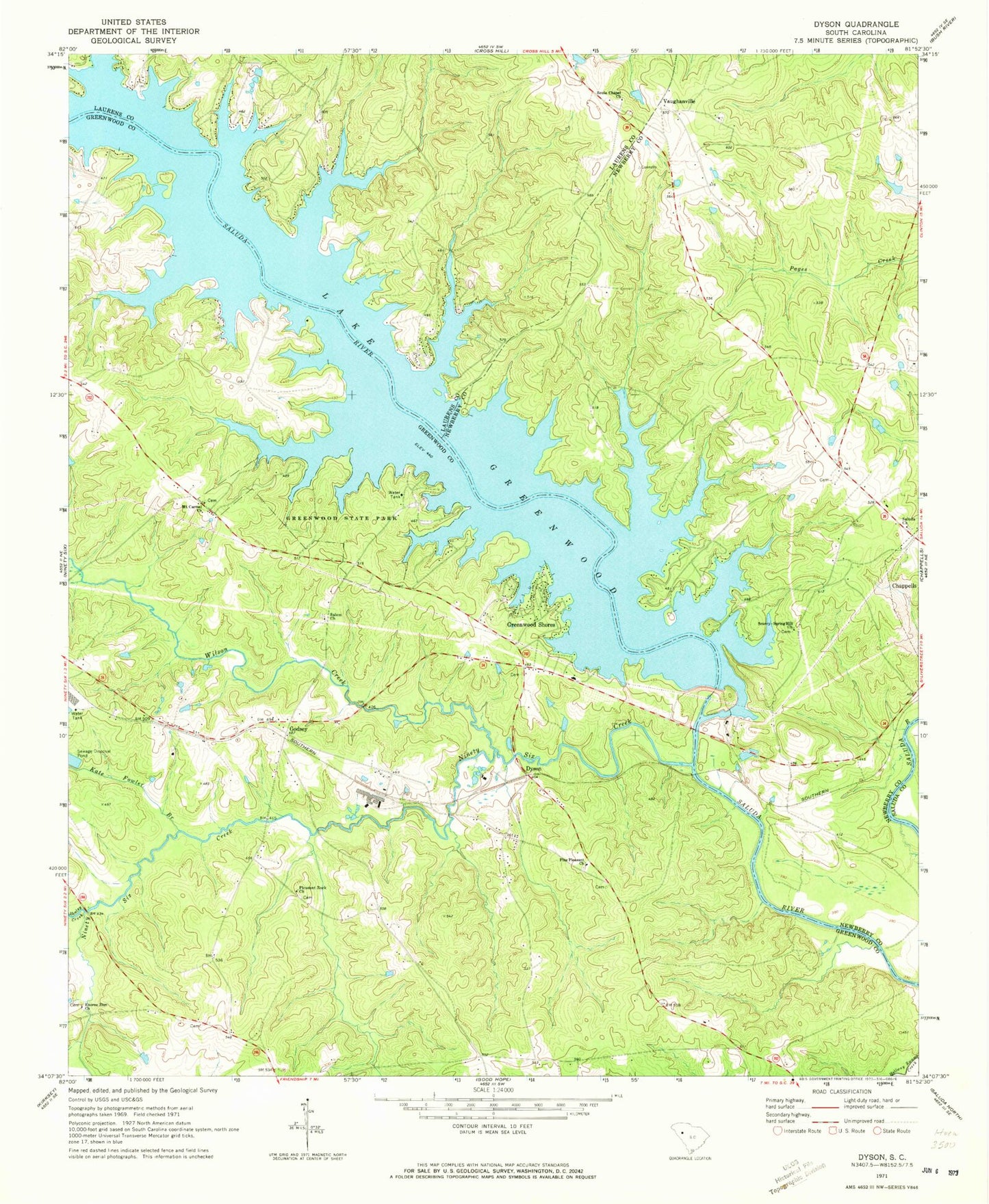
Historical USGS topographic quad map of Dyson in the state of South Carolina. Map scale may vary for some years, but is generally around 1:24,000. Print size is approximately 24" x 27"
This quadrangle is in the following counties: Greenwood, Laurens, Newberry, Saluda.
The map contains contour lines, roads, rivers, towns, and lakes. Printed on high-quality waterproof paper with UV fade-resistant inks, and shipped rolled.
Contains the following named places: Anderson Ferry, Anglers Haven, Bozeman - Scurry Graveyard, Brown Chapel, Chiles Ferry, Cross Roads Cemetery, Cross Roads Church, Dyson, Dysons Bridge, Enoree Zion Church, Enoree Zion Church Cemetery, Godsey, Greenwood Shores, Greenwood State Park, Henley Creek, Kate Fowler Branch, Kinard School, Lake Greenwood Buzzard Roost Dam, Laurens County Fire Department Cross Hill Station 3, Lower Lake Greenwood Fire Station, Lower Lake Greenwood Fire Station 60, Maysons Creek, Maysons Mill, Mount Carmel Church, Mount Carmel Church Cemetery, Newberry County Rural Fire Department Chappells, Ninety Six Creek, Ninety Six Division, Pentecostal Mission, Pine Pleasant Church, Pine Pleasant School, Pleasant Rock Church, Pleasant Rock Church Cemetery, Salem Church, Salem School, Saluda Church, Sauls Chapel Cemetery, Scurry, Scurry-Spring Hill Church, Soule Chapel Church, Vaughanville, Vaughanville School, Wesley Chapel, Wilson Creek