MyTopo
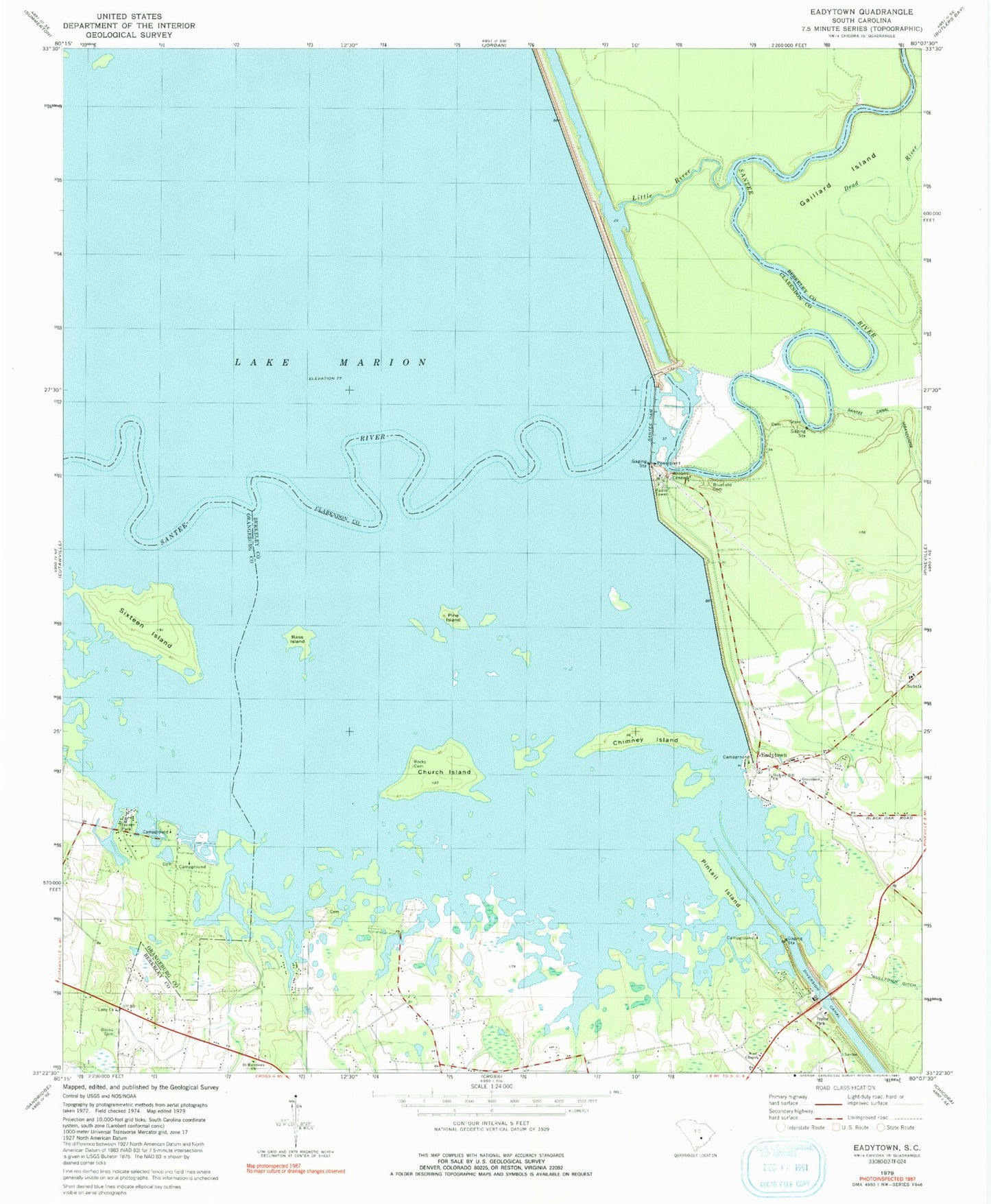
Classic USGS Eadytown South Carolina 7.5'x7.5' Topo Map
Couldn't load pickup availability
Historical USGS topographic quad map of Eadytown in the state of South Carolina. Map scale may vary for some years, but is generally around 1:24,000. Print size is approximately 24" x 27"
This quadrangle is in the following counties: Berkeley, Clarendon, Orangeburg.
The map contains contour lines, roads, rivers, towns, and lakes. Printed on high-quality waterproof paper with UV fade-resistant inks, and shipped rolled.
Contains the following named places: Bass Island, Bethel Church, Bethel School, Blackoak Island, Bluefield Cemetery, Cherry Grove Swamp, Chimney Island, Church Island, Corsada, Dead End Church, Eadytown, Eadytown Fire Department Company 13, Folly Pond School, Gaillard Island, Greenland Church, Greenland Swamp, Hickory Hill Church, Hickory Hill School, Irvin Lake, Little River, Moss Pond, Mount Pleasant Plantation Cemetery, Pine Grove Lake, Pine Island, Pintail Island, Richardson School, Rock Pond Campground, Rocks Cemetery, Rocks Church, Rocks Creek, Rocks Creek School, Saint Lukes Church, Saint Matthews Church, Santee Dam, Sixteen Island, South Carolina Noname 14016 Dam, Spring Plain, Springwood Swamp, Thomas Walter Grave, Unity Church, West Chapel, Wilsons Landing