MyTopo
Classic USGS Eagle Buttes Montana 7.5'x7.5' Topo Map
Regular price
$16.95
Regular price
Sale price
$16.95
Unit price
per
Couldn't load pickup availability
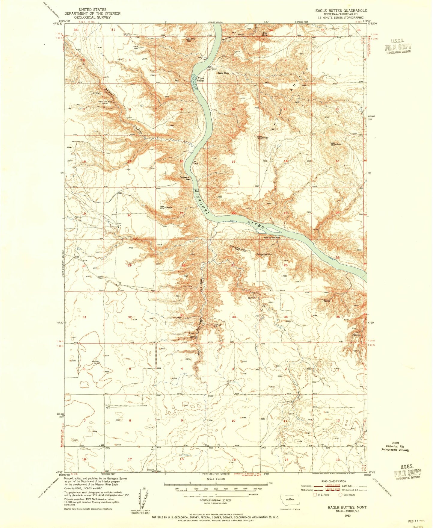
Historical USGS topographic quad map of Eagle Buttes in the state of Montana. Map scale may vary for some years, but is generally around 1:24,000. Print size is approximately 24" x 27"
This quadrangle is in the following counties: Chouteau.
The map contains contour lines, roads, rivers, towns, and lakes. Printed on high-quality waterproof paper with UV fade-resistant inks, and shipped rolled.
Contains the following named places: Butcher Knife Canyon, Citadel Rock, Eagle Buttes, Eagle Rock, Graceville Cemetery, Hole in the Wall, Hole in the Wall Trail, Hole-in-the-Wall, Kipps Rapids, Mud Spring Coulee, Sexton Coal Mines, Sherry Coulee, Ship Rock, Waidman Coal Mine